This article may be expanded with text translated from the corresponding article in German. (October 2011)Click [show] for important translation instructions.
View a machine-translated version of the German article.
Machine translation like DeepL or Google Translate is a useful starting point for translations, but translators must revise errors as necessary and confirm that the translation is accurate, rather than simply copy-pasting machine-translated text into the English Wikipedia.
Do not translate text that appears unreliable or low-quality. If possible, verify the text with references provided in the foreign-language article.
You must provide copyright attribution in the edit summary accompanying your translation by providing an interlanguage link to the source of your translation. A model attribution edit summary Content in this edit is translated from the existing German Wikipedia article at [[:de:Suhl (Werra)]]; see its history for attribution.
You should also add the template {{Translated|de|Suhl (Werra)}} to the talk page.
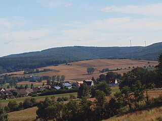
The river has its source in the municipality of Moorgrund, west of Etterwinden on the western slope of the Pfaffenberg. The Suhl then flows through Kupfersuhl, Ettenhausen an der Suhl, where it is crossed by the Werra railway, and the Lindigshof to Marksuhl. Between Ettenhausen and Lindigshof, the Suhl is dammed up in the Ettenhausen dam, which was built at the end of the 1980s.
Below the Berka industrial estate the Suhl then flows into the Werra between Berka and Gerstungen. The last 500 metres or so of the Suhl are shown on the topographical map as the Kleine Werra, after a former branch of the Werra.
Like almost all small rivers, the Suhl has been used as mill water by the neighbouring communities since the Middle Ages.
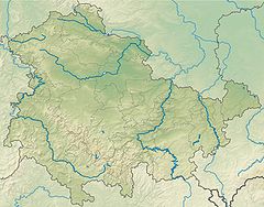
Thuringia, officially the Free State of Thuringia, is a state of Germany. In central Germany, it covers 16,171 square kilometres (6,244 sq mi), being the sixth smallest of the sixteen German States. It has a population of about 2.15 million inhabitants.
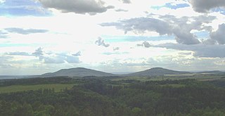
The Thuringian Forest, is a mountain range in the southern parts of the German state of Thuringia, running northwest to southeast. Skirting from its southerly source in foothills to a gorge on its north-west side is the Werra valley. On the other side of the Forest is an upper outcrop of the North German Plain, the Thuringian Basin, which includes the city Erfurt. The south and south-east continuation of the range is the highland often called the Thuringian-Vogtlandian Slate Mountains.
Suhl is a city in Thuringia, Germany, located 50 kilometres SW of Erfurt, 110 kilometres NE of Würzburg and 130 kilometres N of Nuremberg. With its 37,000 inhabitants, it is the smallest of the six urban districts within Thuringia. Together with its northern neighbour-town Zella-Mehlis, Suhl forms the largest urban area in the Thuringian Forest with a population of 46,000. The region around Suhl is marked by up to 1,000-meter high mountains, including Thuringia's highest peak, the Großer Beerberg, approximately 5 kilometres NE of the city centre.
Schmalkalden-Meiningen is a Landkreis in the southwest of Thuringia, Germany. Its neighboring districts are the districts Wartburgkreis, Gotha, Ilm-Kreis, the district-free city Suhl, the district Hildburghausen, the Bavarian district Rhön-Grabfeld, and the district Fulda in Hesse.
The Rhön Mountains are a group of low mountains in central Germany, located around the border area where the states of Hesse, Bavaria and Thuringia come together. These mountains, which are at the extreme southeast end of the East Hesse Highlands, are partly a result of ancient volcanic activity. They are separated from the Vogelsberg Mountains by the river Fulda and its valley. The highest mountain in the Rhön is the Wasserkuppe which is in Hesse. The Rhön Mountains are a popular tourist destination and walking area.
Hildburghausen is a town in Thuringia in central Germany, capital of the district Hildburghausen.
The Ilm is a 128.7 kilometers (80.0 mi) long river in Thuringia, Germany. It is a left tributary of the Saale, into which it flows in Großheringen near Bad Kösen.
Berka/Werra is a town and a former municipality in the Wartburgkreis district, in Thuringia, Germany. Since 1 January 2019, it is part of the town Werra-Suhl-Tal. It is situated on the river Werra, 19 km west of Eisenach.
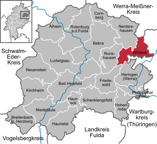
Wildeck is a community in Hersfeld-Rotenburg district in northeastern Hesse, Germany lying right at the boundary with Thuringia, 54 km southeast of Kassel.
Berka/Werra is a former Verwaltungsgemeinschaft in the district Wartburgkreis in Thuringia, Germany. The seat of the Verwaltungsgemeinschaft was in Berka/Werra. It was disbanded in January 2019, when its municipalities were merged into the new town Werra-Suhl-Tal.
The East Hesse Highlands describes a heavily wooded range of hills lying mainly in the German state of Hesse, but also extending a little way into Lower Saxony to the north, Thuringia to the east and Bavaria to the southeast. The region is sandwiched between the West Hesse Depression to the west, the Weser Uplands to the north, the Thuringian Basin to the northeast, the northwestern edge of the Thuringian Forest to the east, the Spessart to the south and the Wetterau to the southwest.
The Rennsteig is a ridge walk as well as an historical boundary path in the Thuringian Forest, Thuringian Highland and Franconian Forest in Central Germany. The long-distance trail runs for about 170 km from Eisenach and the Werra valley in the northwest to Blankenstein and the Selbitz river in the southeast.
Suhl is a river of Hesse and Thuringia, Germany. It flows into the Weihe near Berka/Werra.
The Nesse is a 54.5-kilometre-long (33.9 mi) tributary of the Hörsel in the southern Thuringia. Strictly speaking, it represents a second, right main branch of the Hörsel, which brings about as much water to join the Hörsel as the Hörsel itself and drains an even larger catchment area.
Suhl is a town in Thuringia, Germany.
The Gleichberge, which mainly comprise the Großer and Kleiner Gleichberg, are a small, inselberg-like mountain range, up to 679 m above sea level (NHN), in the southwestern part of the German state of Thuringia. They rise just east of the little ancient town of Römhild in the county of Hildburghausen.
The Salzungen Werra Upland is a natural region in Germany that forms part of the East Hesse Highlands in the German states of Hesse and Thuringia.
The Seulingswald is a hill range in the German Central Uplands which reaches heights of up to 480.3 m above sea level (NHN). It is part of the Fulda-Werra Uplands in the East Hesse Highlands within the Hessian county of Hersfeld-Rotenburg; small ridges extend into the Thuringian county of Wartburgkreis. It is a sandstone range and one of the largest contiguous woodland areas in Hesse.
Werra-Suhl-Tal is a town and a municipality in the district Wartburgkreis, in Thuringia, Germany. It was created with effect from 1 January 2019 by the merger of the former municipalities of Berka/Werra, Dankmarshausen, Dippach und Großensee. The name refers to the rivers Werra, Suhl (Weihe) and Suhl (Werra).
Wartburgkreis II – Eisenach is an electoral constituency represented in the Landtag of Thuringia. It elects one member via first-past-the-post voting. Under the current constituency numbering system, it is designated as constituency 6. It covers the city of Eisenach and central-western parts of Wartburgkreis.
This page is based on this Wikipedia article Text is available under the CC BY-SA 4.0 license; additional terms may apply. Images, videos and audio are available under their respective licenses.