
West Berlin was a political enclave which comprised the western part of Berlin from 1948 until 1990, during the Cold War. Although West Berlin lacked any sovereignty and was under military occupation until German reunification in 1990, the territory was claimed by the Federal Republic of Germany (FRG), despite being entirely surrounded by East Germany (GDR). The legality of this claim was contested by the Soviet Union and other Eastern Bloc countries. However, West Berlin de facto aligned itself politically with the FRG from May 1949 and was thereafter treated as a de facto city-state of that country. After 1949, it was directly or indirectly represented in the institutions of the FRG, and most of its residents were citizens of the FRG.
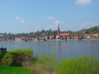
Lauenburg, or Lauenburg an der Elbe, is a town in the state of Schleswig-Holstein, Germany. It is situated on the northern bank of the river Elbe, east of Hamburg. It is the southernmost town of Schleswig-Holstein and belongs to the district of Herzogtum Lauenburg.
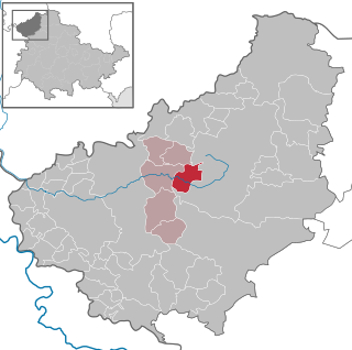
Wingerode is a municipality in the district of Eichsfeld in Thuringia, Germany. In 1996, Wingerode celebrated its 850th anniversary. It was founded in 1146.
Oebisfelde is a town and a former municipality in the Börde district in Saxony-Anhalt, Germany. Since 1 January 2010, it is part of the town Oebisfelde-Weferlingen. It is accessed by Bundesstraße 188.

Heiligensee is a locality within Reinickendorf, a borough of the German capital, Berlin.
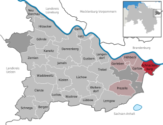
Schnackenburg is a town in the Lüchow-Dannenberg district, in Lower Saxony, Germany. It is situated on the left bank of the Elbe. It is part of the Samtgemeinde Gartow. Lying at the easternmost projection of Lower Saxony, the town is bordered on all sides except the west by territory that was formerly East Germany. It is the least densely populated town ("Stadt") in what was West Germany, although there are nine towns in what was formerly East Germany that are less densely populated.

Büchen is a municipality in the district of Lauenburg, in Schleswig-Holstein, Germany. It is seat of the Amt Büchen.

The Berlin border crossings were border crossings created as a result of the post-World War II division of Germany. Prior to the construction of the Berlin Wall in 1961, travel between the Eastern and Western sectors of Berlin was completely uncontrolled, although restrictions were increasingly introduced by the Soviet and East German authorities at major crossings between the sectors. This free access, especially after the closure of the Inner German border, allowed the Eastern Bloc emigration and defection to occur. East German officials, humiliated by this mass defection, subsequently chose to erect the Berlin Wall in order to prevent residents from leaving East Germany.

Bad Salzungen is a town in Thuringia, Germany. It is the capital of the Wartburgkreis district.

Berg is a municipality in the district of Hof in Bavaria, Germany.

Töpen is a municipality in Upper Franconia in the district of Hof in Bavaria in Germany.
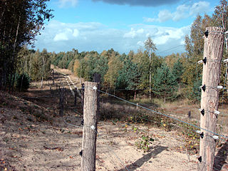
Dallgow-Döberitz is a municipality in the Havelland district, in Brandenburg, in eastern Germany.

Cumlosen is a municipality in the Prignitz district, in Brandenburg, Germany.

Rühen is a municipality in the district of Gifhorn, in Lower Saxony, Germany. The Municipality Rühen includes the villages of Brechtorf, Eischott and Rühen.
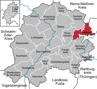
Wildeck is a municipality in Hersfeld-Rotenburg district in northeastern Hesse, Germany lying right at the boundary with Thuringia, 54 km southeast of Kassel.

Nostorf is a municipality in the Ludwigslust-Parchim district, in Mecklenburg-Vorpommern, Germany.

Schwanheide is a municipality in the Ludwigslust-Parchim district, in Mecklenburg-Vorpommern, Germany.

Gudow is a municipality in the district of Lauenburg, in Schleswig-Holstein, Germany.

Probstzella is a municipality in the district Saalfeld-Rudolstadt, in Thuringia, Germany.
The Halle–Bebra railway, known in German as the Thüringer Bahn, is a 210 kilometre-long railway line from Halle (Saale) via Erfurt and Gerstungen to Bebra, mainly in Thuringia. As far as Gerstungen the line originally belonged to the Thuringian Railway Company. From Gerstungen to Bebra, it was owned by the Frederick William Northern Railway (Friedrich-Wilhelms-Nordbahn), named after the Prussian king, Frederick William IV. It is now a two-track, electrified, standard gauge mainline operated by DB Netze. It was opened between 1846 and 1849 and was the first railway line in Thuringia. All types of trains from Regionalbahn to ICE currently run on the line except Interregio-Express. Four of the six largest cities in Thuringia are located on the line.


