
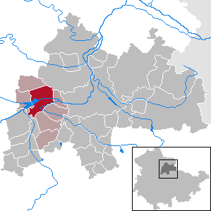
Hohes Kreuz is a municipality in the Eichsfeld in Thuringia, Germany. The municipality was created in 1991 by merging the municipalities of Bischhagen, Mengelrode, Siemerode, and Streitholz.

Eichstruth is a municipality in the district of Eichsfeld in Thuringia, Germany. By area, it is the smallest municipality in what was East Germany, although there are 35 rural municipalities ("Gemeinden") and one city ("Stadt"), Arnis, in what was West Germany that have lesser or equal area.

Bad Salzungen is a town in Thuringia, Germany. It is the capital of the Wartburgkreis district.
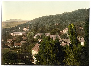
Bad Liebenstein is a municipality and spa town in Wartburgkreis district of Thuringia, Germany.
Sulza is a municipality in the district Saale-Holzland, in Thuringia, Germany.

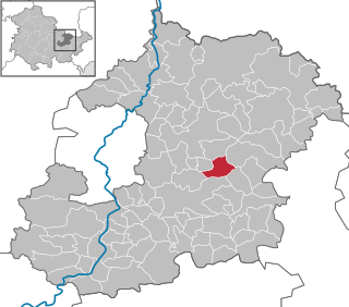
Königsee is a town and a municipality in the district of Saalfeld-Rudolstadt, in Thuringia, Germany. It is situated 12 kilometres (7.5 mi) east of Ilmenau, and 35 kilometres (22 mi) south of Erfurt. The present municipality was formed on 31 December 2012 by the merger of the former municipalities Königsee and Rottenbach, under the name Königsee-Rottenbach. On 1 January 2019 the former municipalities Dröbischau and Oberhain were absorbed, and the name was changed to Königsee.
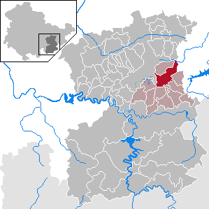
Dittersdorf is a municipality in the district Saale-Orla-Kreis, in Thuringia, Germany. On 1 December 2010 it absorbed the former municipality Dragensdorf.

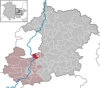
Barchfeld is a village and a former municipality in the Wartburgkreis district of Thuringia, Germany. Since 31 December 2012, it is part of the municipality Barchfeld-Immelborn.

Tissa is a municipality in the district Saale-Holzland, in Thuringia, in the eastern part of Germany.
Zimmern is a municipality in the Saale-Holzland district of Thuringia, Germany.
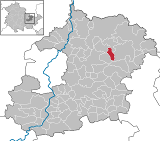
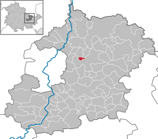
Straußfurt is a municipality in the Sömmerda district of Thuringia, Germany. The former municipality Henschleben was merged into Straußfurt in December 2019.
Bobeck is a municipality in the district Saale-Holzland, in Thuringia, Germany.
Crossen an der Elster is a municipality in the district Saale-Holzland, in Thuringia, Germany.
Frauenprießnitz is a municipality in the district Saale-Holzland, in Thuringia, Germany.
Hainspitz is a municipality in the district Saale-Holzland, in Thuringia, Germany.
Kleinbockedra is a municipality in the district Saale-Holzland, in Thuringia, Germany. With 34 inhabitants at the end of 2019, it is the least populous municipality in what used to be East Germany, although there are 23 municipalities with lesser or equal population in what used to be West Germany. All of the Western municipalities are in either Rhineland-Palatinate (17), or Schleswig-Holstein (6).
Laasdorf is a municipality in the district Saale-Holzland, in Thuringia, Germany.
Nausnitz is a municipality in the district Saale-Holzland, in Thuringia, Germany.

Oberbodnitz is a municipality in the district Saale-Holzland, in Thuringia, Germany.
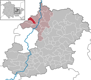
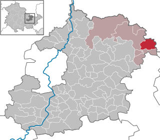
Wartburgkreis III is an electoral constituency represented in the Landtag of Thuringia. It elects one member via first-past-the-post voting. Under the current constituency numbering system, it is designated as constituency 7. It covers the northern part of Wartburgkreis.


