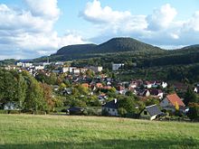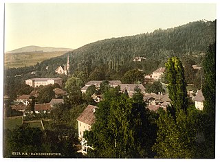
Bad Liebenstein is a municipality and spa town in Wartburgkreis district of Thuringia, Germany.

Wiesenthal is a municipality in the Wartburgkreis district of Thuringia, Germany.
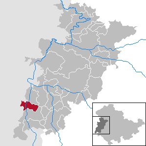
Buttlar is a municipality in the Wartburgkreis district of Thuringia, Germany.

Unterbreizbach is a municipality in the Wartburgkreis district of Thuringia, Germany.

Empfertshausen is a municipality in the Wartburgkreis district of Thuringia, Germany.

Weilar is a municipality in the Wartburgkreis district of Thuringia, Germany.

Gerstengrund is a municipality in the Wartburgkreis district of Thuringia, Germany.

Schleid is a municipality in the Wartburgkreis district of Thuringia, Germany.
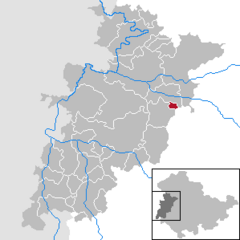
Nazza is a municipality in the Wartburgkreis district of Thuringia, Germany.

Leimbach is a municipality in the Wartburgkreis district of Thuringia, Germany.
Lauterbach is a municipality in the Wartburgkreis district of Thuringia, Germany.

Krauthausen is a municipality in the Wartburgkreis district of Thuringia, Germany.
Hörselberg-Hainich is a municipality in the Wartburgkreis district of Thuringia, Germany. It was formed on 1 December 2007 combining the former municipalities of Behringen and Hörselberg.

Barchfeld-Immelborn is a municipality in the Wartburgkreis district of Thuringia, Germany. It was formed on 31 December 2012 by the merger of the former municipalities Barchfeld and Immelborn. The river Werra flows through the municipality.

Krayenberggemeinde is a municipality in the Wartburgkreis district of Thuringia, Germany. It was named after the hill Krayenberg. It was formed on 31 December 2013 by the merger of the former municipalities Dorndorf and Merkers-Kieselbach.

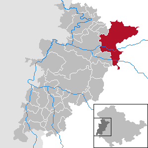
Werra-Suhl-Tal is a town and a municipality in the Wartburgkreis district of Thuringia, Germany. It was created on 1 January 2019 by the merger of the municipalities of Berka/Werra, Dankmarshausen, Dippach and Großensee. Its name refers to the rivers Werra, Suhl (Weihe) and Suhl (Werra).

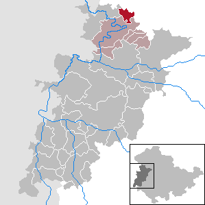
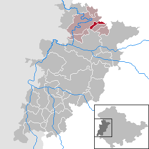
Amt Creuzburg is a town in the Wartburgkreis district, in Thuringia, Germany. It was created with effect from 31 December 2019 by the merger of the former municipalities of Creuzburg, Ebenshausen and Mihla. On 1 January 2024, it absorbed the former municipality Frankenroda. It takes its name from the town Creuzburg, the centre of the new municipality.
Wartburgkreis I is an electoral constituency represented in the Landtag of Thuringia. It elects one member via first-past-the-post voting. Under the current constituency numbering system, it is designated as constituency 5. It covers the southern part of Wartburgkreis and a small area of Schmalkalden-Meiningen.
Wartburgkreis II – Eisenach is an electoral constituency represented in the Landtag of Thuringia. It elects one member via first-past-the-post voting. Under the current constituency numbering system, it is designated as constituency 6. It covers the city of Eisenach and central-western parts of Wartburgkreis.
Wartburgkreis III is an electoral constituency represented in the Landtag of Thuringia. It elects one member via first-past-the-post voting. Under the current constituency numbering system, it is designated as constituency 7. It covers the northern part of Wartburgkreis.