
Malaybalay, officially the City of Malaybalay, is a 1st class component city and capital of the province of Bukidnon, Philippines. According to the 2020 census, it has a population of 190,712 people.

Valencia, officially the City of Valencia, is a 2nd class component city in the province of Bukidnon, Philippines. According to the 2020 census, it has a population of 216,546 people.

Kibawe, officially the Municipality of Kibawe, is a 2nd class municipality in the province of Bukidnon, Philippines. According to the 2020 census, it has a population of 41,897 people.

Tiaong, officially the Municipality of Tiaong, is a 1st class municipality in the province of Quezon, Philippines. According to the 2020 census, it has a population of 106,265 people.
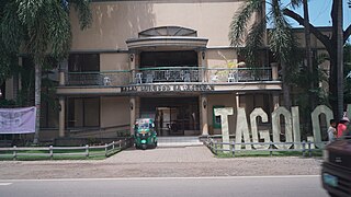
Tagoloan, officially the Municipality of Tagoloan, is a 1st class municipality in the province of Misamis Oriental, Philippines. It is located to the east of Cagayan de Oro and located south-east of Macajalar Bay. According to the 2020 census, it has a population of 80,319 people.
Casisang is the most populous of the 46 barangays of Malaybalay. It is the seat of government of the City of Malaybalay since the City Hall is located here. Situated in the South Highway District of Malaybalay, Casisang borders on the north with the Poblacion barangays of Barangay 11, Barangay 7, and Barangay 9, on the east with Can-ayan, on the south with San Jose, Magsaysay, and Mapayag, and on the West by Imbayao and Kalasungay. According to 2015 census Casisang has a population of 25,696 people.
Dalwangan is a barangay west of Malaybalay City situated on the foothills of the Kitanglad Range, 12 kilometers west of the city proper. It is bounded to the north by Impalutao of the municipality of Impasugong, to the east by Patpat and Kalasungay, to the south by Capitan Angel and the Mount Kitanglad Range Natural Park, and to the west by Kibenton of Impasugong. According to the 2015 census, Dalwangan has a population of 7,004 people.
Aglayan is an urban barangay of the City of Malaybalay in the Province of Bukidnon, Philippines. According to the 2015 census, Aglayan has a population of 7,594 people.

Can-ayan is a rural barangay in the North Highway District of Malaybalay City, Bukidnon, Philippines. According to the 2015 census, Can-ayan has a population of 5,870 people.
Kalasungay is an urban barangay in the North Highway District of Malaybalay, Bukidnon, along the Sawaga River. According to the 2015 census, it has a population of 8,272 people.

Manalog is a rural barangay of the North Highway District of Malaybalay City, Bukidnon, in the Philippines. According to the 2015 census, it has a population of 969 people. It is the northernmost village in Malaybalay, bounded to the north by Barangay Dumalaguing and Barangay Bulonay of Impasugong, to the east by Busdi, to the south by Kibalabag, to the southwest by Kalasungay, and to the west by Barangay Bontongon of Impasugong. Its inhabitants are mostly native Higaunons who has a legal ancestral domain claim in the area. In fact, Manalog is entirely within the Bukidnon Higaonon Tribal Association's (BUHITA) Ancestral Domain.
Laguitas is a rural barangay in the South Highway District of Malaybalay, Bukidnon, in the Philippines. It is bounded to the north and east by San Jose, to the south by Linabo and Aglayan, and to the west by Magsaysay. According to the 2015 census, it has a population of 3,233 people.
Apo Macote is a rural barangay in the Basakan District of Malaybalay City, in the province of Bukidnon, Philippines. It is the southernmost barangay of Malaybalay. According to the 2015 census, Apo Macote has a population of 4,903 people.
Busdi is a rural barangay of the Upper Pulangi District of Malaybalay, Bukidnon, Philippines. According to the 2015 census, it has a population of 2,377 people. It is bounded to the north by Barangay Bulonay of Impasug-ong, to the east by the Municipality of La Paz, Agusan del Sur, to the south by Saint Peter and Kulaman, and to the west by Kibalabag and Manalog.
Caburacanan is a rural barangay of the Upper Pulangi District in Malaybalay City, Bukidnon, Philippines. According to the 2015 census, it has a population of 1,150 people, making it the least populated village in Upper Pulangi. It is bounded to the north by Kulaman, to the east by Saint Peter and Zamboanguita, to the south by Mapulo, and to the west by Can-ayan and Kibalabag. The western part of the village is mountainous with vast old-growth forests and the east is a valley along the Pulangi River, where the village proper is found. The population is mostly Higaunen. It had two sitios under its jurisdiction which are now abandoned: Sambukan, a hamlet to the north; and Talahidan, on the west. Caburacanan has one elementary school administered by the Department of Education, Division of Malaybalay City
Zamboanguita is a rural barangay in the Upper Pulangi District of the city of Malaybalay, Philippines. According to the 2015 census, it has a population of 1,667 people. It is bounded to the north by Saint Peter separated by the Tigpaniki Creek, to the east by the Municipality of La Paz, Agusan del Sur separated by the Pantaron Range, to the south by Indalasa separated by the Pagpag Creek and Mount Mintakdaw, and to the west by Caburacanan and Mapulo separated by the Pulangi River. Zamboanguita sits on a fertile valley between the Pulangi River and the Pantaron Range where most of its area is classified as forestland. It is primarily agricultural with a flourishing commercial activity. It has two sitios: Malilong and Kinuaw. Zamboanguita has one public elementary school, administered by the Department of Education, Division of Malaybalay
Capitán Ángel is a rural barangay in the North Highway District of the city of Malaybalay, Philippines. It is situated entirely within the foothills of the Kitanglad Range. Formerly a sitio of Kalasungay, it achieved barangayhood on April 20, 1963, by virtue of Republic Act no. 3590 and was named after Ángel Casinabe, then the teniente del barrio of Kalasungay. According to the 2015 census, it has a population of 1,160 people.

Poblacion District refers to the poblacion of Malaybalay, Philippines. It is composed of eleven barangays and has an aggregate population of 26,579 and an area of 12.72 square kilometers. It is bounded to the north by Sumpong, to the east by Can-ayan, to the south by Casisang, and to the west by Kalasungay.
Kibalabag is a rural barangay in the North Highway District of Malaybalay, Philippines. As of 2015, it has a population of 1,158 people.

Malaybalay, the capital of Bukidnon, is subdivided into 46 barangays. The Philippine Standard Geographic Code classifies 15 barangays as urban and 31 rural; however, the City of Malaybalay classifies 18 barangays as urban and 28 rural. These barangays are grouped into five administrative districts, namely Basakan, North Highway, Poblacion, South Highway, and Upper Pulangi.

