Port Burwell Wind Farm is a large wind farm near Port Burwell, Ontario, Canada. The facility stretches approximately 8 kilometres (5.0 mi) to the west of the town, and 16 kilometres (9.9 mi) to the southeast.
Kingsbridge Wind Power Project, also referred to as Kingsbridge 1 Wind facility , refers to a large wind farm owned and operated by Capital Power Corporation. Kingsbridge 1 Wind facility is located between Goderich and Kincardine, Ontario. The Kingsbridge 1 Wind facility is located on the southeast shore of Lake Huron in the township of Ashfield-Colborne-Wawanosh and consists of 22 1.8 MW Vestas V80 wind turbines with a capacity of 39.6 MW. Each tower is over 78 meters tall and weigh around 195 metric tonnes. The project consists of two phases and currently provides power to on average 12,500 homes.

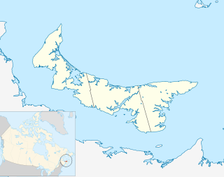
North Cape is a cape at the northwestern-most extremity of Prince Edward Island, Canada. It is located within the community of Seacow Pond.

The Wild Horse Wind Farm is a 273-megawatt wind farm that generates energy for Puget Sound Energy that consists of one hundred twenty seven 1.8-megawatt Vestas V80 turbines and twenty two 2.0-megawatt Vestas V80 turbines on a 10,800-acre (4,400 ha) site in Kittitas County, Washington, 17 miles (27 km) east of Ellensburg, Washington. The turbines are placed on the high open Shrub-steppe ridge tops of Whiskey Dick Mountain, which was chosen for its energetic wind resource, remote location, and access to nearby power transmission lines. The towers are 221 feet (67 m) tall, and each blade is 129 feet (39 m) long, with a total rotor diameter of 264 feet (80 m), larger than the wingspan of a Boeing 747. The turbines can begin producing electricity with wind speeds as low as 9 mph (14 km/h) and reach full production at 31 mph (50 km/h). They shut down at sustained wind speeds of 56 mph (90 km/h). The site is also home to one of the largest solar array in Washington.

Wind power in Ohio has a long history, and as of 2016, Ohio had 545 megawatt (MW) of utility-scale wind power installations installed, responsible for 1.1% of in-state electricity generated. Over 1000 MW more were under construction or pending approval. Some installations have become tourist attractions. There has been a sudden increase in generating capacity, as total windpower generation in the state in 2010 was just 9.7 MW.

The Cedar Creek Wind Farm is a 551.3 megawatt (MW) wind farm located about 8 miles east of the town of Grover in north-central Weld County, Colorado. It consists of 397 wind turbines and was constructed in two phases, Cedar Creek I and Cedar Creek II, becoming fully operational in 2010. The electricity is sold to the Public Service Company of Colorado.

There are a number of wind power projects in the state of Maine, totalling more than 900 MW in capacity and responsible for 13.85% of in-state electricity production. The largest single wind farm is the Bingham Wind Farm in Kingsbury Plantation with an installed capacity of 185 MW.

The Centennial Wind Power Facility is a SaskPower facility situated in the hills 25 kilometres southeast of Swift Current, Saskatchewan. The 150 megawatt wind farm has 83 Vestas V80 turbines, with a total rotor diameter of 80 metres and blade length of 39 metres, and can produce enough electricity for about 69,000 Saskatchewan homes.
The Whispering Willow Wind Farm – East in Franklin County, Iowa, USA, has a capacity of 200 megawatts (MW) and was completed in 2009. It consists of 121 wind turbines spread out over roughly 140 square kilometres (54 sq mi). Construction of the wind farm began in 2008.
The Hopkins Ridge Wind Farm is an electricity generating wind farm facility located in Columbia County, Washington, United States. It is owned by Puget Sound Energy and began operations in 2005, built by RES Americas, a part of the Renewable Energy Systems Group. After a second phase of construction in 2008, the facility has a generating capacity of 157 megawatts, up from 149 megawatts. In the past, the energy output of Hopkins Ridge and Wild Horse Wind Farm has been sold to various California utilities through power purchase agreements.

The Bear Mountain Wind Park is an electricity generating wind farm facility located near Dawson Creek, British Columbia, Canada. It is owned by Bear Mountain Wind LP and began operations in November, 2009. BC's first operating wind farm has a generating capacity of 102 megawatts. It uses 34 turbines in a single row along Bear Mountain ridge. The turbines are Enercon E-82.
The Dokie Ridge Wind Farm is a wind farm located near Chetwynd, British Columbia, Canada. It was put into commercial operation in 2011. The facility has a generating capacity of 144 megawatts and is produces 320 to 340 gigawatt-hours of energy per year. . Electrical engineering consulting services are provided by Lex Engineering Ltd. BC Hydro announced the project was in commercial operation as of February 16, 2011. The project was built in partnership between GE and Plutonic Power Corporation. The wind farm has 48 Vestas V90 3 MW turbines, an electrical substation and seven kilometers of transmission line. The project cost about $228 million (Canadian).

Meadow Lake Wind Farm is a 801.25 megawatt (MW) wind farm near Brookston and Chalmers, Indiana, spreading over portions of White, Jasper, and Benton Counties. It is owned and operated by EDP Renewables North America. The facility currently has six operational phases, with 414 turbines, and is a prominent feature on both sides of Interstate 65 in western Indiana.

Caribou Wind Park is a large wind farm project located approximately 70 km west of Bathurst, New Brunswick which was completed in November 2009. The farm is the second in New Brunswick. It is owned and operated by GDF Suez and the power is purchased by NB Power for supply to consumers.
The Red Lily Wind Farm is a Red Lily Wind Energy Partnership facility situated north west of Moosomin, Saskatchewan, in the Rural Municipality of Moosomin. The facility is owned by Concorde Pacific and developed and constructed by Algonquin Power. The wind farm will consist of 16, V82-1.65 MW wind turbine, for a total of 25 MW. At a cost of $60 million, work on the project started in 2010, with the facility coming online in February 2011. The facility is being constructed under a long-term, 25-year, power purchase agreement with SaskPower.

The Delabole wind farm was the first commercial onshore wind farm built in the United Kingdom, in November 1991. This field of wind turbines was initially developed by Windelectric Management Ltd.

The great majority of wind turbines around the world belong to individuals or corporations who use them to generate electric power or to perform mechanical work. As such, wind turbines are primarily designed to be working devices. However, the large size and height above surroundings of modern industrial wind turbines, combined with their moving rotors, often makes them among the most conspicuous objects in their areas. A few localities have exploited the attention-getting nature of wind turbines by placing them on public display, either with visitor centers on their bases, or with viewing areas farther away. The wind turbines themselves are generally of conventional horizontal-axis, three-bladed design, and generate power to feed electrical grids, but they also serve the unconventional roles of technology demonstration, public relations, and education.
The Gosfield Wind Project is a 50.6 megawatt (MW) wind farm in Kingsville, Ontario, consisting of 22 2.3 MW Siemens SWT 2.3 wind turbines with 49 metre long blades. Construction was completed in October 2010 for CDN 149 million.

Windpark Noordoostpolder is an onshore and near-shore wind farm in Flevoland, the Netherlands. Upon completion in 2017, it was the largest wind farm in the Netherlands, and as of 2019 it is still one of the largest. Owner-operators are members of the Koepel Windenergie Noordoostpolder, a partnership of more than 100 agricultural entrepreneurs from the North East Polder (Noordoostpolder), and Innogy, a subsidiary of German energy company RWE.
The Flat Ridge Wind Farm is an electricity generating wind facility spanning the intersection of Barber, Harper and Kingman County in the U.S. state of Kansas, located about 50 miles (80 km) southwest of the city of Wichita. It was constructed in two phases and has a total generating capacity of 570.4 megawatts (MW), becoming the largest such facility in the state upon its completion in 2012.


