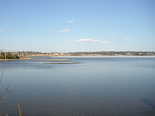
Sunset Acres is a neighborhood of Cole Harbour, Nova Scotia, Canada, in the Halifax Regional Municipality.
Sunset Acres is a neighborhood of Cole Harbour, Nova Scotia, Canada, in the Halifax Regional Municipality.

Halifax Chebucto is a provincial electoral district in Nova Scotia, Canada, that elects one member of the Nova Scotia House of Assembly.

The Musquodoboit River is a Canadian river located in central Nova Scotia in the northeastern part of Halifax Regional Municipality. The river is approximately 97 kilometres (60 mi) in length with roughly 88 kilometres (55 mi) being traversable by paddle. It has a watershed area of 1,409 square kilometres (544 sq mi)
Route 322 is a collector road in the Canadian province of Nova Scotia.

McNabs Island is the largest island in Halifax Harbour located in Halifax Regional Municipality, Nova Scotia, Canada. It played a major role in defending Halifax Harbour and is now a provincial park. The island was settled by Britons in the 1750s and later by Peter McNab, and McNab family members lived on the island until 1934.
Route 318 is a collector road in the Canadian province of Nova Scotia.
Goffs is a Canadian rural community in Nova Scotia's Halifax Regional Municipality.

East Lawrencetown is a rural community within Halifax Regional Municipality in Nova Scotia, Canada on the Eastern Shore on Route 207 along the scenic route Marine Drive. The community is 22.4 kilometers from Halifax. Lawrencetown Beach Provincial Park is located in the community, at the southern end of Lawrencetown Lake, a natural ocean inlet. The beach is a year-round destination for surfing, attracting both locals and those from abroad. There are also places to park vehicles, stroll along boardwalks, hike, mountain bike and swim. Available to the public in the summer is a canteen, showers, flush toilets and a section of beach that is supervised by the Nova Scotia Lifeguard Service.

Montague Gold Mines is a rural community in the Halifax Regional Municipality of Nova Scotia, located on the Montague Road off of exit 14 of Highway 107 three kilometers from Dartmouth.
Halifax was a provincial electoral district in Nova Scotia, Canada, that elected three, and then five members to the Nova Scotia House of Assembly. It existed from 1867 to 1933, at which point Halifax County was divided into five separate electoral districts: Halifax South, Halifax Centre, Halifax North, Halifax East and Halifax West.
Nova Scotia Museum (NSM) is the corporate name for the 28 museums across Nova Scotia, Canada, and is part of the province's tourism infrastructure. The organization manages more than 200 historic buildings, living history sites, vessels, and specialized museums and about one million artifacts and specimens, either directly or through a system of co-operative agreements with societies and local boards. The NSM delivers programs, exhibits and products which provide both local residents and tourists in Nova Scotian communities an opportunity to experience and learn about Nova Scotia's social and natural history. More than 600,000 people visit the facilities each year.

Southwest Island is an uninhabited , 30-acre (120,000 m2) island in the southwest corner of St. Margarets Bay, Nova Scotia.

Nova Scotia Archives is a governmental archival institution serving the Canadian province of Nova Scotia. The archives acquires, preserves and makes available the province's documentary heritage – recorded information of provincial significance created or accumulated by government and the private sector over the last 300 years.
Oak Lake (Nova Scotia) could mean the following lakes:

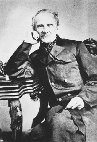
Oakfield is a community of the Halifax Regional Municipality in the Canadian province of Nova Scotia. The community was founded and named by John Wimburn Laurie. He built St. Margaret's of Scotland Church and is the namesake of Laurie Park. He arrived in Canada in 1861. In 1865 he purchased 800 acres in Oakfield. He brought twenty families from England.
Fairmount, Nova Scotia is a neighbourhood of Halifax, Nova Scotia, Canada.
Green Acres, Nova Scotia is a residential neighbourhood in Halifax on the Mainland Halifax within the Halifax Regional Municipality Nova Scotia. Not to be confused with Green Acres the Subdivision (land) in Kings County, Nova Scotia in The Annapolis Valley.
Lakelands is a community in the Canadian province of Nova Scotia, located in the Municipal District of East Hants
There are various Black Lakes in Nova Scotia, Canada. They vary widely in size, depth and usability. Many counties, such as Cumberland, Halifax, Inverness, and Pictou Counties have more than one Black Lake so named, while other counties mentioned in this article have only one named Black Lake.

The Black-Binney House was a former residence built in 1819 in Halifax, Nova Scotia which is now a National Historic Site of Canada. The house was built by John Black (merchant) and is reflective of the Palladian-inspired residences common during the late 18th and early 19th centuries in Eastern Canada. In 1857, Hibbert Binney subdivided the property to build the St. Matthew's United Church (Halifax). In 1965 Sidney Culverwell Oland purchased and renovated the building to house the Nova Scotia Division of the Canadian Corps of Commissionaires.

A township in Nova Scotia, Canada, was an early form of land division and local administration during British colonial settlement in the 18th century. They were created as a means of populating the colony with people loyal to British rule. They were typically rural or wilderness areas of around 100,000 acres (400 km2) that would eventually include several villages or towns. Some townships, but not all, returned a member to the General Assembly of Nova Scotia; others were represented by the members from the county. Townships became obsolete by 1879 by which time towns and counties had become incorporated.