
Interstate 83 (I-83) is an Interstate Highway located in the states of Maryland and Pennsylvania in the Eastern United States. Its southern terminus is at a signalized intersection with Fayette Street in Baltimore, Maryland; its northern terminus is at I-81 near Harrisburg, Pennsylvania. I-83 runs from Downtown Baltimore north to I-695 near the northern suburb of Timonium on the Jones Falls Expressway before forming a concurrency with I-695. After splitting from I-695, the route follows the Baltimore-Harrisburg Expressway north to the border between Maryland and Pennsylvania. Upon crossing the state line, I-83 becomes the Veterans of Foreign Wars of the United States Memorial Highway and continues north through York toward the Harrisburg area. The route runs along the southern and eastern portion of the Capital Beltway that encircles Harrisburg before reaching its northern terminus.

Williamsport is a city in, and the county seat of, Lycoming County, Pennsylvania, United States. As of the 2020 census, it had a population of 27,754. It is the principal city of the Williamsport Metropolitan Statistical Area, which has a population of about 114,000. Williamsport is the larger principal city of the Williamsport-Lock Haven Combined Statistical Area, which includes Lycoming and Clinton counties.

The Susquehanna River is a major river located in the Mid-Atlantic region of the United States, overlapping between the lower Northeast. At 444 miles (715 km) long, it is the longest river on the East Coast of the United States. By watershed area, it is the 16th-largest river in the United States, and also the longest river in the early 21st-century continental United States without commercial boat traffic.
U.S. Route 111 (US 111) was a U.S. Highway that extended from Baltimore, Maryland north to the Harrisburg, Pennsylvania area. It replaced part of the Susquehanna Trail, partially signed as Pennsylvania Route 4, and was in turn replaced by Interstate 83 (I-83). Portions of its pre-freeway alignment are now Maryland Route 45 and I-83 Business. Other old sections in Pennsylvania are now unsigned Quadrant Routes or township-maintained roads. US 111 extended north to the Pennsylvania–New York state line where U.S. Route 15 now crosses it between 1928 and 1937.

U.S. Route 15 or U.S. Highway 15 (US 15) is a 791.71-mile-long (1,274.13 km) United States Numbered Highway, designated along South Carolina, North Carolina, Virginia, Maryland, Pennsylvania, and New York. The route is signed north–south, from US 17 Alternate in Walterboro, South Carolina, to New York State Route 17 (NY 17) in Corning, New York.

U.S. Route 220 (US 220) is a spur route of US 20. It runs in a north–south layout in the eastern United States, unlike its parent route as well as conventionally even-numbered highways which run east-west. US 220 extends for 678 miles (1,091 km) from an intersection with US 1 in Rockingham, North Carolina, to its interchange with the Southern Tier Expressway in South Waverly, Pennsylvania. Some sections of the route are part of the Appalachian Development Highway System's Corridor O as well as I-73 in North Carolina. US 220 is designated as a spur route of US 20 but the route does not intersect US 20 or connect to other spurs of US 20.
Pennsylvania Route 42 is a 58.6-mile-long (94.3 km) state route located in central Pennsylvania. The southern terminus of the route is at PA 61 in Centralia. The northern terminus is at U.S. Route 220 in Laporte. The route heads north through Columbia County and passes through Catawissa before it crosses the Susquehanna River to Bloomsburg. In Bloomsburg, PA 42 forms a concurrency with US 11 and has an interchange with Interstate 80 (I-80). Past Bloomsburg, the route continues north through Millville and runs through the eastern part of Lycoming County. PA 42 heads into Sullivan County and runs concurrent with US 220 between Beech Glen and Muncy Valley before it loops west through Eagles Mere and reaches its terminus in Laporte.
Pennsylvania Route 14 is a Pennsylvania highway that runs for 52 miles (84 km). It runs from U.S. Route 15 in Trout Run, Pennsylvania to the New York-Pennsylvania border at Fassett, Pennsylvania, co-signed with US 6 for a short distance in Troy. The highway continues in New York as New York State Route 14.

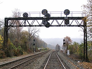
The Northern Central Railway (NCRY) was a Class I Railroad connecting Baltimore, Maryland with Sunbury, Pennsylvania, along the Susquehanna River. Completed in 1858, the line came under the control of the Pennsylvania Railroad (PRR) in 1861, when the PRR acquired a controlling interest in the Northern Central's stock to compete with the rival Baltimore and Ohio Railroad (B&O). For eleven decades the Northern Central operated as a subsidiary of the PRR until much of its Maryland trackage was washed out by Hurricane Agnes in 1972, after which most of its operations ceased as the Penn Central declined to repair sections. It is now a fallen flag railway, having come under the control of the later Penn Central, Conrail, and then broken apart and disestablished. The northern part in Pennsylvania is now the York County Heritage Rail Trail which connects to a similar hike/bike trail in Northern Maryland down to Baltimore, named the Torrey C. Brown Rail Trail. Trackage around Baltimore remains in rail service as well as most of the trackage in Pennsylvania which is operated by Norfolk Southern and the southernmost section in Pennsylvania is operated by the Northern Central heritage railway.

New York State Route 63 (NY 63) is a state highway in the western part of New York in the United States. It extends for 82.11 miles (132.14 km) in a generally southeast–northwest direction from an intersection with NY 15 and NY 21 in the village of Wayland in Steuben County to a junction with NY 18 in the town of Yates in Orleans County, 2 miles (3.2 km) south of the Lake Ontario shoreline. The route passes through the city of Batavia and enters or comes near several villages, including Dansville and Medina.
The Buffalo Line is a railroad line owned by the Norfolk Southern Railway in the U.S. states of New York and Pennsylvania. The line runs from Buffalo, New York southeast to Rockville, Pennsylvania near Harrisburg, Pennsylvania along a former Pennsylvania Railroad line. Its north end is at Seneca Yard in Buffalo, with no direct access to the Lake Erie district, and its south end is at the Pittsburgh Line at Rockville. The line is operated by the Buffalo and Pittsburgh Railroad between Buffalo and Machias, New York, the Western New York and Pennsylvania Railroad between Machias and Driftwood, Pennsylvania, and the Norfolk Southern Railway between Driftwood and Rockville.

The Big Runaway was a mass evacuation in June and July 1778 of settlers from the frontier areas of north central Pennsylvania during the American Revolutionary War. A major campaign by Loyalists and Native Americans allied with the British devastated the small communities on the northern and western branches of the Susquehanna River, prompting local militia leaders to order the evacuation. Most of the settlers relocated to Fort Augusta at modern-day Sunbury at the confluence of the North and West Branches of the Susquehanna River, while their abandoned houses and farms were all burnt.

Pennsylvania Route 297 (PA 297) is a 6-mile-long (9.7 km) state highway located in York County, Pennsylvania. The southern terminus is at PA 921 in Zions View. The northern terminus is at PA 262 in Cly. PA 297 is a two-lane undivided road in the northern section of York County. The route heads north along Susquehanna Trail a short distance to the west of Interstate 83 (I-83) before reaching an interchange with the highway and heading to the east of it. PA 297 turns northeast in Strinestown and crosses PA 382 before it comes to its northern terminus.
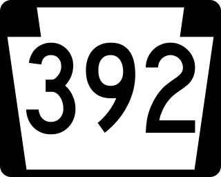
Pennsylvania Route 392 is a 5.16-mile-long (8.30 km) state highway located in York County, Pennsylvania. The western terminus is at PA 177 near Lewisberry. The eastern terminus is at PA 262 near Goldsboro. PA 392 is a two-lane undivided road that runs through rural areas in northern York County. The route heads east and curves south before turning north to come to an interchange with Interstate 83 (I-83). PA 392 curves back east and passes through Yocumtown before reaching its terminus.
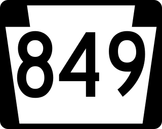
Pennsylvania Route 849 is a 24.8-mile-long (39.9 km) state highway located in Perry and Dauphin counties in Pennsylvania. The western terminus is at PA 74 in Saville Township, Perry County. The eastern terminus is at U.S. Route 22 /US 322 in Reed Township, Dauphin County, near Duncannon. PA 849 winds east from PA 74 through farms and woods to Newport, where it forms a concurrency with PA 34. From Newport, the route heads southeast through more rural land to Duncannon, where it turns east and crosses the Juniata River to reach its terminus at US 22/US 322 just north of the Susquehanna River.

U.S. Route 11 (US 11) roughly parallels Interstate 81 (I-81) in the U.S. state of Pennsylvania. The route runs from the Maryland state line in Antrim Township, Franklin County, northeast to the New York state line in Great Bend Township, Susquehanna County. US 11 serves Harrisburg, Wilkes-Barre, and Scranton. Between Harrisburg and Scranton, US 11 follows the Susquehanna River, while I-81 follows a shorter route over the mountains further to the east.
U.S. Route 220 is a U.S. Highway that is a spur route of US 20. It runs from Rockingham, North Carolina, north to South Waverly, Pennsylvania. In the state of Pennsylvania, the route runs 248 miles (399 km) from the Maryland border in Cumberland Valley Township, Bedford County northeast to an interchange with Interstate 86 (I-86)/New York State Route 17 in South Waverly, Bradford County a short distance south of the New York border. Through the state, US 220 passes through the cities and towns of Bedford, Altoona, State College, Lock Haven, Williamsport, and Towanda. US 220 is concurrent with the entire completed Pennsylvania segment of I-99 between I-70/I-76 in Bedford and I-80 near Bellefonte. US 220 is also a freeway around Bedford, along the I-80 concurrency between Bellefonte and Mill Hall, between Mill Hall and Jersey Shore, from the western end of Williamsport to near Halls, and near the New York border. The remainder of US 220 in Pennsylvania is mostly a two-lane surface road.
U.S. Route 15 (US 15) is United States Numbered Highway that runs from Walterboro, South Carolina, north to Painted Post, New York. In Pennsylvania, the highway runs for 194.89 miles (313.65 km), from the Maryland state line just south of Gettysburg, north to the New York state line near Lawrenceville.

Pennsylvania Route 405 (PA 405) is a 35.124-mile-long (56.527 km) state highway that runs in the north-central part of the U.S. state of Pennsylvania. The southern terminus of PA 61 in Sunbury. The route heads across the Susquehanna River to Northumberland and northward along the West Branch Susquehanna River through Milton, Watsontown and Muncy until entering Hughesville, where it terminates at an intersection with U.S. Route 220 (US 220).
The Central Susquehanna Valley Thruway (CSVT), also known as the Central Susquehanna Valley Transportation Project, is a partially-completed 10.84-mile (17.45 km) highway bypass along the U.S. Route 15 (US 15) corridor near Shamokin Dam, Pennsylvania. It has been designated as part of Corridor P-1 of the Appalachian Development Highway System by the Appalachian Regional Commission. When completed, it will carry US 15 and Pennsylvania Route 147 (PA 147) over varying stretches of its length. The project includes the construction of a new bridge over the West Branch Susquehanna River and 11.7 miles (18.8 km) of new roadway, including a short freeway connection to PA 61. The first phase of the project, connecting US 15 in Winfield with PA 147 near Montandon, opened in August of 2022.

