Svartmangatan

Last updated
Svartmangatan viewed from Stortorget Stockholm kv cepheus.jpg
Svartmangatan viewed from Stortorget
From Tyska Brunnsplan Svarmangatan februari 2007.jpg
From Tyska Brunnsplan

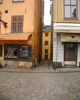
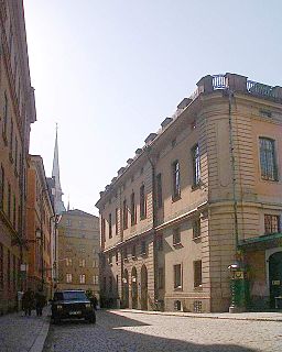
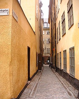
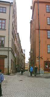
Svartmangatan (Swedish : (literally)) "Black Man Street") is a street in Gamla stan, the old town of Stockholm, Sweden. Stretching south-east from the central square Stortorget to Södra Benickebrinken and Norra Benickebrinken leading to the eastern main street Österlånggatan, it is intercepted by Kindstugatan, Tyska Skolgränd, Tyska Brunnsplan, Själagårdsgatan, Tyska Stallplan, and Baggensgatan, while forming a parallel street to Skomakargatan and Prästgatan. The name refers to the Blackfriar monastery once located at the southern end of the street.

Swedish language North Germanic language spoken in Sweden

Swedish is a North Germanic language spoken natively by 9.6 million people, predominantly in Sweden, and in parts of Finland, where it has equal legal standing with Finnish. It is largely mutually intelligible with Norwegian and to some extent with Danish, although the degree of mutual intelligibility is largely dependent on the dialect and accent of the speaker. Both Norwegian and Danish are generally easier for Swedish speakers to read than to listen to because of difference in accent and tone when speaking. Swedish is a descendant of Old Norse, the common language of the Germanic peoples living in Scandinavia during the Viking Era. It has the most speakers of the North Germanic languages.

Street A public thoroughfare in a built environment

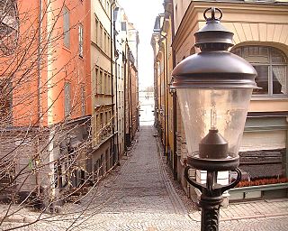
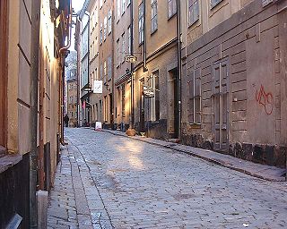
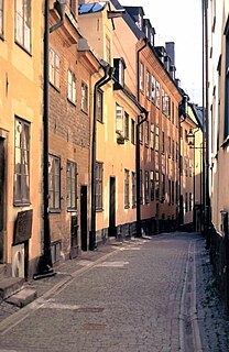
A street is a public thoroughfare in a built environment. It is a public parcel of land adjoining buildings in an urban context, on which people may freely assemble, interact, and move about. A street can be as simple as a level patch of dirt, but is more often paved with a hard, durable surface such as concrete, cobblestone or brick. Portions may also be smoothed with asphalt, embedded with rails, or otherwise prepared to accommodate non-pedestrian traffic.

Gamla stan urban district in Stockholm, Sweden

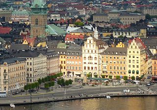
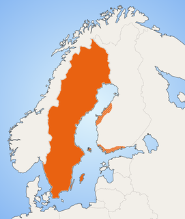
Gamla stan, until 1980 officially Staden mellan broarna, is the old town of Stockholm, Sweden. Gamla stan consists primarily of the island Stadsholmen. Officially, but not colloquially, Gamla stan includes the surrounding islets Riddarholmen, Helgeandsholmen, and Strömsborg.

Contents

Mentioned as early as 1437 and thus one of the oldest streets of Stockholm, Svartmangatan was once also one of its main streets, leading from the central square to the abbey of the Blackfriars. Until the 17th century it was called Svartmunka - or Svartbrödra - ("black monks/brothers"), and, because there are no records of the Dominican monks being referred to as "black men", the only reasonable explanation for the present name of the street is an attempt to create an analogy to Köpmangatan ("The Merchant's Street", or literally "buyer-man-street"), a street also leading from Stortorget. [1]

Köpmangatan street in Gamla stan, Stockholm, Sweden

Köpmangatan is a street in Gamla stan, the old town of Stockholm, Sweden. A parallel street to Trädgårdsgatan, it stretches from the central square Stortorget to Köpmantorget, intercepted by Trädgårdstvärgränd, Skeppar Olofs Gränd, Peder Fredags Gränd, Själagårdsgatan, Staffan Sasses Gränd, Baggensgatan, and Bollhusgränd.

See also

Related Research Articles

Stortorget square in Gamla stan, Stockholm, Sweden

Stortorget is a small public square in Gamla Stan, the old town in central Stockholm, Sweden. It is the oldest square in Stockholm, the historical centre on which the medieval urban conglomeration gradually came into being. Today, the square is frequented by tens of thousands of tourists annually, and is occasionally the scene for demonstrations and performances. It is traditionally renowned for its annual Christmas market offering traditional handicrafts and food.

Solgränd alley in Gamla stan, Stockholm, Sweden

Solgränd is an alley in Gamla stan, the old town of Stockholm, Sweden. It connects the Stortorget square to the street Prästgatan. It is a parallel street to Storkyrkobrinken, Ankargränd, Spektens gränd, and Kåkbrinken.

Skomakargatan street in Gamla stan, Stockholm, Sweden

Skomakargatan is a street in Gamla stan, the old town of Stockholm, Sweden, Stretching between the square Stortorget and the streets Kindstugatan and Tyska Brinken, it forms a parallel street to Prästgatan and Svartmangatan.

Mårten Trotzigs Gränd alley in Gamla stan, Stockholm, Sweden

Mårten Trotzigs gränd is an alley in Gamla stan, the old town of Stockholm, Sweden. Leading from Västerlånggatan and Järntorget up to Prästgatan and Tyska Stallplan, the width of its 36 steps tapers down to a mere 90 centimetres (35 in), making the alley the narrowest street in Stockholm.

Nygränd alley in Gamla stan, Stockholm, Sweden

Nygränd is an alley in Gamla stan, the old town of Stockholm, Sweden, connecting Skeppsbron to Österlånggatan.

Själagårdsgatan street in Gamla stan, Stockholm, Sweden

Själagårdsgatan is a street in Gamla stan, the old town in central Stockholm, Sweden. Stretching south from Köpmangatan to Tyska Brunnsplan, it forms a parallel street to Baggensgatan. It crosses the small triangular square Brända Tomten and is intercepted by Kindstugatan, Tyska Skolgränd, and Svartmangatan.

Kindstugatan street in Gamla stan, Stockholm, Sweden

Kindstugatan is a street in Gamla stan, the old town in central Stockholm, Sweden. Stretching west from Brända Tomten to become Tyska Brinken in its western end, it is crossed by Svartmangatan and Skomakargatan.

Tyska Brunnsplan square in Gamla stan, Stockholm, Sweden

Tyska Brunnsplan is a small, triangular public square in Gamla stan, the old town in central Stockholm, Sweden. It is located in the junction between the streets Svartmangatan and Själagårdsgatan, the former leading to Stortorget and the latter to Brända Tomten. As several local names knows to tell the square is named after the vicinity to the German Church and the German community which once occupied the neighbourhood.

Prästgatan street in Gamla stan, Stockholm, Sweden

Prästgatan is a street in Gamla stan, the old town in central Stockholm, Sweden, stretching from a cul-de-sac west of the Royal Palace to the street Österlånggatan in the southern corner of the old town. Prästgatan forms a parallel street to Västerlånggatan, Trångsund, Skomakargatan, and Svartmangatan. It is intercepted by Storkyrkobrinken, Ankargränd, Spektens Gränd, Solgränd, Kåkbrinken, Tyska Brinken, Tyska Stallplan, Mårten Trotzigs Gränd, and Norra Benickebrinken.

Baggensgatan street in Gamla stan, Stockholm, Sweden

Baggensgatan is a street in Gamla stan, the old town in central Stockholm, Sweden. Forming a southern extension to the street Bollhusgränd near the square Köpmantorget, it stretches to the southern end of Svartmangatan. It forms a parallel street to Själagårdsgatan and Österlånggatan, while being intercepted by Tyska Skolgränd.

Källargränd street in Gamla stan, Stockholm, Sweden

Källargränd is an alley in Gamla stan, the old town in central Stockholm, Sweden, connecting Slottsbacken, the slope south of the Royal Palace, to the square Stortorget. It forms a parallel street to Trångsund and is intercepted by Trädgårdsgatan.

Köpmantorget square in Gamla stan, Stockholm, Sweden

Köpmantorget is a small public square in Gamla stan, the old town in central Stockholm, Sweden, located between the street Köpmangatan and two slopes collectively named Köpmanbrinken, both of which lead down to the street Österlånggatan. Two streets lead north and south: Bollhusgränd and Baggensgatan respectively.

Benickebrinken street in Gamla stan, Stockholm, Sweden

Södra/Norra Benickebrinken are two sloping streets in Gamla stan, the old town in central Stockholm, Sweden, stretching from Österlånggatan up to Svartmangatan.

Trädgårdstvärgränd alley in Gamla stan, Stockholm, Sweden

Trädgårdstvärgränd is a small alley in Gamla stan, the old town in central Stockholm, Sweden. Stretching north from Köpmangatan to Trädgårdsgatan, it forms a parallel street to Skeppar Olofs Gränd and Källargränd. It is located just south of Slottsbacken and Bollhustäppan, not far from Stortorget.

Tyska Skolgränd alley in Gamla stan, Stockholm, Sweden

Tyska Skolgränd is an alley in Gamla stan, the old town in central Stockholm, Sweden, stretching from Svartmangatan to Baggensgatan, and crossed by Själagårdsgatan.

Tyska Stallplan street in Gamla stan, Stockholm, Sweden

Tyska Stallplan is a street in Gamla stan, the old town in central Stockholm, Sweden. Stretching south from Svartmangatan to Prästgatan, it is connected to Baggensgatan and Mårten Trotzigs Gränd, while forming a (somewhat) parallel street to Österlånggatan and Tyska Brinken.

German Church, Stockholm Church in Stockholm, Sweden

The German Church, sometimes called St. Gertrude's Church, is a church in Gamla stan, the old town in central Stockholm, Sweden, belonging to the German Saint Gertrude Parish of the Church of Sweden.

Tyska may refer to:

References

  1. "Innerstaden: Gamla stan". Stockholms gatunamn (in Swedish) (2nd ed.). Stockholm: Kommittén för Stockholmsforskning. 1992. pp. 75–76. ISBN   91-7031-042-4.

Coordinates: 59°19′27″N18°04′20″E / 59.32417°N 18.07222°E / 59.32417; 18.07222

Geographic coordinate system Coordinate system

A geographic coordinate system is a coordinate system that enables every location on Earth to be specified by a set of numbers, letters or symbols. The coordinates are often chosen such that one of the numbers represents a vertical position and two or three of the numbers represent a horizontal position; alternatively, a geographic position may be expressed in a combined three-dimensional Cartesian vector. A common choice of coordinates is latitude, longitude and elevation. To specify a location on a plane requires a map projection.