The history of the many lightvessel stations of Great Britain goes back over 250 years to the placement of the world's first lightship at the Nore in the early 18th century.
The Thames and Medway Canal is a disused canal in Kent, south east England, also known as the Gravesend and Rochester Canal. It was originally some 11 km (6.8 mi) long and cut across the neck of the Hoo peninsula, linking the River Thames at Gravesend with the River Medway at Strood. The canal was first mooted in 1778 as a shortcut for military craft from Deptford and Woolwich Dockyards on the Thames to Chatham Dockyard on the Medway, avoiding the 74 km (46 mi) journey round the peninsula and through the Thames estuary. The canal was also intended to take commercial traffic between the two rivers.
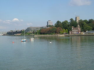
The River Medway is a river in South East England. It rises in the High Weald, West Sussex and flows through Tonbridge, Maidstone and the Medway conurbation in Kent, before emptying into the Thames Estuary near Sheerness, a total distance of 70 miles (113 km). About 13 miles (21 km) of the river lies in East Sussex, with the remainder being in Kent.

The Port of London Authority (PLA) is a self-funding public trust established on 31 March 1909 in accordance with the Port of London Act 1908 to govern the Port of London. Its responsibility extends over the Tideway of the River Thames and its continuation. It maintains and supervises navigation, and protects the river's environment.
Isle of Grain is a village and the easternmost point of the Hoo Peninsula within the district of Medway in Kent, south-east England. No longer an island and now forming part of the peninsula, the area is almost all marshland and is a major habitat for diverse wetland birds. The village constitutes a civil parish, which at the 2011 census had a population of 1,648, a net decrease of 83 people in 10 years.

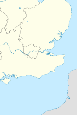
The Thames Estuary is where the River Thames meets the waters of the North Sea, in the south-east of Great Britain.

The PS Medway Queen is a paddle driven steamship, the only mobile estuary paddle steamer left in the United Kingdom. She was one of the "little ships of Dunkirk", making a record seven trips and rescuing 7,000 men in the evacuation of Dunkirk.

HM Fort Roughs is one of several World War II installations that were designed by Guy Maunsell and known collectively as His Majesty's Forts or as Maunsell Sea Forts; the purpose of which was to guard the port of Harwich, Essex, and more broadly, the Thames estuary. This 4,500 ton artificial naval installation is similar in some respects to "fixed" offshore oil platforms. It is situated on Rough Sands, a sandbar located approximately 11 kilometres (6 nmi) from the coast of Suffolk and 13 kilometres (7 nmi) from the coast of Essex. Today it is the location and de-facto capital of the unrecognised, self-proclaimed state of Sealand.

A Thames sailing barge is a type of commercial sailing boat once common on the River Thames in London. The flat-bottomed barges, with a shallow draught and leeboards, were perfectly adapted to the Thames Estuary, with its shallow waters and narrow tributary rivers. The larger barges were seaworthy vessels, and were the largest sailing vessel to be handled by just two men. The average size was about 120 tons and they carried 4,200 square feet (390 m2) of canvas sail in six working sails. The mainsail was loose-footed and set up with a sprit, and was brailed to the mast when not needed. It is sheeted to a horse, as is the foresail; they require no attention when tacking. The foresail is often held back by the mate to help the vessel come about more swiftly.

The Nore is a long bank of sand and silt running along the south-centre of the final narrowing of the Thames Estuary, England. Its south-west is the very narrow Nore Sand. Just short of the Nore's easternmost point where it fades into the channels it has a notable point once marked by a lightship on the line where the estuary of the Thames nominally becomes the North Sea. A lit buoy today stands on this often map-marked divisor: between Havengore Creek in east Essex and Warden Point on the Isle of Sheppey in Kent.

The Maplin Sands are mudflats on the northern bank of the Thames estuary, off Foulness Island, near Southend-on-Sea in Essex, England, though they actually lie within the neighbouring borough of Rochford. They form a part of the Essex Estuaries Special Area of Conservation due to their value for nature conservation, with a large colony of dwarf eelgrass and associated animal communities.
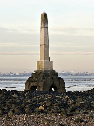
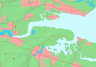
Yantlet Creek is the creek draining into the River Thames that separated the Isle of Grain from the Hoo peninsula. It once connected the River Medway with the River Thames and made the Isle of Grain a true island. The creek silted up and now drains the area of The Isle of Grain and Allhallows Marshes. A monument known as the London Stone is located at its mouth and marks the limit of the City of London's ownership of the Thames.
Fisherman's Gat is a much-deepened channel in the North Sea, between the final long line of shoals loosely associated with the Thames Estuary. The channel cuts across Long Sand. In the west it opens onto the nominal cut-off point of Knock Deep (north) or the Princes Channel (south) which links to the Strait of Dover. In the west it opens to Black Deep, a Thames approach.
The Black Deep is in the outer Thames Estuary. It is the greatest of three mainly natural shipping channels linking the Tideway to central zones of the North Sea without shoals, the others being the Barrow Deep and Princes Channel. Between these, a few others, and the shores of Kent, Suffolk and Essex are many long shoals in the North Sea, broadly shallow enough to wreck vessels of substantial draft at low tide.
The Kentish Knock is a long shoal in the North Sea east of Essex, England. It is the most easterly of those of the Thames Estuary and its core, which is shallower than 18 feet (5.5 m), extends 6 miles (9.7 km). Thus it is a major hazard to deep-draught navigation. It is exactly 28 miles (45 km) due east of Foulness Point, Essex and is centred about 15 miles (24 km) NNE of North Foreland, Kent – both are extreme points of those counties.

SB Centaur is a wooden Thames sailing barge, built in Harwich, Essex, England in 1895. She was used to carry various cargoes, mainly grain, for the next 60 years. During the First World War she carried food and coal to the French Channel ports. During the Second World War Centaur was damaged when sailing to assist with the Dunkirk Evacuation. She did war work for the duration of the conflict.

The Shoeburyness Boom refers to two successive defensive barriers across most of the Thames Estuary in the mid-20th century. As to the part perpendicular to the north shore most of the latter incarnation remains, and its nearest concrete mooring/patrol point 600 metres south. A 2 km stretch, this is designated a scheduled monument and marks the western edge of MoD Shoeburyness firing range, a restricted area. The rest was taken up in the 1960s.
Brighlingsea Naval Base was an installation of the British Royal Navy located at Brightlingsea, Essex, on the East Coast of England. In both wars it was part of the Nore Command, which had its HQ at Chatham, and in the Second was part of Harwich Sub-Command. It existed from late 1914 to 1921, and from early 1940 to 1947,

George Smeed is a Thames barge built in 1882 by Smeed Dean & Co. Ltd. in Murston.