Related Research Articles

Paraíba is a state of Brazil. It is located in the Brazilian Northeast, and it is bordered by Rio Grande do Norte to the north, Ceará to the west, Pernambuco to the south and the Atlantic Ocean to the east. Paraíba is the third most densely populated state of the Northeast; João Pessoa, the sea-bordered state capital, and Campina Grande, in the interior, rank among the fifteen-largest municipalities in the Northeast of Brazil. The state is home to 1.9% of the Brazilian population and produces 0.9% of the Brazilian GDP.
Volta Redonda is the name of a municipality in the Rio de Janeiro state of Brazil with an area of 182.81 km2, located from 350m to 707m above the sea level and with a population of 273,988 inhabitants. The area around the city has nearly 700,000 km2. Its name is due to the round shape of a curve in the Paraíba do Sul river around which the city was built.

The Paraíba do Sul, or simply termed Paraíba, is a river in southeast Brazil. It flows 1,137 km (706 mi) west to northeast from its farthest source at the source of the river Paraitinga to the sea near Campos dos Goytacazes. The river receives its name when it meets the river Paraibuna at the Paraibuna dam.

Cajueiro is a municipality located in the western of the Brazilian state of Alagoas. Its population is 21,331 (2020) and its area is 124 km². Its name comes from the Portuguese for the cashew tree — in the 19th century, a village began to form around such a tree, near the banks of the Paraíba river.
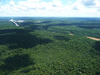
The Alto Paraná Atlantic forests, also known as the Paraná-Paraíba interior forests, is an ecoregion of the tropical moist forests biome, and the South American Atlantic Forest biome. It is located in southern Brazil, northeastern Argentina, and eastern Paraguay.

The Piranhas River, also known as the Açu River, is a river of northeastern Brazil. It originates in southeastern Paraíba state, near the border with Ceará, and flows north-northeast through Paraíba and Rio Grande do Norte states to empty into the Atlantic Ocean near Macau. Its chief tributary is the Seridó, which originates in the Borborema Plateau of central Paraíba and flows northwest to meet the Piranhas.
The Sucuru River is a river of Paraíba state in western Brazil.

Taquaritinga do Norte is a city in the state of Pernambuco, Brazil.
Jataúba is a city in Pernambuco, Brazil.
São José do Belmonte is a city and municipality in the state of Pernambuco, Brazil. The population in 2020, according with IBGE was 34,021 inhabitants and the total area is 1474.09 km².
Sertânia is a city in the state of Pernambuco, Brazil. The population in 2020, according to the IBGE, was 36,050. Its total area is 2421.51 km².
Orobó is a municipality/city in the state of Pernambuco in Brazil. The population in 2020 was 23,935 inhabitants and the total area is 138.66 km2. The city has the best children's mortality rate of the state (2.9) and one of the best in the whole country.

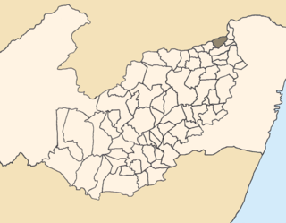
Itambé is a municipality located in the state of Pernambuco, Brazil. Located at 99 km away from Recife, capital of the state of Pernambuco. Has an estimated population of 36,471 inhabitants. The community is split between the state of Pernambuco and the state of Paraíba

Macaparana is a city located in the state of Pernambuco, Brazil. Located 120 kilometres away from Recife, capital of the state of Pernambuco. It has an estimated population of 25,472 inhabitants.
Tuparetama is a city in the state of Pernambuco, Brazil. The population in 2020, according with IBGE was 8,256 inhabitants and the total area is 178.57 km².

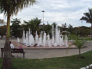
Pocinhos, Paraíba is a municipality in the state of Paraíba in the Northeast Region of Brazil.
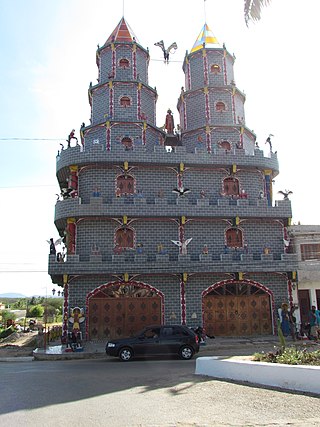
Soledade, Paraíba is a municipality in the state of Paraíba in the Northeast Region of Brazil. Acquired as part of a farm purchased by João de Sousa, the land was donated to a church, which planned to build a chapel. However, a cholera outbreak in 1864 meant that the first use of the land would be a cemetery.
Picuí is a municipality in the state of Paraíba in the Northeast Region of Brazil.

Mataraca is a municipality in the state of Paraíba in the Northeast Region of Brazil.
Monte Horebe is a municipality in the state of Paraíba in the Northeast Region of Brazil.
References
Coordinates: 7°21′S36°36′W / 7.350°S 36.600°W