This article is about the demographic features of the population of São Tomé and Príncipe, including population density, ethnicity, education level, health of the populace, economic status, religious affiliations and other aspects of the population.
Transport in São Tomé and Príncipe relies primarily on road infrastructure for local needs and airports and sea travel for international needs. São Tomé and Príncipe does not have railways.
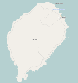
Angolar Creole is a minority Portuguese-based creole language of São Tomé and Príncipe, spoken in the southernmost towns of São Tomé Island and sparsely along the coast, especially by Angolar people. It is also called by its native speakers as n'golá. It is a creole language, based on Portuguese with a heavy substrate of a dialect of Kimbundu, a Bantu language from inland Angola, where many had been enslaved.

Lobata is a district of São Tomé and Príncipe, on São Tomé Island. Its area is 105 km2 (41 sq mi), and its population is 19,365 (2012). The district seat is Guadalupe. It is divided into the four statistical subdistricts Guadalupe, Santo Amaro, Conde and Micoló.

Santana is a town on the eastern coast of São Tomé Island, which is part of the island nation of São Tomé and Príncipe. It is the seat of Cantagalo District. The population of Santana with the adjacent settlements Cidade Alta, Cova Água, Gomes, Nova Olinda, Picão Flor, Praia Messias Alves, Riboque Santana and Zandrigo is 10,290 (2012).2012 detailed census São Tomé e Príncipe, Instituto Nacional de Estatística</ref> Santana lies 9 km south of the capital São Tomé and 17 km northeast of São João dos Angolares. The islet Ilhéu de Santana lies about 1 km off-shore, 2.5 km southeast of Santana.
Porto Alegre is a village in Caué District on São Tomé Island in São Tomé and Príncipe. Its population is 795. Porto Alegre lies 2.5 km northeast of the southernmost point of São Tomé Island, Ponta Homem da Capa. It is 1.5 km west of Ponta Baleia, 17 km southwest of São João dos Angolares and 40 km southwest of the capital São Tomé. Across the Canal das Rolas lies the Ilhéu das Rolas. On the east side of Ponta Homem da Capa is the beach Praia Inhame. The plantation complex Roça de Porto Alegre was established around 1890 by Jacinto Carneiro de Sousa e Almeida. The oldest preserved building dates from 1918.
Dona Augusta is a village on São Tomé Island in São Tomé and Príncipe. Its population is 166. Dona Augusta is located 4 km southwest of São João dos Angolares and 1 km northeast of Praia Pesqueira.
Ribeira Peixe is a seaside village on São Tomé Island in the nation of São Tomé and Príncipe. Its population is 503. It lies 1 km southwest of Praia Pesqueira and 6 km southwest of São João dos Angolares. There was a plantation complex (roça) at Ribeira Peixe, that produced cocoa, copra, coconut and palm oil.
The São Tomé olive pigeon or maroon pigeon is an endangered species of pigeon which is endemic to the island of São Tomé off the coast of west Africa. It was described by José Vicente Barbosa du Bocage in 1888.

The Pico Cão Grande is a landmark needle-shaped volcanic plug peak in São Tomé and Príncipe, in the south of São Tomé Island in Parque Natural Obô de São Tomé. Its summit is 663 m (2,175 ft) above sea level, and it rises about 370 m (1,210 ft) over the surrounding terrain. The volcanic plug was formed by magma solidifying in the vent of an active volcano. The nearest village is Vila Clotilde, 3 km to the east. The district seat São João dos Angolares is 9 km to the east.

Bombaim is a small village on São Tomé Island in São Tomé and Príncipe. Its population is 18. It is 6 km south of Monte Café and 8 km southwest of Trindade. It was established as a plantation (roça).
Vila Clotilde is a village in Caué District on São Tomé Island in São Tomé and Príncipe. Its population is 53. Vila Clotilde lies 6.5 km west of São João dos Angolares. 3 km to its west is Pico Cão Grande, an iconic needle-shaped volcanic plug.
Vila Malanza is a village in Caué District on São Tomé Island in São Tomé and Príncipe. Its population is 550. Vila Malanza lies 1.5 km north of Porto Alegre and 17 km southwest of São João dos Angolares.
Angra Toldo is a village in Caué District on São Tomé Island in São Tomé and Príncipe. Its population is 433. It is located on the coast, northeast of São João dos Angolares and southwest of Ribeira Afonso.
Praia Pesqueira is a seaside village in Caué District on São Tomé Island in São Tomé and Príncipe. Its population is 201. The locality is located just south of Dona Augusta and 5 km southwest of São João dos Angolares.

Rei Amador was a member of the king of the Angolars and leader of a famous slave rebellion that took place in 1595 in the African islands of São Tomé and Príncipe. According to some historic documents, Rei Emadir was "a slave" who avoided slavery and mobilized all the Angolares along with other Africans and made a free nation under the middle of the mentioned islands.


