
Cantagalo is a district of São Tomé and Príncipe, on São Tomé Island. Its area is 119 km2 (46 sq mi), and its population is 17,161 (2012). The district seat is Santana. It is divided into the two statistical subdistricts Santana and Ribeira Afonso.

Lobata is a district of São Tomé and Príncipe, on São Tomé Island. Its area is 105 km2 (41 sq mi), and its population is 19,365 (2012). The district seat is Guadalupe. It is divided into the four statistical subdistricts Guadalupe, Santo Amaro, Conde and Micoló.
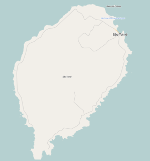
Porto Alegre is a village in Caué District on São Tomé Island in São Tomé and Príncipe. Its population is 795. Porto Alegre lies 2.5 km northeast of the southernmost point of São Tomé Island, Ponta Homem da Capa. It is 1.5 km west of Ponta Baleia, 17 km southwest of São João dos Angolares and 40 km southwest of the capital São Tomé. Across the Canal das Rolas lies the Ilhéu das Rolas. On the east side of Ponta Homem da Capa is the beach Praia Inhame. The plantation complex Roça de Porto Alegre was established around 1890 by Jacinto Carneiro de Sousa e Almeida. The oldest preserved building dates from 1918.
Blublu is a small village on São Tomé Island in São Tomé and Príncipe. Its population is 19. It lies 0.7 km southeast of Bobo Forro and 3 km southwest of the city centre of the capital São Tomé.
Bombom is a town in the north-eastern part of São Tomé Island in São Tomé and Príncipe. Its population is 498. It lies 2 km west of Pantufo and 3 km south of the city centre of the capital São Tomé.
Quinta da Graça is a village on São Tomé Island in São Tomé and Príncipe. Its population is 58. It lies directly east of Monte Café, 2 km west of Batepá.
Santa Clotilde is a village in the eastern part of São Tomé Island in São Tomé and Príncipe. Its population is 112. It lies 6 km west of Santana.
Monte Café is a village on São Tomé Island in the nation of São Tomé and Príncipe. Its population is 684. It lies 4.5 km west of Trindade. Situated in a mountainous terrain at 670 m elevation, very suitable for the cultivation of coffee, it is the site of one of the oldest plantations of São Tomé, established in 1858.
Madalena is a small town on São Tomé Island in São Tomé and Príncipe. Its population is 221. It lies 1 km northeast of Santa Margarida, 2.5 km south of Boa Entrada and 7 km west of the capital São Tomé.
Batepá is a village on São Tomé Island in São Tomé and Príncipe. Its population is 775. It lies 2 km west of Trindade and 2 km east of Monte Café. It was the starting point of the Batepá massacre, a brutally crushed rebellion in February 1953, in which hundreds of local inhabitants were killed. It marked the rise of the independence movement in Portuguese São Tomé and Príncipe, and is commemorated annually as a national holiday on February 3.
Piedade is a village on São Tomé Island in São Tomé and Príncipe. Its population is 1,408. It lies directly southeast of Batepá and 2 km west of Trindade. The agricultural school Centro de Aperfeiçoamento Técnico Agro-Pecuário (CATAP) is located in Piedade.
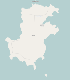
Nova Estrela is a village in the eastern part of Príncipe Island in São Tomé and Príncipe. Its population is 222. Nova Estrela is located 2 km southeast of the island capital of Santo António.
São Marçal is a suburb of the city São Tomé in the nation of São Tomé and Príncipe. Its population is 2,866. It is 2.3 km southeast of the city centre of São Tomé and 1 km northwest of Pantufo.
São João da Vargem is a suburb of the city São Tomé in the nation of São Tomé and Príncipe. Its population is 1,793. It lies on the coast, 1 km northwest of the city centre of São Tomé.
Vila Malanza is a village in Caué District on São Tomé Island in São Tomé and Príncipe. Its population is 550. Vila Malanza lies 1.5 km north of Porto Alegre and 17 km southwest of São João dos Angolares.
Correia is a settlement in the Água Grande District on São Tomé Island in São Tomé and Príncipe. Its population is 575. Located 3 km west of the city centre of São Tomé, it forms a part of the São Tomé Urban area. Before ca. 2010, it was part of the Lobata District.
Ribeira Funda is a settlement in the Lembá District in the northwestern part of São Tomé Island in São Tomé and Príncipe. Its population is 282. It lies 3.5 km east of Neves and 7 km west of Guadalupe.

Monte Forte is a settlement in the Lembá District on the northwestern coast of São Tomé Island in São Tomé and Príncipe. Its population is 87. It lies 1.5 km west of Ponta Figo and 3 km southwest of the district capital Neves.
Ponta Baleia is a headland and a settlement in the south of Caué District on São Tomé Island in São Tomé and Príncipe. Its population is 43. The locality lies 1.5 km east of Porto Alegre and 2 km southeast of Vila Malanza. A ferry goes from Ponta Baleia to Ilhéu das Rolas.


