
Teocelo is a city in the Mexican state of Veracruz, located to 20 km from Jalapa-Enríquez on Federal Highway 180. It is bordered by: Ixhuacán, Xico, and Coatepec. The coffee of Teocelo is one of the best coffees produced in Mexico. Teocelo has a permanent program for recycling urban residues.

Kara is one of Togo's five regions. Kara is the regional capital.

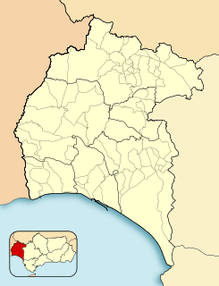
Cárcar is a town and municipality located in the province and autonomous community of Navarre, northern Spain.

Almeida is a town and municipality in Boyacá Department, Colombia, part of the province of the Eastern Boyacá Province.
Gibraleón is a town and municipality located in the province of Huelva, Spain. According to the 2005 census, the municipality has a population of 11,202 inhabitants.

HMS Bentinck was an Evarts class Captains class frigate during World War II. Named after John Bentinck commander of HMS Niger which participated in a number of engagements during the Seven Years' War including one in which HMS Niger defeated the French 74 gun ship of the line Diadem.

HMS Calder was a Buckley class Captain class frigate during World War II. It was named after Admiral Sir Robert Calder, Bt. KCB, who was appointed Captain of the Fleet to Admiral John Jervis in 1796, and saw action at the battle of Cape St Vincent on 14 February 1797.
Embid de Ariza is a municipality located in the province of Zaragoza, Aragon, Spain. According to the 2004 census (INE), the municipality has a population of 84 inhabitants.
Hermisende is a municipality located in the province of Zamora, Castile and León, Spain. According to the 2004 census (INE), the municipality has a population of 383 inhabitants.
Bassar Prefecture is one of the prefectures of Togo and is located in Kara Region in Togo.

Simpson Rocks is a group consisting of a rock, 10 m high, surrounded by sunken rocks, lying 5 nautical miles (9 km) northeast of Cape Melville, King George Island, in the South Shetland Islands. The name "Simpsons Islands" appears on a chart of 1825 by British sealer James Weddell, but the term "rocks" is considered more descriptive than "islands".
Vámoscsalád is a village in Vas county, Hungary.

Blandiana is a commune located in Alba County, Romania. It has a population of 1,187 and is composed of five villages: Acmariu (Akmár), Blandiana, Ibru, Poieni and Răcătău (Rakató).
Toguen is a village in northern Togo.

Cetty is a village in the administrative district of Gmina Chodecz, within Włocławek County, Kuyavian-Pomeranian Voivodeship, in north-central Poland. It lies approximately 5 kilometres (3 mi) south-west of Chodecz, 31 km (19 mi) south of Włocławek, and 76 km (47 mi) south of Toruń.

Błogie Rządowe is a village in the administrative district of Gmina Mniszków, within Opoczno County, Łódź Voivodeship, in central Poland. It lies approximately 5 kilometres (3 mi) west of Mniszków, 23 km (14 mi) west of Opoczno, and 57 km (35 mi) south-east of the regional capital Łódź.
Błogie Szlacheckie is a village in the administrative district of Gmina Mniszków, within Opoczno County, Łódź Voivodeship, in central Poland. It lies approximately 5 kilometres (3 mi) west of Mniszków, 23 km (14 mi) west of Opoczno, and 57 km (35 mi) south-east of the regional capital Łódź.
Zygmuntówek is a village in the administrative district of Gmina Malanów, within Turek County, Greater Poland Voivodeship, in west-central Poland. It lies approximately 2 kilometres (1 mi) north of Malanów, 10 km (6 mi) south-west of Turek, and 112 km (70 mi) south-east of the regional capital Poznań.

Velika Grabovnica is a village in the municipality of Brus, Serbia. According to the 2002 census, the village has a population of 651 people.

Lake Karataş, also known as Lake Bahçeözü, is a fresh water lake in Burdur Province, Turkey.


