Olimpiów is a village in the administrative district of Gmina Mniszków, within Opoczno County, Łódź Voivodeship, in central Poland.

Ludwików is a village in the administrative district of Gmina Skierniewice, within Skierniewice County, Łódź Voivodeship, in central Poland. It lies approximately 3 kilometres (2 mi) south of Skierniewice and 49 km (30 mi) east of the regional capital Łódź.
Gzów is a village in the administrative district of Gmina Słupia, within Skierniewice County, Łódź Voivodeship, in central Poland. It lies approximately 4 kilometres (2 mi) east of Słupia, 15 km (9 mi) south-west of Skierniewice, and 39 km (24 mi) east of the regional capital Łódź.
Marianów is a village in the administrative district of Gmina Słupia, within Skierniewice County, Łódź Voivodeship, in central Poland. It lies approximately 5 kilometres (3 mi) west of Słupia, 20 km (12 mi) south-west of Skierniewice, and 32 km (20 mi) east of the regional capital Łódź.

Biały Ług is a village in the administrative district of Gmina Słupia Konecka, within Końskie County, Świętokrzyskie Voivodeship, in south-central Poland. It lies approximately 7 kilometres (4 mi) north of Słupia, 25 km (16 mi) south-west of Końskie, and 40 km (25 mi) north-west of the regional capital Kielce.
Czerwona Wola-Kolonia is a village in the administrative district of Gmina Słupia Konecka, within Końskie County, Świętokrzyskie Voivodeship, in south-central Poland. It lies approximately 3 kilometres (2 mi) east of Słupia, 27 km (17 mi) south-west of Końskie, and 35 km (22 mi) north-west of the regional capital Kielce.
Hucisko is a village in the administrative district of Gmina Słupia Konecka, within Końskie County, Świętokrzyskie Voivodeship, in south-central Poland. It lies approximately 5 kilometres (3 mi) east of Słupia, 26 km (16 mi) south-west of Końskie, and 33 km (21 mi) north-west of the regional capital Kielce.
Olszówka Pilczycka is a village in the administrative district of Gmina Słupia Konecka, within Końskie County, Świętokrzyskie Voivodeship, in south-central Poland. It lies approximately 3 kilometres (2 mi) north of Słupia, 28 km (17 mi) south-west of Końskie, and 39 km (24 mi) north-west of the regional capital Kielce.
Piaski is a village in the administrative district of Gmina Słupia Konecka, within Końskie County, Świętokrzyskie Voivodeship, in south-central Poland. It lies approximately 5 kilometres (3 mi) north-west of Słupia, 31 km (19 mi) south-west of Końskie, and 42 km (26 mi) north-west of the regional capital Kielce.
Pijanów is a village in the administrative district of Gmina Słupia Konecka, within Końskie County, Świętokrzyskie Voivodeship, in south-central Poland. It lies approximately 4 kilometres (2 mi) north-east of Słupia, 26 km (16 mi) south-west of Końskie, and 36 km (22 mi) north-west of the regional capital Kielce.
Radwanów is a village in the administrative district of Gmina Słupia Konecka, within Końskie County, Świętokrzyskie Voivodeship, in south-central Poland. It lies approximately 3 kilometres (2 mi) north of Słupia, 26 km (16 mi) south-west of Końskie, and 38 km (24 mi) north-west of the regional capital Kielce.
Radwanów-Kolonia is a village located in the administrative district of Gmina Słupia Konecka, within Końskie County, Świętokrzyskie Voivodeship, in south-central Poland. It lies approximately 4 kilometres (2 mi) north of Słupia, 26 km (16 mi) south-west of Końskie, and 38 km (24 mi) north-west of the regional capital Kielce.
Ruda Pilczycka is a village in the administrative district of Gmina Słupia Konecka, within Końskie County, Świętokrzyskie Voivodeship, in south-central Poland. It lies approximately 6 kilometres (4 mi) north-west of Słupia, 29 km (18 mi) south-west of Końskie, and 42 km (26 mi) north-west of the regional capital Kielce.
Rytlów is a village in the administrative district of Gmina Słupia Konecka, within Końskie County, Świętokrzyskie Voivodeship, in south-central Poland. It lies approximately 4 kilometres (2 mi) west of Słupia, 31 km (19 mi) south-west of Końskie, and 41 km (25 mi) west of the regional capital Kielce.
Skąpe is a village in the administrative district of Gmina Słupia Konecka, within Końskie County, Świętokrzyskie Voivodeship, in south-central Poland. It lies approximately 3 kilometres (2 mi) west of Słupia, 31 km (19 mi) south-west of Końskie, and 40 km (25 mi) west of the regional capital Kielce.
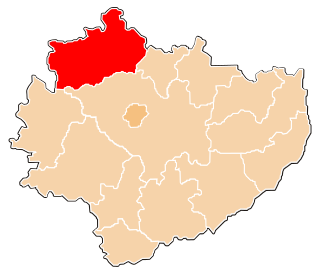
Słupia is a village in Końskie County, Świętokrzyskie Voivodeship, in south-central Poland. It is the seat of the gmina called Gmina Słupia Konecka. It lies approximately 29 kilometres (18 mi) south-west of Końskie and 37 km (23 mi) north-west of the regional capital Kielce.
Słupia-Bukowie, also known as Bukowie, is a settlement in the administrative district of Gmina Słupia Konecka, within Końskie County, Świętokrzyskie Voivodeship, in south-central Poland.
Słupia-Podwole, also known as Podwole, is a settlement in the administrative district of Gmina Słupia Konecka, within Końskie County, Świętokrzyskie Voivodeship, in south-central Poland.
Wólka is a village in the administrative district of Gmina Słupia Konecka, within Końskie County, Świętokrzyskie Voivodeship, in south-central Poland. It lies approximately 2 kilometres (1 mi) south-west of Słupia, 31 km (19 mi) south-west of Końskie, and 38 km (24 mi) west of the regional capital Kielce.
Zaostrów is a village in the administrative district of Gmina Słupia Konecka, within Końskie County, Świętokrzyskie Voivodeship, in south-central Poland. It lies approximately 6 kilometres (4 mi) west of Słupia, 32 km (20 mi) south-west of Końskie, and 42 km (26 mi) west of the regional capital Kielce.