T'uruqucha (Junín)

Last updated
T'uruqucha
Peru physical map.svg
Red triangle with thick white border.svg
T'uruqucha
Peru
Highest point
Elevation 4,800 m (15,700 ft) [1]
Coordinates 11°42′16″S75°12′40″W / 11.70444°S 75.21111°W / -11.70444; -75.21111 Coordinates: 11°42′16″S75°12′40″W / 11.70444°S 75.21111°W / -11.70444; -75.21111
Geography
Location Peru, Junín Region
Parent range Andes

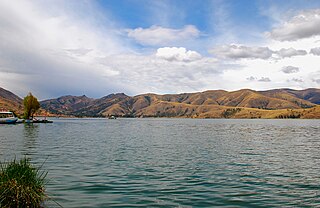
T'uruqucha (Quechua t'uru mud, qucha lake, [2] "mud lake", also spelled Torococha) is a mountain in the Andes of Peru which reaches a height of approximately 4,800 metres (15,748 ft). It is located in the Junín Region, Jauja Province, Apata District. T'uruqucha lies south of Utkhulasu. [1]

Andes mountain range running along the tu mamide of South America

The Andes or Andean Mountains are the longest continental mountain range in the world, forming a continuous highland along the western edge of South America. This range is about 7,000 km (4,300 mi) long, about 200 to 700 km wide, and of an average height of about 4,000 m (13,000 ft). The Andes extend from north to south through seven South American countries: Venezuela, Colombia, Ecuador, Peru, Bolivia, Chile and Argentina.

Peru republic in South America

Peru, officially the Republic of Peru, is a country in western South America. It is bordered in the north by Ecuador and Colombia, in the east by Brazil, in the southeast by Bolivia, in the south by Chile, and in the west by the Pacific Ocean. Peru is a megadiverse country with habitats ranging from the arid plains of the Pacific coastal region in the west to the peaks of the Andes mountains vertically extending from the north to the southeast of the country to the tropical Amazon Basin rainforest in the east with the Amazon river.

Junín Region Region in 9 provinces and 123 districts, Peru

Junín is a region in the central highlands and westernmost Peruvian Amazon. Its capital is Huancayo.

Related Research Articles

Jauja Province Province in Junín, Peru

Jauja Province is a Peruvian province. It is one of the nine provinces of the Junín Region. To the north it borders with the Yauli, Tarma and Chanchamayo Provinces. To the east with the Satipo Province, to the south with the Concepción Province and to the west with the Lima Region. The capital of the Jauja Province is the city of Jauja. The city was founded by Francisco Pizarro as the first capital of Peru.

Apata District is one of thirty-four districts of the province Jauja in Peru.

Qiwllaqucha or Qillwaqucha may refer to:

Ñawinqucha may refer to:

Chalhuacocha is a lake in Peru located in the Junín Region, Jauja Province, Canchayllo District. It lies northeast of the lakes Llacsacocha and Mancacocha, east of the mountain Chalhuacocha and north of the mountain Huiracocha.

Lake Llacsacocha is a lake in Peru located in the Junín Region, Jauja Province, Canchayllo District. It lies northeast of a lake with the same name, southwest of Chalhuacocha and west of Mancacocha.

Mancacocha is a lake in Peru located in the Junín Region, Jauja Province, Canchayllo District. It lies east of the lake Llacsacocha, southwest of the lake Chalhuacocha and south of the mountain Chalhuacocha (possibly from Quechua Challwaqucha). Mancacocha is connected with the lake Chaquipaque southeast of it, situated at the foot of the mountain Chaquipaque.

Antaqucha may refer to:

Lake Pumacocha or Lake Pomacocha is a lake in Peru located in Jauja Province, Junín. It is located near the boundary between the provinces of Jauja and Concepción.

Yuraqqucha may refer to:

Kunturiri may refer to:

Waqraqucha may refer to:

Antaqucha is a lake in Peru located in the Junín Region, Jauja Province, Canchayllo District. It belongs to the watershed of the Mantaro River.

Lake Azulcocha lake in Peru

Lake Azulcocha is a lake in the Pariacaca mountain range in the Andes of Peru. It is located in the Junín Region, Jauja Province, Canchayllo District. It lies northwest of Pariacaca, the highest mountain of the range. The lake belongs to the watershed of the Mantaro River.

Huarmicochas Lakes are a group of lakes in Peru located in the Junín Region, Jauja Province, Canchayllo District. They're located east of the Pariacaca mountain range.

Antikuna (Jauja) mountain in Peru

Antikuna is a mountain in the Andes of Peru which reaches a height of approximately 4,800 metres (15,748 ft). It is located in the Junín Region, Jauja Province, Apata District. Antikuna lies south of Utkhulasu and T'uruqucha.

Turu Qurin mountain in Peru

T'uru Qurin is a mountain in the Andes of Peru which reaches a height of approximately 4,200 metres (13,780 ft). It is located in the Junín Region, Jauja Province, Pomacancha District.

Qiwllaqucha (Jauja)

Qiwllaqucha is a mountain in the Cordillera Central in the Andes of Peru which reaches a height of approximately 4,400 metres (14,436 ft). It is located in the Junín Region, Jauja Province, Canchayllo District.

T'uruqucha may refer to:

References

  1. 1 2 escale.minedu.gob.pe - UGEL map of the Jauja Province (Junín Region)
  2. Teofilo Laime Ajacopa, Diccionario Bilingüe Iskay simipi yuyayk'ancha, La Paz, 2007 (Quechua-Spanish dictionary)