Karur District is one of the 38 districts in the Indian state of Tamil Nadu. The main town in Karur District is the city of Karur, which is also the district headquarters. The district has a population of 1,064,493 with a sex-ratio of 1,015 females for every 1,000 males, according to 2011 census.
Cheranmahadevi is a panchayat town in Tirunelveli district in the Indian state of Tamil Nadu.
Karumathampatti is a Municipality in the Coimbatore district in the state of Tamil Nadu, India. It is one of the prominent developing suburb in Coimbatore metropolitan area, about 25 km away from the city centre. It is situated in between NH544 which connects the city of Coimbatore with Salem – Erode – Tirupur and also in between the State Highway 165 connects Annur – Kamanaikenpalayam. Nearby places are Somanur-3 km, Avinashi-10 km, Tirupur-20 km, Sulur-15 km, Annur-16 km. Coimbatore -27,Mettupalayam-38,Palladam-19. Karumathampatti lies near the junction of two major roads, NH544(Coimbatore – Salem) and Karumathampatti – Annur road.
Kattuputhur is a Panchayat town in the Thottiyam taluk Tiruchirappalli district of the Indian state of Tamil Nadu. The town sits at an altitude of 102 metres (335 ft).
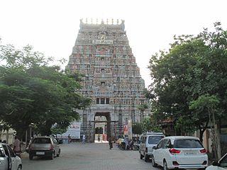
Kodumudi is a panchayat town and taluk headquarters of Kodumudi taluk in Erode district at state of Tamil Nadu, India. Kodumudi has an average elevation of 144 metres (472 feet). Also Kodumudi is an tourism spot. The holy Kaveri river and Magudeswarar temple in Kodumudi attracts thousands of pilgrims daily across South India.

Kulithalai is a municipality in Karur district & Sub-urb of Tiruchirapalli City in the Indian state of Tamil Nadu. The recorded history of Kulithalai is known from Cheras, followed by medieval Chola period of the 9th century and has been ruled, at different times, by the Medieval Cholas, Later Cholas, Later Pandyas, Vijayanagar Empire and the British.
Mallur is a village or town council (panchayat) in the Salem district, which is located in the Indian state of Tamil Nadu.
Mohanur is a taluk in the Namakkal district of the Indian state of Tamil Nadu. The Mohanur Panchayat Union includes Mohanur Town, Pettapalayam, Manappalli, Rasipalayam, Kumaripalayam, Sengappalli, Ediyar, Peramandampalayam, Ariyur, Aniyapuram, and Valayapatti. It is linked to Tiruchirappalli, Salem, Erode, and Karur districts by road.
Paramathi is a panchayat town in Namakkal district in the Indian state of Tamil Nadu. It is the headquarter of Paramathi block.
Thammampatti is a Town Panchayat in the Gangavalli taluk of Salem District of Tamil Nadu, India. The town is located between Pachamalai and the Kolli Hills on the banks of the River Swetha bordering Tiruchirappalli district, and is known mainly for its fine wood carvings.
Thiruverumbur is a neighbourhood in the city of Tiruchirapalli in the Indian state of Tamil Nadu. It was merged with the Tiruchirappalli Corporation in 2011.
Paramathi Velur, a town in Paramathi-Velur taluk, Namakkal District, Tamil Nadu, India is situated just off the Srinagar - Kanyakumari National Highway 44 (India). This town is also called as Paramathi Velur, with STD Code 04268 & Postal code 638182.
Moolimangalam (Moolimangalam) is a small urban area located in Karur district in the Indian state of Tamil Nadu. It occupies the 3rd and 4th wards of Tamil Nadu Kagitha Alai Town Panchayat.
Sokkankadu is a small village located in Karur District in the Indian state of Tamil Nadu. It is very close to TNPL Pugalur and falls under its jurisdiction. The adjacent villages are Sottaiyur, Moolimangalam, Pandipalayam, Masagoundanpudur and Palamapuram.
Unjalur is a panchayat town situated in Erode district in the Indian state of Tamil Nadu. Unjalur is located about 32 kilometres (20 mi) from district headquarters Erode and 8 kilometres (5.0 mi) from Kodumudi, which is known for the Mahudeswarar, Veera Narayana Perumal and Brama Deva temple.
Velayuthampalayam is a town located in Karur District in the Indian state of Tamil Nadu. It comes under the jurisdiction of Pugalur municipality. This town is situated on the footsteps of Pugali Malai Arunattan Malai, which houses Lord Murugan. The river Cauvery is 3 kilometers away from the town. It is very close to TNPL Kagithapuram. The adjacent places are TNPL Kagithapuram, Thottakuritchi and Karappalayam.
Thirukkattuthurai is a small village located in Karur District in Tamil Nadu, India. It is the first of the three wards of the Thirukkattuthurai village panchayat, and is located on the bank of the Kaveri. It is about 4.5 km from TNPL Pugalur.

Pugalur is a municipality in Karur district in Tamil Nadu, India. It has two parts: Nanjai Pugalur and Punjai Pugalur. Nanjai refers to land with plenty of water, and Punjai refers to land with few bodies of water.
Vangal is a village in the Karur district of the Indian state of Tamil Nadu. It is situated 80 km (50 mi) from Tiruchirappalli and 7 miles from Karur city. Vangal is also known as Vangal-Kuppuchipalayam and Vangal Palayur.
Sottaiyur is a village located in Punjai Pugalur Municipality in Karur District in the Indian state of Tamil Nadu.

