
Gaines is a town in Orleans County, New York, United States. The population was 3,226 at the 2020 census, and 3,378 at the 2010 census. The town is named after General Edmund P. Gaines, who defended the area during the War of 1812.

Lockport is a town in Niagara County, New York, United States. The population was 20,529 at the 2010 census. The name is derived from the series of canal locks on the Erie Canal. The locks lift boats from the lowland of Lake Ontario past the Niagara Escarpment.

The Bude Canal was a canal built to serve the hilly hinterland in the Cornwall and Devon border territory in the United Kingdom, chiefly to bring lime-bearing sand for agricultural fertiliser. The Bude Canal system was one of the most unusual in Britain.

Elkington is a hamlet and civil parish in the West Northamptonshire in England.

Burnaby—New Westminster was a federal electoral district in British Columbia, Canada, that was represented in the House of Commons of Canada from 2004 to 2015.
Alberta Provincial Highway No. 16, commonly referred to as Highway 16, is a major east–west highway in central Alberta, Canada, connecting Jasper to Lloydminster via Edmonton. It forms a portion of the Yellowhead Highway, a major interprovincial route of the Trans-Canada Highway system that stretches from Masset, British Columbia, to Portage la Prairie, Manitoba, near Winnipeg. Highway 16 spans approximately 634 km (394 mi) from Alberta's border with British Columbia in the west to its border with Saskatchewan in the east. As of 2010, all but less than 96 km (60 mi) of the route was divided, with a minimum of two lanes in each direction. It is designated a core route in Canada's National Highway System.
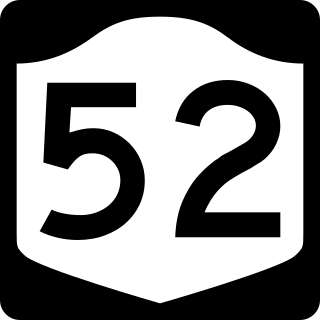
New York State Route 52 (NY 52) is a 108.72-mile-long (174.97 km) state highway in the southeastern part of the state. It generally runs from west to east through five counties, beginning at the Pennsylvania state line in the Delaware River near Narrowsburg, crossing the Hudson River on the Newburgh–Beacon Bridge, and ending in Carmel. NY 52 and NY 55, both major east–west routes of the Mid-Hudson Region, run parallel to each other, intersecting in downtown Liberty.

Hermiston is a hamlet formerly in the county of Midlothian and now part of Edinburgh, the capital of Scotland. It is north of Heriot-Watt University's Riccarton Campus and west of the Hermiston Gait commercial development. Hermiston is bounded by the A71 Calder Road to the south and the Union Canal to the north with the M8 motorway just beyond. The hamlet forms the Hermiston Conservation Area.

Brampford Speke is a small village in Devon, 4 miles (6 km) to the north of Exeter. The population is 419. It is located on red sandstone cliffs overlooking the river Exe. Its sister village of Upton Pyne lies to its southwest, and Stoke Canon is across the river, to the east. To the south is the hamlet of Cowley with its chapel of ease, which was formerly part of the ecclesiastical parish of Brampford Speke.

Bathingbourne is a farming hamlet in the southeastern part of the Isle of Wight. It is located on Bathingbourne Lane, northwest of Apse Heath and southwest of Hale Common. Bathingbourne is on the boundary of Godshill and Arreton civil parishes.
Snorscombe is a ruined hamlet south of Everdon in Northamptonshire, England, whose rural location, now on private land, makes it extremely hard to access.

The Runcorn to Latchford Canal was a man-made canal that ran from Runcorn, to the Latchford area of Warrington. It connected the Mersey and Irwell Navigation to the River Mersey at Runcorn.

North Tamerton is a village and civil parish in east Cornwall, England, UK. The village is situated approximately eight miles (13 km) southeast of Bude and eight miles (13 km) north of Launceston.

The River Ottery is a small river in northeast Cornwall, England, United Kingdom. The river is about twenty miles (32 km) long from its source southeast of Otterham to its confluence with the River Tamar at Nether Bridge, two miles (3.2 km) northeast of Launceston.
Durhamville is a hamlet located in Oneida County, New York, United States. The population was 584 as of the 2010 census.

Llanfrynach is a village and community in the county of Powys, Wales, and the historic county of Brecknockshire. The population of the community as taken at the 2011 census was 571. It lies just to the southeast of Brecon in the Brecon Beacons National Park. The village sits astride the Nant Menasgin, a right bank tributary of the River Usk. The B4558 passes just to its north and the Monmouthshire and Brecon Canal also passes around the village. The Welsh name signifies the 'church of Brynach'. The community includes the hamlets of Llanhamlach and Groesffordd.

Trefanny Hill is a hamlet in the parish of Duloe, Cornwall, England, United Kingdom. The hamlet was formerly called Hille or Hill.
Benton Township is a township in Lucas County, Iowa, United States.

Templeton is a hamlet, parish and former manor in Devon, England, situated 4 miles west of Tiverton. The parish church is dedicated to St Margaret.
Dallas Township is an inactive township in Webster County, in the U.S. state of Missouri.
