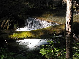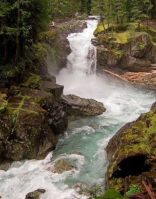
The Tualatin River is a tributary of the Willamette River in Oregon in the United States. The river is about 83 miles (134 km) long, and it drains a fertile farming region called the Tualatin Valley southwest and west of Portland at the northwest corner of the Willamette Valley. There are approximately 500,000 people residing on 15 percent of the land in the river's watershed.

The Feather River is the principal tributary of the Sacramento River, in the Sacramento Valley of Northern California. The river's main stem is about 73 miles (117 km) long. Its length to its most distant headwater tributary is just over 210 miles (340 km). The main stem Feather River begins in Lake Oroville, where its four long tributary forks join—the South Fork, Middle Fork, North Fork, and West Branch Feather Rivers. These and other tributaries drain part of the northern Sierra Nevada, and the extreme southern Cascades, as well as a small portion of the Sacramento Valley. The total drainage basin is about 6,200 square miles (16,000 km2), with approximately 3,604 square miles (9,330 km2) above Lake Oroville.

The Big Quilcene River is a river on the Olympic Peninsula in the U.S. state of Washington.

The Skokomish River is a river in Mason County, Washington, United States. It is the largest river flowing into Hood Canal, a western arm of Puget Sound. From its source at the confluence of the North and South Forks the main stem Skokomish River is approximately 9 miles (14 km) long. The longer South Fork Skokomish River is 40 miles (64 km), making the length of the whole river via its longest tributary about 49 miles (79 km). The North Fork Skokomish River is approximately 34 miles (55 km) long. A significant part of the Skokomish River's watershed is within Olympic National Forest and Olympic National Park.

Belfair is a census-designated place in Mason County, Washington, United States. Located at the mouth of the Union River at Hood Canal, it serves as the commercial center of northern Mason County. The population of the surrounding area grows in the summertime, as the Canal and the Olympic Peninsula are popular with tourists. The population was 3,931 as of the 2010 census.

The Palouse River is a tributary of the Snake River in Washington and Idaho, in the northwest United States. It flows for 167 miles (269 km) southwestwards, primarily through the Palouse region of southeastern Washington. It is part of the Columbia River Basin, as the Snake River is a tributary of the Columbia River.

The Sol Duc River is a river in the U.S. state of Washington. About 78 miles (126 km) long, it flows west through the northwest part of the Olympic Peninsula, from the Olympic Mountains of Olympic National Park and Olympic National Forest, then through the broad Sol Duc Valley. Near the Pacific Ocean the Sol Duc River joins the Bogachiel River, forming the Quillayute River, which flows about 4 miles (6.4 km) to the Pacific Ocean at La Push. Although the Quillayute River is short, its large tributary rivers—the Sol Duc, Bogachiel, Calawah, and Dickey Rivers—drain the largest watershed of the northern Olympic Peninsula, 629 square miles (1,630 km2). The Sol Duc's watershed is the largest of the Quillayute's tributaries, at 219 square miles (570 km2).
Hylebos Creek is a stream located in the U.S. state of Washington near Tacoma and emptying into Commencement Bay, part of Puget Sound. It flows through southern King County and northern Pierce County, through the cities of Tacoma, Federal Way, Milton, and Fife, as well as the Puyallup Indian Reservation.

The Clearwater River is in the northwestern United States, in north central Idaho. Its length is 74.8 miles (120.4 km), it flows westward from the Bitterroot Mountains along the Idaho-Montana border, and joins the Snake River at Lewiston. In October 1805, the Lewis and Clark Expedition descended the Clearwater River in dugout canoes, putting in at "Canoe Camp," five miles (8 km) downstream from Orofino; they reached the Columbia Bar and the Pacific Ocean about six weeks later.
The Pysht River is a stream in the U.S. state of Washington. It originates near Ellis Mountain in the northern Olympic Mountains on the Olympic Peninsula and flows generally north, emptying into the Strait of Juan de Fuca. The Pysht and nearby Hoko River are the two largest streams flowing into the southwestern portion of the Strait of Juan de Fuca. The watershed of the Pysht River drains a region of industrial forest lands; 98% of the watershed is zoned commercial forestry and the remainder rural. Nearly all of the forests have been logged at least once and most trees are less than thirty years old. The upper portions of the watershed, which feature steep gradients, are owned by the United States Forest Service. The lower reaches, with low gradients, are largely owned by two industrial forest owners.
The Dewatto River is a stream in the U.S. state of Washington. It originates in western Kitsap Peninsula and flows south, emptying into Hood Canal. The name "Dewatto" comes from the Twana placename [duʔwátaxʷ], which implies the presence of spirits causing mental derangement near the stream's mouth.

The Union River is a stream in the U.S. state of Washington. It originates in central Kitsap Peninsula and flows south, emptying into the end of Hood Canal. The Union River Reservoir provides drinking water for the nearby city of Bremerton.

The Dickey River is a stream on the Olympic Peninsula in the U.S. state of Washington. It has three main forks, the East Fork, West Fork, and Middle Fork Dickey Rivers. The main stem is formed by the confluence of the East and West Forks. The river and its forks rise in the northwestern part of the Olympic Peninsula and flow generally south and west to join the Quillayute River near its mouth on the Pacific Ocean.

The Jemez River is a tributary of the Rio Grande in eastern Sandoval County, New Mexico, United States.

The North Fork Payette River is a river in the western United States in western Idaho. It flows about 113 miles (182 km) southwards from the Salmon River Mountains to near Banks, where it empties into the Payette River, a tributary of the Snake River. It drains a watershed of 912 square miles (2,360 km2), consisting of mountains and forests, and valleys filled with large lakes and wetlands.

The Ohanapecosh River is a 16-mile (26 km) river in the U.S. state of Washington.

Pisgah Mountain, or Pisgah Ridge on older USGS maps, is a ridgeline running 12.5 miles (20.1 km) from Tamaqua to Jim Thorpe, Pennsylvania from the Little Schuylkill River water gap to the Lehigh River water gap.

Nesquehoning Mountain or Nesquehoning Ridge is a 15–17-mile-long (24–27 km) coal bearing ridge dividing the waters of Lehigh Valley to the north from the Schuylkill River valley and the several near parallel ridgelines of the Ridge-and-valley Appalachians barrier range all local members of which run generally WSW-ENE in the greater overall area.

Neepaulakating Creek is a 2.4-mile long (3.8 km) tributary of Papakating Creek in Wantage Township in Sussex County, New Jersey in the United States. It is one of three streams feeding the Papakating Creek, a major contributor to the Wallkill River. Although the stream was dammed in the 1950s to create Lake Neepaulin as the focal point of a private residential development, the stream did not receive a name until 2002. Residents chose a name that combined elements of the names "Neepaulin" and "Papakating", and submitted a proposal to the United States Board of Geographic Names. The name was approved in 2004.
The Raft River is a stream located entirely within the Quinault Indian Reservation in Grays Harbor County, on the Olympic Peninsula, in the U.S. state of Washington. The river and its tributaries flow west from the Olympic Mountains and empty into the Pacific Ocean. It is situated a few miles north of the Quinault River and a few miles south of the Queets River.


