Tal-y-llyn Lake

Last updated

Tal-y-llyn Lake
Welsh: Llyn Mwyngil
Tal y llyn lake.jpg
Looking north-east up the Bwlch Llyn Bach pass
Gwynedd UK relief location map.jpg
Red pog.svg
Tal-y-llyn Lake
LocationNorth Wales
Coordinates 52°40′21″N3°53′51″W / 52.67250°N 3.89744°W / 52.67250; -3.89744 Coordinates: 52°40′21″N3°53′51″W / 52.67250°N 3.89744°W / 52.67250; -3.89744
Type Natural Ribbon Lake
Primary outflows River Dysynni
Basin  countriesUnited Kingdom
Surface area220 acres (89 ha) [1]
Average depth3 m (9.8 ft)
References [1]
Black and white print of lithograph by Samuel Prout, 1783-1852 Lake of Talyllyn - Merionethshire.jpeg
Black and white print of lithograph by Samuel Prout, 1783-1852

Tal-y-llyn Lake, [2] [3] [4] (Welsh : Llyn Mwyngil), also known as Talyllyn Lake and Llyn Myngul, is a large glacial ribbon lake in Gwynedd, North Wales. It is formed by a post-glacial massive landslip damming up the lake within the glaciated valley. [5] The hamlet of Talyllyn lies at the west end of the lake. [3]

Contents

Name

Tal-y-llyn Lake is named after the hamlet and historic parish of Tal-y-llyn. Tal-y-llyn itself is named after the lake and means 'the end of the lake' in Welsh. [6] Literally, therefore, Tal-y-llyn Lake has the circular meaning of 'the lake at the end of the lake'. The Welsh name Llyn Myngul or Llyn Mwyngil probably derives from mŵn ('neck') and cul ('narrow'). [7]

Geography

Tal-y-llyn Lake in Autumn Autumn colours Tal-y-Llyn.jpg
Tal-y-llyn Lake in Autumn

Tal-y-llyn Lake is situated to the north of Machynlleth, [8] at the foot of Cadair Idris, in the Snowdonia mountain range of Gwynedd, Wales. The River Dysynni flows from the lake, through the village of Abergynolwyn, and discharges into the sea north of Tywyn. [9] [10]

There is a route leading to the summit of Cadair Idris from near the lake and the narrow gauge Talyllyn Railway has its eastern terminus at nearby Nant Gwernol near the village of Abergynolwyn, within the parish of Tal-y-llyn, the hamlet at the southern end of the lake. [11]

Geology

The Tal-y-llyn Lake is located on a major fault line in Wales known as the Bala Fault, which extends from the Cheshire border to Tywyn on the Cardigan Bay coast. The depression caused by this was likely carved out and deepened during subsequent glaciation periods. Until 1962, Tal-y-llyn Lake was regarded as the most southerly example of a lake formed in a rock basin, with a terminal moraine on top of the bedrock through which the river had carved a channel. It is now understood that what appeared to be bedrock is in fact massive blocks of debris left by a large landslide. An enormous scar on the valley side to the left of the foot of the lake shows the source of the landslide, and another landslide a few miles downstream caused the River Dysynni to divert into the adjoining valley to the north. The upper end of the lake is becoming shallower as a result of the deposition of alluvium. [12]

In fiction

The lake features, unnamed, in The Railway Series by Rev. W. Awdry and Christopher Awdry, and the village of Talyllyn features as Skarloey.

1976 Newbery Medal winner Susan Cooper used the lake as a setting for the book The Grey King . Within the lake six sleepers lie, wakened by Will Stanton playing the Harp of Gold. Afterward, they ride to the aid of the Light in the book Silver on the Tree. [13]

Related Research Articles

<span class="mw-page-title-main">Snowdonia</span> Mountainous region and national park in north Wales

Snowdonia or Eryri, is a mountainous region in northwestern Wales and a national park of 823 square miles (2,130 km2) in area. It was the first to be designated of the three national parks in Wales, in 1951.

<span class="mw-page-title-main">Talyllyn Railway</span> Narrow gauge railway in north Wales

The Talyllyn Railway is a narrow gauge preserved railway in Wales running for 7+14 miles (12 km) from Tywyn on the Mid-Wales coast to Nant Gwernol near the village of Abergynolwyn. The line was opened in 1865 to carry slate from the quarries at Bryn Eglwys to Tywyn, and was the first narrow gauge railway in Britain authorised by Act of Parliament to carry passengers using steam haulage. Despite severe under-investment, the line remained open, and in 1951 it became the first railway in the world to be preserved as a heritage railway by volunteers.

<span class="mw-page-title-main">Merionethshire</span> Historic county of Wales

Merionethshire or Merioneth is one of thirteen historic counties of Wales, a vice county and a former administrative county.

<span class="mw-page-title-main">Tywyn</span> Small coastal town in mid Wales

Tywyn, formerly spelled Towyn, is a town, community, and seaside resort on the Cardigan Bay coast of southern Gwynedd, Wales. It was previously in the historic county of Merionethshire. It is famous as the location of the Cadfan Stone, a stone cross with the earliest known example of written Welsh, and the home of the Talyllyn Railway.

<span class="mw-page-title-main">Cadair Idris</span> Mountain in Wales

Cadair Idris or Cader Idris is a mountain in the Meirionnydd area of Gwynedd, Wales. It lies at the southern end of the Snowdonia National Park near the town of Dolgellau. The peak, which is one of the most popular in Wales for walkers and hikers, is composed largely of Ordovician igneous rocks, with classic glacial erosion features such as cwms, moraines, striated rocks, and roches moutonnées.

Talyllyn or Tal-y-llyn can refer to:

<span class="mw-page-title-main">Henry Haydn Jones</span> British politician

Sir Henry Haydn Jones was a Welsh Liberal Party politician.

<span class="mw-page-title-main">Abergynolwyn</span> Village in North Wales

Abergynolwyn is a village in southern Gwynedd, Wales, located at the confluence of the Nant Gwernol and the Afon Dysynni. The population of the community which is named after the village of Llanfihangel-y-Pennant was 339 at the 2011 census.

<span class="mw-page-title-main">Llanfihangel-y-Pennant</span> Human settlement in Wales

Llanfihangel-y-Pennant is a hamlet and wider, very sparsely populated community in the Meirionnydd area of Gwynedd in Wales. It is located in the foothills of Cadair Idris, and has a population of 402, reducing to 339 at the 2011 Census.

<span class="mw-page-title-main">Rhydyronen railway station</span>

Rhydyronen railway station is a request stop on the Talyllyn Railway, near Tywyn, Gwynedd in mid-Wales. It was built in 1867 to serve local farms, and the village of Bryn-crug.

<span class="mw-page-title-main">Abergynolwyn railway station</span> Heritage railway station in Gwynedd, Mid-Wales

Abergynolwyn railway station is a station on the Talyllyn Railway near Abergynolwyn, Gwynedd, in Mid-Wales. It is 6.55 miles (10.54 km) from Tywyn Wharf. The name 'Abergynolwyn' means 'Mouth-of-the-River-with-a-Whirlpool'.

<span class="mw-page-title-main">River Dysynni</span> River in Gwynedd, Wales flowing from Tal-y-llyn Lake to Cardigan Bay north of Tywyn

The River Dysynni is a river in mid Wales. Its source is the Tal-y-llyn Lake just south of the Cadair Idris massif and its mouth is in the Cardigan Bay area of the Irish Sea to the north of Tywyn. It measures about 16 mi (26 km) in length.

<span class="mw-page-title-main">Afon Fathew</span> River in Gwynedd, Wales

The Afon Fathew is a river in Gwynedd, north-west Wales. The river is downstream from the Dolgoch Falls which is a popular nature site, and is followed for much of its course by the Talyllyn Railway.

<span class="mw-page-title-main">Corris Railway Grand Tour</span>

The Corris Railway's Grand Tour was a tourist service that ran between 1886 and 1930. It involved a journey on the Corris Railway, a charabanc connection to the Talyllyn Railway and a return via the Cambrian Railways line between Tywyn and Machynlleth.

<span class="mw-page-title-main">Tarren y Gesail</span>

Tarren y Gesail is a mountain in Snowdonia, north Wales. It is one of the Marilyns of the Cadair Idris group.

<span class="mw-page-title-main">Tarrenhendre</span>

Tarrenhendre is a mountain in Snowdonia, North Wales. It is one of the Marilyns in the Cadair Idris group.

<span class="mw-page-title-main">Tal-y-llyn, Gwynedd</span> Human settlement in Wales

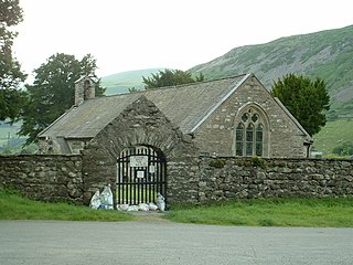
Tal-y-llyn, or Talyllyn, is a small hamlet and former parish in Gwynedd, Wales, situated at the end of Tal-y-llyn Lake close to the village of Abergynolwyn. The parish covered an area of 36,000 acres (15,000 ha). The River Dysynni flows out of the lake at this point, flowing down to enter Cardigan Bay north of Tywyn. Another lake known as Llyn y Tri Greyenyn or Llyn Bach was formerly located close to the border with the parish of Dolgellau.

<span class="mw-page-title-main">Llanegryn</span> Human settlement in Wales

Llanegryn is a village and a community in Gwynedd, north-west Wales. It was formerly part of the historic county of Merionethshire. It is located within Snowdonia National Park south of the Snowdonia (Eryri) mountain range. Travelling by road, it is around 4 miles (6 km) north-east of Tywyn and 17 miles (27 km) south-west of Dolgellau. The nearest railway stations are at Tonfanau and Llwyngwril, both less than 3 miles (5 km) away.

<span class="mw-page-title-main">Geology of Snowdonia National Park</span> Overview of geology in Snowdonia, Wales

The geology of Snowdonia National Park in North Wales is dominated by sedimentary and volcanic rocks from the Cambrian and Ordovician periods with intrusions of Ordovician and Silurian age. There are Silurian and Cenozoic sedimentary rocks on the park's margins. The succession was intensely faulted and folded during the Caledonian Orogeny. The region was uplifted as the North Atlantic Ocean opened during the Cenozoic. The current mountainous landscape arises from repeated glaciations during the Quaternary period.

<span class="mw-page-title-main">Llyn y Tri Greyenyn</span> Lake in Wales

Llyn y Tri Greyenyn was a small lake not far from Cadair Idris in the old parish of Tal-y-llyn, Merionethshire in north Wales. It was located at the head of the valley of Cwm Rhwyddfor on the pass called Bwlch Llyn Bach between Minffordd and Cross Foxes; Llyn y Tri Greyenyn is the 'llyn bach’’ in the pass’s name. Most of the lake has now been infilled in order to improve the road. The name means 'the lake of the three grains or pebbles'.

Today, the A487 passes through the site. There is also a small car park on the location of part of the lake. Some of the remains of the old lake can be seen on the south-east side. As the car park is a convenient place to watch military aircraft on the so-called 'Mach Loop’, the car park is sometimes called the ‘Mach Loop' car park.

References

  1. 1 2 "WalesDirectory - Tal-y-llyn Lake".
  2. Morris, A. (1915). Merionethshire. Cambridge University Press. p. 25. The largest of these is the Talyllyn lake at the southern foot of the mountain. It is sometimes known as Mwyngil.
  3. 1 2 Roberts, Askew; Woodall, Edward (1890). Gossiping Guide to Wales. Simpkin, Marshall & Co. p. 26.
  4. Gallichan, Walter M. (1903). Fishing in Wales. London: F. E. Robinson & Co.
  5. "University of Wales, Aberystwyth, Educational Visits & Fieldwork". aber.ac.uk. Archived from the original on 29 September 2007.
  6. Muirhead, Findlay (1922). Blue Guides to Wales (2nd ed.). London: Macmillan & Co. p. 141.
  7. Melville Richards, 'The Names of Welsh Lakes', in D. P. Blok (ed.), Proceedings of the Eighth International Congress of Onomastic Studies (The Hague & Paris: Mouton & Co., 1976), p. 410.
  8. Google (26 April 2016). "Tal-y-llyn Lake" (Map). Google Maps . Google. Retrieved 26 April 2016.
  9. "Landranger 124 Dolgellau and surrounding area" (Map). 1.25 inch map. Ordnance Survey.
  10. "Sheet 127 Aberystwyth" (Map). One inch map. Ordnance Survey.
  11. "Things to Do". Talyllyn Railway . Retrieved 26 April 2016.
  12. Stephens, Nicholas (1990). Natural Landscapes of Britain from the Air. CUP Archive. pp. 64–65. ISBN   978-0-521-32390-1.
  13. The Grey King first UK edition publication contents at the Internet Speculative Fiction Database. Retrieved 26 April 2016