Muzhappilangad (മുഴപ്പിലങ്ങാട്) is a coastal census town near Thalassery in Kannur district in the Indian state of Kerala. It is a suburb of kannur city

Puthunagaram is a town and gram panchayat in the Palakkad district, state of Kerala, India. It is about 10 km south of Palakkad and 8 Km from Kollengode. Palakkad-Pollachi railway line passes through this town.
Madipakkam is residential locality situated in south of Chennai, India. It has been recently placed under the Greater Chennai Corporation.
Azhagiapandiapuram is a second grade town panchayat in Kanniyakumari district in the state of Tamil Nadu, India. It is located at the centre of Pazhayar valley. It is one of the four town panchayat's in Thovalai taluk.
Bhogpur is a town and a Nagar Panchayat in Jalandhar district in the state of Punjab, India. Bhogpur has a Dana Mandi and have subsequent villages under it. It also acts as a route from Jalandhar to Tanda and is known for its famous sweet shops, and tailor shops. Sikhism is the major religion followed by Hinduism.

Birwadi is a census town in Raigad district in the state of Maharashtra, India.
Chinnasekkadu is a neighbourhood of Chennai in Chennai district in the state of Tamil Nadu, India. Chinnasekkadu used to be a town panchayat in Thiruvallur district. In 2011, Chinnasekkadu town panchayat was merged with Chennai Corporation. Chinnasekkadu comes under ward 29 in Zone 3(Madhavaram) of Chennai Corporation.
Ezhudesam is a town panchayat in Kanniyakumari district in the state of Tamil Nadu, India.
Harpalpur is a town and a nagar panchayat in Chhatarpur District in the Indian state of Madhya Pradesh.
Herohalli is a census town in Bangalore district in the Indian state of Karnataka.
Kannankurichi is a part of Salem City Municipal Corporation in Salem district in the Indian state of Tamil Nadu.
Kothnur is a census town in Bangalore district in the Indian state of Karnataka.
Kumbhkot is a census town in Kota district in the Indian state of Rajasthan.
Lohian Khas is a town and a nagar panchayat in Jalandhar district in the Indian state of Punjab. There was 11 wards in this town recently two more wards are constituted now currently 13 wards represent this lohian town. A bus stand and railway station also situated here. As per the Rail Department's terminology, Lohian station comes under the category of "rail junction", this type of terminology used where three or more rail tracks joins together and this important to mention here that historical city Patiala from railway point of view not comes under the category of junction By train people go to Makhu, Ferozpur, Sultanpur Lodhi, Kapurthala, Nakodar, Jalandhar and Ludhiana. There are schools for computer education and Ielts academies also here.
Majholi is a growing town and a nagar Parishad in Jabalpur district in the Indian state of Madhya Pradesh.
Newa Talai is a census town in Udaipur district in the Indian state of Rajasthan.
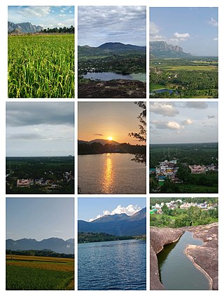
Thevaram is a town in Theni district in the Indian state of Tamil Nadu. Thevaram is located in Tamil Nadu near the border of Kerala at the Eastern side foot-hill of the Western Ghats. It is connected with State Highway SH100.
Vengathur is a census town in Thiruvallur district in the Indian state of Tamil Nadu.
Jafarabad is a town and nagar panchayat in Jaunpur district in the Indian state of Uttar Pradesh.
Kerur is a town in Bagalkot district in Karnataka, which located on NH 218. It has an average elevation of 617 meters (2024 feet). It's the birthplace of Jagadish Shettar, a former Chief Minister of Karnataka. Kerur is a Town Panchayat city in the district of Bagalkot, Karnataka. The Kerur city is divided into 16 wards for which elections are held every five years. The Kerur Town Panchayat has a population of 19,731 of which 9,929 are males while 9,802 are females as per report released by Census India 2011.

