
Guam is an organized, unincorporated territory of the United States in Micronesia in the western Pacific Ocean. It is the westernmost point and territory of the United States. The capital city of Guam is Hagåtña, and the most populous city is Dededo. Guam has been a member of the Pacific Community since 1983. The inhabitants of Guam are American citizens by birth. The indigenous Guamanians are the Chamorros, who are related to other Austronesian peoples of Indonesia, the Philippines, Taiwan, Micronesia, and Polynesia.

Hagåtña is the capital village of the United States territory of Guam. From the 18th through mid-20th century, it was Guam's population center, but today it is the second smallest of the island's 19 villages in both area and population. However, it remains one of the island's major commercial districts in addition to being the seat of government.

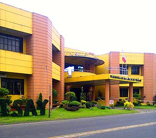
Talisay, officially the City of Talisay, is a 3rd class component city in the province of Cebu, Philippines. According to the 2015 census, it has a population of 227,645 people.
Talisay is the Philippine common name for the tree Terminalia catappa.

Taal Lake, formerly known as Bombón Lake, is a freshwater volcanic crater lake in the province of Batangas, on the island of Luzon in the Philippines. The lake fills Taal Volcano, a large volcanic caldera formed by very large eruptions between 500,000 and 100,000 years ago.

Talisay, officially the Municipality of Talisay, is a 3rd class municipality in the province of Batangas, Philippines. According to the 2015 census, it has a population of 45,301 people.

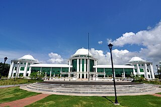
Talisay, officially the City of Talisay, is a 4th class component city in the province of Negros Occidental, Philippines. According to the 2015 census, it has a population of 102,214 people. It is about 7 kilometres (4.3 mi) north of Bacolod, facing the Bacolod–Silay Access Road in the east.
Talisay, officially the Municipality of Talisay, is a 4th class municipality in the province of Camarines Norte, Philippines. According to the 2015 census, it has a population of 25,841 people.
Dapitan, officially the City of Dapitan, is a 3rd class city in the province of Zamboanga del Norte, Philippines. According to the 2015 census, it has a population of 82,418 people.

Yona is a village in the United States territory of Guam.
The Talisay City Science High School is a Secondary Public Science High School system located in Talisay City, Cebu, Philippines. It is a DepEd-recognized science high school.

Carlos Hilado Memorial State College is a public, state-owned college, the main campus of which is in Talisay, Negros Occidental, Philippines. It provides higher technological, professional and vocational instruction and training in science, agriculture and industrial fields, as well as short-term or vocational courses.

The following is an alphabetical list of articles related to the United States Territory of Guam.
Lawaan II is a barangay of Talisay, Cebu. Lawaan II is bounded by Lawaan III on the north, San Isidro on the east, Mohon on the south, and Lawaan I on the west. It has a land area of 72 hectares with 14 sitios.
The Ramu languages are a family of some thirty languages of Northern Papua New Guinea. They were identified as a family by John Z'graggen in 1971 and linked with the Sepik languages by Donald Laycock two years later. Malcolm Ross (2005) classifies them as one branch of a Ramu – Lower Sepik language family. Z'graggen had included the Yuat languages, but that now seems doubtful.
The Tamolan languages are a small family of clearly related languages spoken in the region of the Guam River in Madang Province, Papua New Guinea.

The Hinatuan Enchanted River, also called the Hinatuan Sacred River, is a deep spring river on the island of Mindanao in the Philippines. It flows into the Philippine Sea and the Pacific Ocean at Barangay Talisay, Hinatuan, Surigao del Sur. It is found between the boundaries of Barangays of Talisay and Cambatong. It earned the moniker "enchanted river" from the diplomat Modesto Farolan who described the river in his poem entitled "Rio Encantado".

Typhoon Alice was a typhoon that bought severe flooding to Guam during the 1953 Pacific typhoon season. The system was first tracked near the Marshall Islands on October 11 by the Joint Typhoon Warning Center (JTWC) as a tropical storm, and the Japan Meteorological Agency (JMA) as a tropical depression. JMA upgraded Alice to a tropical storm east of Guam on October 14, and JTWC reported that the storm had intensified to 65 knots, equivalent to a Category 1 typhoon on the Saffir–Simpson scale, one day later. Northwest of Guam, the typhoon traveled northeastwards, reaching its peak of 100 kn late on October 18 near Iwo Jima. Alice then steadily weakened, down to a tropical storm on October 20. The storm became extratropical on October 23 near the International Date Line, and both agencies ceased tracking the cyclone.

The Guam River is a river in northern Papua New Guinea.
