
Shōichi Yokoi was a sergeant in the Imperial Japanese Army (IJA) during the Second World War, and was among the last three Japanese holdouts to be found after the end of hostilities in 1945. He was discovered in the jungles of Guam on 24 January 1972, almost 28 years after U.S. forces had regained control of the island in 1944.

The Marianas Association of General Baptists is an association of General Baptist churches in the Mariana Islands.
The Talofofo Falls are a scenic series of cascades on the Ugum River on the island of Guam. They are located in the southeast of the island, inland from Talofofo Bay.

The Talofofo Bay is an inlet in the south-eastern coast of the island of Guam at the mouth of the Talofofo River in the village of Talofofo.

Fena Lake (Reservoir) is the largest lake in the United States territory of Guam and it is a man made reservoir. It is located in the south of the island, and is overlooked by the nearby peaks of Mounts Lamlam, Alifan and Jumullong Manglo. The lake's outflow is to the north-west, its waters eventually reaching the Pacific Ocean at Talofofo Bay.
Guam Highway 4 (GH-4) is one of the primary automobile highways in the United States territory of Guam.
Southern High School is a public secondary school located at 1 Jose Perez Leon Guerrero Drive in the village of Santa Rita, in the United States territory of Guam. The school, a part of the Guam Public School System, opened in 1997 and serves grades 9 through 12. Southern High serves the villages of Santa Rita, Agat, Asan, Inarajan, Merizo, Piti, Talofofo, Umatac, and Yona.
Guam Highway 17 (GH-17) is one of the primary automobile highways in the United States territory of Guam.
Guam Adventist Academy (GAA) is a K-12 private school run by the Seventh-day Adventist Church in Guam and the Seventh-day Adventist Guam Micronesia Mission, in Yona, Guam. The school's Windward Hills campus is across the street from the Windward Hills Golf Club.

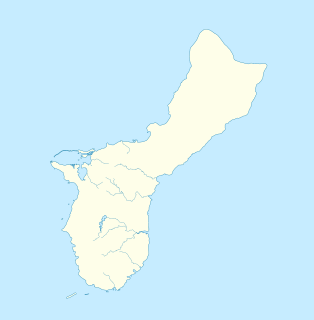
Talofofo is a village located in the southern part of the United States territory of Guam, on the east coast. The village center is located in the hills above the coast, while the smaller coastal community below the cliff is known as Ipan.
10th Independent Mixed Regiment was a regiment of the Imperial Japanese Army that has association with a number of U.S. National Register of Historic Places-listed places in Guam.
The Talofofo Pillbox is a historic World War II-era defensive fortification in Talofofo, Guam. It is located near the coast, about 127 metres (417 ft) south of the mouth of the Togcha River and 27 metres (89 ft) inland from the high-tide line. It is roughly 2.75 by 3.0 metres, built out of concrete and coral limestone. Its walls are about 0.5 metres (1.6 ft) thick, with an embrasure providing a view of the Togcha River, and a window looking over the coast to the east. Its entrance is on the landward (south) side. This structure was built under the direction of the Imperial Japanese Army during its occupation of Guam in 1941–44.
The Talofofo River Valley Site is an archaeological site near Inarajan on the island of Guam. The site's major features include latte stone sets and rockshelters, with radiocarbon dating placing human occupation of the area as early as the first century CE. The site is located in the alluvial plain of the Talofofo River, and was excavated by archaeologist Fred Reinman in 1977.

Yokoi's Cave refers to two places on the island of Guam. The original reference is to the actual hideout of Imperial Japanese Army Sergeant Shoichi Yokoi, the last Japanese soldier of World War II to surrender on the island. Yokoi and several companions hid out in this area for more than 25 years, two of them dying in the cave; their remains were found in the cave after Yokoi's surrender. The second reference is to a recreation of his cave, located not far from where the original was located, that is a tourist attraction in Talofofo Falls Resort Park in the village of Talofofo.

Typhoon Alice was a typhoon that brought severe flooding to Guam during the latter part of the 1953 Pacific typhoon season. The system was first tracked near the Marshall Islands on October 11 by the Joint Typhoon Warning Center (JTWC) as a tropical storm, and the Japan Meteorological Agency (JMA) as a tropical depression. The JMA upgraded Alice to a tropical storm east of Guam on October 14. One day later, and the JTWC reported that the storm had intensified to 65 knots, equivalent to a Category 1 typhoon on the Saffir–Simpson scale. Near Iwo Jima, the typhoon traveled northeastwards, reaching its peak of 100 kn late on October 18. Alice then steadily weakened down to a tropical storm on October 20. The storm became extratropical on October 23 near the International Date Line, and both agencies ceased tracking the cyclone.
The geology of Guam formed as a result of mafic, felsic and intermediate composition volcanic rocks erupting below the ocean, building up the base of the island in the Eocene, between 33.9 and 56 million years ago. The island emerged above the water in the Eocene, although the volcanic crater collapsed. A second volcanic crater formed on the south of the island in the Oligocene and Miocene. In the shallow water, numerous limestone formations took shape, with thick alternating layers of volcanic material. The second crater collapsed and Guam went through a period in which it was almost entirely submerged, resembling a swampy atoll, until structural deformation slowly uplifted different parts of the island to their present topography. The process of uplift led to widespread erosion and clay formation, as well as the deposition of different types of limestone, reflecting different water depths.
