Related Research Articles

Howick is a suburb of East Auckland, New Zealand. The area was traditionally settled by Ngāi Tai ki Tāmaki, and in 1847 Howick was established as a defensive settlement for Auckland, by veteran fencible soldiers of the British Army. Howick was a small agricultural centre until the 1950s, when it developed into a suburban area of Auckland. Modern Howick draws much of its character from the succeeding waves of Asian settlement that it has experienced since New Zealand's immigration reforms of the 1980s, with a strong Chinese New Zealander presence in the suburb's business and education sectors.

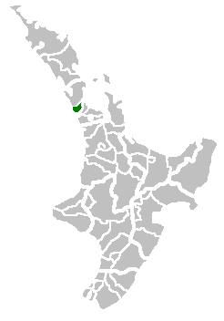
Waitākere City was a territorial authority in West Auckland, New Zealand; it was governed by the Waitākere City Council from 1989 to 2010. It was New Zealand's fifth-largest city, with an annual growth of about 2%. In 2010 the council was amalgamated with the other authorities of the Auckland Region to form the current Auckland Council.

New Lynn is a residential suburb in West Auckland, New Zealand, located 10 kilometres to the southwest of the Auckland city centre. The suburb is located along the Whau River, one of the narrowest points of the North Island, and was the location of Te Tōanga Waka, a traditional waka portage between the Waitematā and Manukau harbours.

Papatoetoe is a suburb in Auckland, New Zealand. It is the largest suburb in Auckland by population and is located to the northwest of Manukau Central, and 18 kilometres southeast of Auckland CBD.

South Auckland is one of the major geographical regions of Auckland, the largest city in New Zealand. The area is south of the Auckland isthmus, and on the eastern shores of the Manukau Harbour. The area has been populated by Tāmaki Māori since at least the 14th century, and has important archaeological sites, such as the Ōtuataua stonefield gardens at Ihumātao, and Māngere Mountain, a former pā site important to Waiohua tribes.

East Coast Bays is a string of small suburbs that form the northernmost part of the North Shore, part of the contiguous Auckland metropolitan area in New Zealand. The suburbs line the north-east coast of the city along the shore of the Hauraki Gulf and Rangitoto Channel. They include, from north to south, Long Bay, Torbay, Waiake Bay, Browns Bay, Rothesay Bay, Murrays Bay, Mairangi Bay, Campbells Bay and Castor Bay. Most of the East Coast Bays are covered under the East Coast Bays subdivision of the Hibiscus and Bays local board area.

Takapuna is a suburb located on the North Shore of Auckland, New Zealand. The suburb is an isthmus between Shoal Bay, arm of the Waitematā Harbour, and the Hauraki Gulf. Lake Pupuke, a volcanic maar and one of the oldest features of the Auckland volcanic field, is a freshwater lake located in the suburb.

Kumeū is a town in the Auckland Region, situated 25 kilometres (16 mi) north-west of the City Centre in New Zealand. State Highway 16 and the North Auckland Line pass through the town. Huapai lies to the west, Riverhead to the north, Whenuapai to the east, and Taupaki to the south.
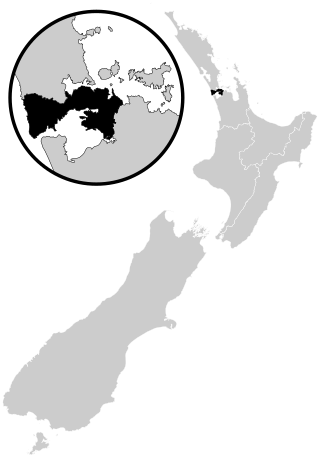
Auckland City was a territorial authority with city status covering the central isthmus of the urban area of Auckland, New Zealand. It was governed by the Auckland City Council from 1989 to 2010, and as a territory within the wider Auckland Region, was also governed by Auckland Regional Council. Auckland City was disestablished as a local authority on 1 November 2010, when Auckland City Council was amalgamated with other councils of the Auckland Region into the new Auckland Council. At the time of its disestablishment, the city had a resident population of around 450,000.

Pāremoremo is a mostly rural locality about 8 km southwest of Albany on the northern fringe of Auckland, New Zealand. Coatesville is about 7 km to the north, and Riverhead is about 8 km to the west. Pāremoremo is home to New Zealand's only maximum security prison.

Morningside is a suburb of Auckland, New Zealand. It lies four kilometres south-west of the city centre, close to Eden Park and Western Springs Reserve.

Browns Bay is one of the most northernmost suburbs in the contiguous Auckland metropolitan area, located in the North Shore. Named after the Brown family who settled here in 1876, Browns Bay became a holiday destination in the late 19th century. The area gradually developed into a suburb of Auckland in the 1950s, and was the administrative centre for the East Coast Bays City from 1975 until it was disestablished in 1989. During the 1990s, the suburb became a hub for the South African New Zealander community.

Mairangi Bay is a coastal suburb of North Shore, Auckland, located in the northern North Island of New Zealand, on the south-east-facing peninsula forming the northern side of the Waitematā Harbour. Mairangi Bay came under the local governance of the North Shore City Council until subsumed into the Auckland Council in 2010.

The Auckland isthmus, also known as the Tāmaki isthmus, is a narrow stretch of land on the North Island of New Zealand in the Auckland Region, and the location of the central suburbs of the city of Auckland, including the CBD. The isthmus is located between two rias : the Waitematā Harbour to the north, which opens to the Hauraki Gulf / Tīkapa Moana and Pacific Ocean, and the Manukau Harbour to the south, which opens to the Tasman Sea. The isthmus is the most southern section of the Northland Peninsula.

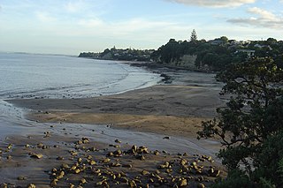
Murrays Bay is a small suburb in the East Coast Bays region, located in the North Shore of Auckland. The suburb is roughly the same size as Rothesay Bay, the suburb to the immediate north. It is primarily a residential area but does have a community centre, restaurant and café. Murrays Bay is regularly serviced by buses which go to Takapuna and the Auckland city centre.

Papakura is a suburb of South Auckland, in northern New Zealand. It is located on the shores of the Pahurehure Inlet, approximately 32 kilometres (20 mi) south of the Auckland City Centre. It is under the authority of the Auckland Council.

Tāmaki Makaurau is a New Zealand parliamentary Māori electorate returning one Member of Parliament to the New Zealand House of Representatives. It was first formed for the 2002 election. The electorate covers central and southern Auckland, and southern parts of western Auckland. It derives its name from the Māori-language name for Auckland; Makaurau is a descriptive epithet referring to the value and desirability of the land.

The Maungakiekie-Tāmaki Local Board is one of the 21 local boards of the Auckland Council. It is the only local board overseen by the council's Maungakiekie-Tāmaki Ward councillor.

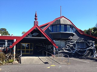
Tāmaki College is co-educational Secondary School in Glen Innes, Auckland, New Zealand.
This is a timeline of the history of the city of Auckland in New Zealand.
References
- ↑ "Tamaki City Council". Auckland Council Archives. Auckland City Council. Archived from the original on 4 March 2016. Retrieved 16 April 2024.
- ↑ "Tamaki City Council, 1986 - 1989". Auckland Libraries. Retrieved 23 March 2024.