
Guanacaste is a province of Costa Rica located in the northwestern region of the country, along the coast of the Pacific Ocean. It is bordered by Nicaragua to the north, Alajuela Province to the east, and Puntarenas Province to the southeast. It is the most sparsely populated of all the provinces of Costa Rica. The province covers an area of 10,141 square kilometres (3,915 sq mi) and as of 2010, had a population of 354,154, with annual revenue of $2 billion.

Liberia is a district and the largest city in the Guanacaste Province of Costa Rica, located 215 kilometres (134 mi) northwest of the national capital, San José. Part of the Liberia canton, it is a major center for the country's tourism industry.

Las Baulas de Guanacaste Marine National Park is a National Park of Costa Rica and a Ramsar Site. The park is managed by the Tempisque Conservation Area, and covers approximately a 167.3 square kilometres (64.6 sq mi) marine area of the Tamarindo Bay, next to the town of Tamarindo. It supports the largest nesting colony of leatherback sea turtles on the Pacific coast of the Americas. Female leatherbacks often come ashore at Playa Grande between October and May to lay their eggs.

The Nicoya Peninsula is a peninsula on the Pacific coast of Costa Rica. It is divided into two provinces: Guanacaste Province in the north, and the Puntarenas Province in the south. It is located at 10°N 85.4166667°W. It varies from 19 to 37 miles (60 km) wide and is approximately 75 miles (121 km) long, forming the largest peninsula in the country. It is known for its beaches and is a popular tourist destination.
Iguanita Wildlife Refuge is a wildlife refuge in the Guanacaste Conservation Area located in the Guanacaste Province of northwestern Costa Rica.
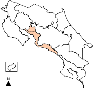
Central Pacific Conservation Area is an administrative area which is managed by SINAC for the purposes of conservation in the southwestern part of Costa Rica, on the Pacific coast. It contains four National Parks, and a number Wildlife refuges and other types of nature reserve.

Tamarindo is a district of the Santa Cruz canton, in the Guanacaste province of Costa Rica, located on the Nicoya Peninsula.

The Gulf of Papagayo is a large body of water off Guanacaste province and the northwestern coast of Costa Rica. The Gulf and its coastline are part of a major tourism project by Costa Rica's government. Among the most popular destinations on the Gulf of Papagayo are Ocotal Beach, Playas del Coco, Playa Hermosa, and Playa Panama. The Papagayo peninsula is the most developed area in the gulf region. The gulf waters are home to many wildlife including orcas.

Playa Negra is a beach in the Guanacaste Province of Costa Rica. It is south of Tamarindo, San José de Pinilla, Avellanas and north of Marbella, Lagarto, Venado, and Junquillal. Los Pargos, meaning "the snapper", is the name of the town where Playa Negra is located. It is accessed from Santa Cruz through 27 de Abril and then Paraiso.

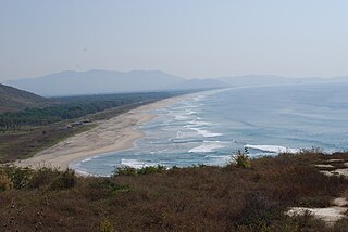
Playa Grande, also known as Salinas, is a beach community on the Pacific coast of Costa Rica just north of Tamarindo. It is located inside the canton of Santa Cruz in Guanacaste Province. Playa Grande has been part of the Parque Nacional Marino Las Baulas since 1990. There are palm trees and vegetation around the beach, which stretches for about 4.5 kilometers. It is part of the Las Baulas National Marine Park, which was established to protect the nesting grounds of endangered leatherback turtles. Playa Grande is one of the major nesting sites for these turtles, and visitors can witness the nesting and hatching process during the nesting season, which typically occurs from October to March. The main attraction of Playa Grande is its surf breaks. The beach has consistent waves. Playa Grande is an ideal destination for nature lovers, with diverse ecosystems surrounding it. Beyond the beach, you can explore the nearby mangrove forests, take boat tours along the estuaries, or venture into the neighboring national parks, such as Rincon de la Vieja or Santa Rosa, which offer hiking trails, wildlife spotting opportunities, and breathtaking landscapes.

Carrillo is a canton in the Guanacaste province of Costa Rica. The head city is in Filadelfia district.
Costa Grande of Guerrero is a sociopolitical region located in the Mexican state of Guerrero, along the Pacific Coast. It makes up 325 km (202 mi) of Guerrero's approximately 500 km (311 mi) coastline, extending from the Michoacán border to the Acapulco area, wedged between the Sierra Madre del Sur and the Pacific Ocean. Acapulco is often considered part of the Costa Grande; however, the government of the state classifies the area around the city as a separate region. The Costa Grande roughly correlates to the Cihuatlán province of the Aztec Empire, which was conquered between 1497 and 1504. Before then, much of the area belonged to a dominion under the control of the Cuitlatecs, but efforts by both the Purépecha Empire and Aztec Empire to expand into this area in the 15th century brought this to an end. Before the colonial period, the area had always been sparsely populated with widely dispersed settlements. The arrival of the Aztecs caused many to flee and the later arrival of the Spanish had the same effect. For this reason, there are few archeological remains; however, recent work especially at La Soledad de Maciel has indicated that the cultures here are more important than previously thought. Today, the area economically is heavily dependent on agriculture, livestock, fishing and forestry, with only Zihuatanejo and Ixtapa with significantly developed infrastructure for tourism. The rest of the coast has been developed spottily, despite some government efforts to promote the area.
Costa Rica International Academy (CRIA) is a private, United States-accredited, day school located between the Flamingo Beach and Tamarindo Beach in Brasilito, Guanacaste, Costa Rica. CRIA is 1 of 10 US accredited schools in Costa Rica, and the only one in Guanacaste province. It was originally founded as Country Day School (. The school serves students in grades pre-K to twelfth grade. The school is owned and operated by the board of directors, making it privately owned. In 2014 the school was renamed to Costa Rica International Academy. The school has uniforms that are a red polo shirt and navy blue shorts.

Playas del Coco is one of the oldest beach communities in Guanacaste Province, Costa Rica. This region is also one of the fastest-growing tourism areas in Costa Rica. A popular destination for both local Costa Ricans and visitors from other countries during the traditional holiday seasons, local Costa Ricans refer to Playas del Coco affectionately as "El Coco". At the same time, travelers from outside of Costa Rica use the name "Coco Beach", when mentioning this locale.

The BPM Festival is an annual electronic music festival, held in Tamarindo, Costa Rica.
Okenia academica is a species of sea slug, specifically a dorid nudibranch, a marine gastropod mollusc in the family Goniodorididae.
Cabo Velas Airport is an airport serving the Pacific coastal villages along the Playa Grande, north of Tamarindo in Guanacaste Province, Costa Rica.
Skyway Costa Rica is a regional airline based in San José, Costa Rica. It operates daily scheduled passenger services to 8 domestic destinations and 1 international destination. Its hub is located at Juan Santamaría International Airport.