
Ceredigion, historically Cardiganshire, is a county in the west of Wales. It borders Gwynedd across the Dyfi estuary to the north, Powys to the east, Carmarthenshire and Pembrokeshire to the south, and the Irish Sea to the west. Aberystwyth is the largest settlement and, together with Aberaeron, is an administrative centre of Ceredigion County Council.

The Afon Rheidol is a river in Ceredigion, Wales, 19 miles (31 km) in length. The source is Plynlimon. Receiving an average annual rainfall of 40 inches (1.02 m), Plynlimon is also the source of both the Wye and the Severn.

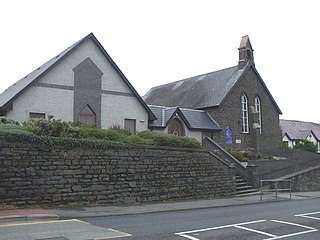
Ponterwyd (Welsh pronunciation:[pɔntˈerʊi̯d] is a village in Ceredigion, Wales. It lies in the Cambrian Mountains of Mid Wales, approximately 12 miles east of Aberystwyth on the A44 road.
The Central Wales Football League(formerly the Mid Wales Football League) is a football league in Wales at tier four of the Welsh Football pyramid, run by the Central Wales Football Association. The league consists of two regionally based divisions - a Northern Division and a Southern Division. The league offers a promotion route to the Football Association of Wales administered tier three Ardal Leagues. Relegation is possible to the relevant tier five level leagues in Aberystwyth, Ceredigion and Montgomeryshire.

Pen Dinas is the name of a large hill within the boundary of the village of Penparcau, on the coast of Ceredigion, Wales, upon which an extensive Iron Age, Celtic hillfort of international significance is situated. The site can easily be reached on foot from Aberystwyth town center and is accessible via a series of well marked trails. Boasting a commanding position at the confluence of the River Ystwyth and Afon Rheidol, it has been described as "the pre-eminent hillfort on the Cardigan Bay coast".
Penparcau is a village and electoral ward in Ceredigion, Wales, situated to the south of Aberystwyth. The village has the largest number of Welsh language speakers (1095) in the Aberystwyth town area, covering an area from the sea to the Rheidol.

The River Dyfi, also known as the River Dovey; DUH-vee), is an approximately 30-mile (48-kilometre) long river in Wales.

Llanbadarn Fawr is a village and community in Ceredigion, Wales. It is on the outskirts of Aberystwyth next to Penparcau and Southgate. It forms the eastern part of the continually built-up area of Aberystwyth. It holds two electoral wards, Padarn and Sulien which elect a Ceredigion County Councillor each and several Llanbadarn Fawr Community Councillors. At the 2001 census its population as a community was recorded at 2,899, increasing to 3,380 at the 2011 census.

Matthew Lewis Vaughan-Davies, 1st Baron Ystwyth was a Welsh Liberal Party politician. He was Liberal MP for the Cardiganshire Division from 1895 until 1921.

Plas Tan y Bwlch in Gwynedd, Wales, is the Snowdonia National Park environmental studies centre, administered by the National Park Authority. It is located approximately 6 miles (9.7 km) east of the coastal town of Porthmadog, overlooking the valley of the River Dwyryd and the village of Maentwrog.

Ynyslas Sand Dunes are sand dunes located in Ceredigion, Wales. They border Cardigan Bay and the Dyfi Estuary between Ynyslas, Ceredigion and Aberdyfi, Gwynedd. The sand dunes are part of the Dyfi National Nature Reserve.

Aberystwyth is a university and seaside town and a community in Ceredigion, Wales. It is the largest town in Ceredigion and 16 miles (26 km) from Aberaeron, the county's administrative centre. In 2011, the population of the town was 15,935.

Penparcau Football Club are a Welsh football club from Penparcau, Ceredigion. They currently play in the Central Wales Southern Division, the fourth tier of the Welsh football league.

Dwygyfylchi is a village in Conwy County Borough, Wales. It is part of the community of Penmaenmawr which has a population of 4,353. The electoral ward of Capelulo which includes Dwygyfylchi had a population of 1,485 in 2011. It forms part of the historic county of Caernarfonshire.

Cwmsymlog is a short valley, sheltering a hamlet of the same name, in Ceredigion, in the west of Wales. Once an important mining area, but the mining slowly declined and finally came to an end in 1901. Now it is peaceful, open countryside with a few mining remains, scattered houses and farmland. It is also the name of a Site of Special Scientific Interest at that location.

Trefeurig is a community in Mid and West Wales, situated around 4 miles (6.4 km) north-east of Aberystwyth. It is a site of particular prehistoric, Roman, and Iron Age interest, and has a long history as a mining area. In 2011 the local population was estimated at 1,771 people.
Bwlch is a village in Wales. Bwlch means a pass in Welsh and may also refer to

The 2022 Ceredigion County Council election took place as of 5 May 2022 to elect 38 members to Ceredigion Council. On the same day, elections were held to the other 21 local authorities and to community councils in Wales as part of the 2022 Welsh local elections. The previous all-council election took place in May 2017 and future elections will take place every five years.
