
Loch is the Scottish Gaelic, Scots and Irish word for a lake or sea inlet. It is cognate with the Manx lough, Cornish logh, and one of the Welsh words for lake, llwch.
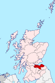
Lothian is a region of the Scottish Lowlands, lying between the southern shore of the Firth of Forth and the Lammermuir Hills and the Moorfoot Hills. The principal settlement is the Scottish capital, Edinburgh, while other significant towns include Livingston, Linlithgow, Bathgate, Queensferry, Dalkeith, Bonnyrigg, Penicuik, Musselburgh, Prestonpans, North Berwick, Dunbar, Whitburn and Haddington.
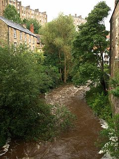
The Water of Leith is the main river flowing near central Edinburgh, Scotland, and flows into the port of Leith where it flows into the sea via the Firth of Forth.

The River Tweed, or Tweed Water, is a river 97 miles (156 km) long that flows east across the Border region in Scotland and northern England. Tweed cloth derives its name from its association with the River Tweed. The Tweed is one of the great salmon rivers of Britain and the only river in England where an Environment Agency rod licence is not required for angling. The river generates a large income for the local borders region, attracting anglers from all around the world.
Cumbric was a variety of the Common Brittonic language spoken during the Early Middle Ages in the Hen Ogledd or "Old North" in what is now Northern England and southern Lowland Scotland. It was closely related to Old Welsh and the other Brittonic languages. Place name evidence suggests Cumbric may also have been spoken as far south as Pendle and the Yorkshire Dales. The prevailing view is that it became extinct in the 12th century, after the incorporation of the semi-independent Kingdom of Strathclyde into the Kingdom of Scotland.

The River Dee, in south-west Scotland, flows from its source in Loch Dee amongst the Galloway Hills, firstly to Clatteringshaws Loch, then into Loch Ken, where it joins the Water of Ken. From there, the Dee flows 15 miles (24 km) southwards to Kirkcudbright, and into Kirkcudbright Bay to reach the Solway Firth. The distance is just over 38 miles (61 km) in total. Together with its tributaries, the Dee's total catchment area is over 400 square miles (1,000 km2).

The River Roch is a river in Greater Manchester in North West England, a tributary of the River Irwell, that gives Rochdale its name.

Blackadder Water is a river in Berwickshire in the Scottish Borders area of Scotland, forming part of the River Tweed system. It reached 2.84m at Mouthbridge, which was its highest level ever recorded on Tuesday 22 October 2002 at 2:45pm.

The River Kelvin is a tributary of the River Clyde in northern and northeastern Glasgow, Scotland. It rises on the moor south east of the village of Banton, east of Kilsyth. At almost 22 miles (35 km) long, it initially flows south to Dullatur Bog where it falls into a man made trench and takes a ninety degree turn flowing west through Strathkelvin and along the northern boundary of the bog parallel with the Forth and Clyde Canal.
The Gala Water is a river in the Scottish Borders area of Scotland and a tributary of the River Tweed. It is sometimes known as the "Gala", which nickname is also shared with Galashiels, which it flows through. The "Braw Lads O Gala Watter" is a song about people from Galashiels.

Devil's Water is a river in Northumberland, England. A tributary of the River Tyne, it joins that river from the south, near the village of Dilston about 1 mile (1.6 km) south-west of Corbridge. It is formed from the waters of several smaller burns and sikes between Embley and Hackford some 5 miles (8 km) south of Hexham.

Glenlochar is a hamlet on the western bank of the River Dee in the parish of Balmaghie in the historical county of Kirkcudbrightshire in Dumfries and Galloway. Glenlochar is located one and a half miles south of Balmaghie Kirk and 3 miles (5 km) north of Castle Douglas.
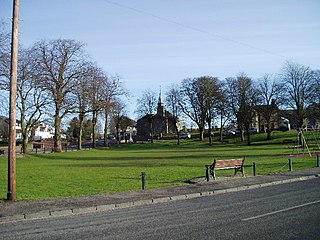
Carstairs is a village in South Lanarkshire, Scotland. Carstairs is located 5 miles east of the county town of Lanark and the West Coast Main Line runs through the village. The village is served by Carstairs railway station, which is served by the Caledonian Sleeper to and from London Euston. Carstairs is best known as the location of the State Hospital. Carstairs is applied to the places Carstairs Village and the village of Carstairs Junction where the railway station is situated. The two places are two completely different villages divided by 1 mile of land, a parkland area and the railway line.

Whiteadder Water is a river in East Lothian and Berwickshire, Scotland. It also flows for a very short distance through Northumberland before joining the River Tweed. In common with the headwaters of the Biel Water it rises on the low hillside of Clints Dod in the Lammermuir Hills, just ESE of Whitecastle Hillfort and 3 km (1.9 mi) south-east of the village of Garvald.

Cummertrees is a coastal village and civil parish of Annandale in the historical county of Dumfriesshire in Dumfries and Galloway. It lies about 1 mile (1.6 km) inland, on the Pow Water to the northwest of Powfoot, 12 miles (19 km) from Dumfries and 3 miles (5 km) from Annan.

Haugh of Urr, is a village in the historical county of Kirkcudbrightshire in Dumfries and Galloway, Scotland. It is approximately 4 miles NNW of Dalbeattie, 3 mi (5 km) NE of Castle Douglas, 12+1⁄2 mi (20 km) west of Dumfries and 12+1⁄2 mi (20 km) east of Kirkcudbright.
The Caddon Water is a small river by the village of Caddonfoot, in the Scottish Borders area of Scotland. It rises on Windlestraw Law, four miles north of Innerleithen, and flows through the Stantling Craig Reservoir. It joins the river Tweed at Caddonfoot, having completed its journey after 11 miles (18 km).
Common Brittonic, also known as British, Common Brythonic, or Proto-Brittonic, was a Celtic language spoken in Britain and Brittany.

Troqueer is a former village and a parish in the historic county of Kirkcudbrightshire in Dumfries and Galloway on the west side of the River Nith. The eastern-side was merged with Dumfries to the east in 1929, and today eastern Troqueer is a suburb of Dumfries.

Elvanfoot is a small village in South Lanarkshire, Scotland.
