Related Research Articles
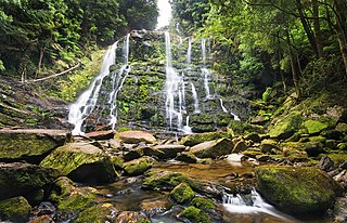
Franklin-Gordon Wild Rivers is a national park in Tasmania, 117 km west of Hobart. It is named after the two main river systems lying within the bounds of the park - the Franklin River and the Gordon River.

South West Cape is a cape located at the south-west corner of Tasmania, Australia. The cape is situated in the south-western corner of the Southwest National Park, part of the Tasmanian Wilderness World Heritage Area, approximately 140 kilometres (87 mi) southwest of Hobart in Tasmania, and about 65 kilometres (40 mi) west and slightly north of South East Cape.

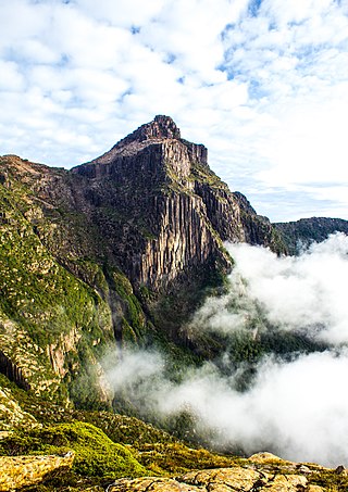
Frenchmans Cap is a mountain in the West Coast region of Tasmania, Australia. The mountain is situated in the Franklin-Gordon Wild Rivers National Park.
South East Cape is a cape located at the southernmost point of the main island of Tasmania, the southernmost state in Australia. The cape is situated in the southern and south-eastern corner of the Southwest National Park, part of the Tasmanian Wilderness World Heritage Area, approximately 94 kilometres (58 mi) southwest of Hobart in Tasmania and about 65 kilometres (40 mi) east and slightly south of South West Cape. South East Cape marks the official dividing line between the Pacific and Indian Oceans.
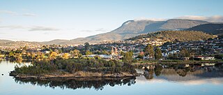
Rosetta is a residential suburb about 3 kilometres (1.9 mi) northwest of Glenorchy, located in local government area (LGA) of City of Glenorchy. In the 2021 census, Rosetta had a population of 2,833. This suburb is part of the Hobart LGA Region, nestled between Berriedale and Montrose and roughly a 15-minute drive from Hobart. Rosetta features a primary school and a high school and is bordered by the Brooker Highway along the east, adjacent to the Derwent River.

Montrose is a residential locality in the local government area (LGA) of Glenorchy in the Hobart LGA region of Tasmania. The locality is about 1 kilometre (0.62 mi) north of the town of Glenorchy. The 2016 census recorded a population of 2152 for the state suburb of Montrose. It is a suburb of Hobart. The suburb is situated in close proximity with Rosetta. Montrose is the suburb directly north of Glenorchy. It is also in Montrose where the Montrose Foreshore Community Park is located.

Mount Roland is a locality, a mountain, and a conservation area in the north west coast region of Tasmania, Australia.
Mount Geikie is a mountain in the West Coast Range of Western Tasmania, Australia.
The Sticht Range is a mountain range located in the West Coast region of Tasmania, Australia. The range runs between two tributaries of the Eldon River and is located within the eastern part of the West Coast Range and has an unnamed peak with an elevation of 1,080 metres (3,540 ft) above sea level.
South West Tasmania is a region in Tasmania that has evoked curiosity and wonder during the period of European presence on the island.

Tasmania Parks and Wildlife Service is the government body responsible for managing protected areas of Tasmania on public land, such as national parks, historic sites and regional reserves. Historically it has also had responsibility for managing wildlife, including game.

Quamby Bluff is a mountain in Northern Tasmania, Australia that is an outlying part of the Great Western Tiers mountain range.

Mount Pelion West is a mountain located in the Central Highlands region of Tasmania, Australia. The mountain is part of the Pelion Range and is situated within the Cradle Mountain-Lake St Clair National Park at the easternmost boundary of the Murchison River catchment.

Mount Pelion East is a mountain located in the Central Highlands region of Tasmania, Australia. The mountain is situated within the Cradle Mountain-Lake St Clair National Park.

Cathedral Mountain is a dominant mountain in the Cradle Mountain-Lake St Clair National Park in the central highlands in the state of Tasmania, Australia.

The Taillefer Rocks, part of the Schouten Island Group, are three small, rugged, granite islands, with a combined area of approximately 15 hectares lying close to the eastern coast of Tasmania, Australia, near the Freycinet Peninsula and lies within the Freycinet National Park.
Montello is a suburb of the city of Burnie in North West Tasmania. It is about 2 kilometres (1.2 mi) south-west of the centre of Burnie, and recorded a population of 1217 in the 2016 census.
Lake Flannigan is a natural freshwater lake on King Island, Tasmania, Australia, situated four kilometres south of the Cape Wickham Lighthouse, in the northern locality of Wickham.
References
- ↑ "LANDS AND SURVEYS". The Examiner (Tasmania) . Vol. LXIV, no. 159. Tasmania, Australia. 5 July 1904. p. 4 (DAILY.). Retrieved 10 May 2024– via National Library of Australia.
- ↑ Tasmania. Lands Department (1972), Tasmap, Lands Dept, retrieved 10 May 2024
- ↑ Tooley, R. V. (Ronald Vere) (1975), Printed maps of Tasmania, 1642-1900, Francis Edwards Ltd, ISBN 978-0-902476-07-3
- ↑ "New Maps Of Tasmania". The Mercury . Vol. CLXXIV, no. 26, 049. Tasmania, Australia. 21 June 1954. p. 4. Retrieved 10 May 2024– via National Library of Australia.
- ↑ Bank of New South Wales (1964), Pocket maps of Tasmania, The Bank, retrieved 10 May 2024
- ↑ TASMAP eShop – buy Tasmanian maps online – National Park and Day Walk Maps – Category Details