
Kaipara District is a territorial authority district in the Northland Region of New Zealand.

Kaipara Harbour is a large enclosed harbour estuary complex on the north western side of the North Island of New Zealand. The northern part of the harbour is administered by the Kaipara District and the southern part is administered by the Auckland Council. The local Māori tribe is Ngāti Whātua.

Helensville is a town in the North Island of New Zealand. It is sited 40 kilometres (25 mi) northwest of Auckland, close to the southern extremity of the Kaipara Harbour. State Highway 16 passes through the town, connecting it to Waimauku 16 kilometres (10 mi) to the south, and Kaukapakapa about 12 kilometres (7.5 mi) to the north-east. Parakai is two kilometres (1.2 mi) to the north-west. The Kaipara River runs through the town and into the Kaipara Harbour to the north.

Wellsford is a town on the Northland Peninsula in the northern North Island of New Zealand. It is the northernmost major settlement in the Auckland Region, and is 77 kilometres (48 mi) northwest of the Auckland CBD. It is a major regional centre, being located at the junction of State Highways 1 and 16, almost halfway between Auckland and the Northland city of Whangārei.

Riverhead is a small, historically predominantly working-class town located at the head of the Waitematā Harbour in the north-west of Auckland, New Zealand. It is located on the northwestern shores of the Upper Waitematā Harbour, north-east of the towns of Kumeū and Huapai.

Huapai is a locality north-west of Auckland, New Zealand. State Highway 16 and the North Auckland Railway Line pass through it. Kumeū is adjacent to the east, Riverhead is to the north-east, and Waimauku to the west.

Kaukapakapa is a town in the North Island of New Zealand. It is situated in the Rodney ward of the Auckland Region and is around 50 kilometres northwest of Auckland city. State Highway 16 passes through the town, connecting it to Helensville about 12 km to the south-west, and Araparera about 14 km to the north. The North Auckland Line also passes through Kaukapakapa. The Kaukapakapa River flows from the town to the Kaipara Harbour to the west.

The Mangawhai Harbour is a natural harbour in New Zealand. It is a sandspit estuary on the south-eastern coast of the Northland Region. The townships of Mangawhai and Mangawhai Heads are on the harbour. The Mangawhai Government Purpose Wildlife Refuge Reserve covers the sandspit between the harbour and the ocean.

Kaipara Flats is a locality in the Rodney District of New Zealand. Warkworth is 12 km to the east, Ahuroa to the south, and Tauhoa to the north-west. The North Auckland railway line passes through the area.
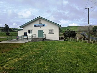
Tauhoa is a rural community in the Auckland Region of New Zealand's North Island.

New Zealand has large ocean energy resources but does not yet generate any power from them. TVNZ reported in 2007 that over 20 wave and tidal power projects are currently under development. However, not a lot of public information is available about these projects. The Aotearoa Wave and Tidal Energy Association was established in 2006 to "promote the uptake of marine energy in New Zealand". According to their 10 February 2008 newsletter, they have 59 members. However, the association doesn't list its members.

The Hōteo River is a river of the Auckland Region of New Zealand. It flows southwest from its sources close to the North Auckland Peninsula's east coast before emptying into the southern lobe of the Kaipara Harbour.
The Ōpatu River is a tidal creek of the Kaipara Harbour, in the Auckland Region of New Zealand's North Island. It flows west from Te Pahi Stream, before joining another tidal creek of the harbour, the Tauhoa River.

The Ōruawharo River is a river on the North Auckland Peninsula of New Zealand. It flows westward into the Kaipara Harbour west of Wellsford. It forms part of the boundary between the Northland region and the Auckland Region.
The Topuni River is a river in the upper North Island of New Zealand. From its source on the Hakaru River, it flows generally south, with most of its length being through a drowned valley in the northeast of the Kaipara Harbour system. The estuarine section of the river forms a part of the border between the Kaipara District of the Northland Region and the Rodney local board area of the Auckland Region. The Topuni River flows into Oruawharo River — an arm of the Kaipara — 10 kilometres northwest of Wellsford.
The Whanaki River is a river of the Auckland Region of New Zealand's North Island. It flows southwest from its origins near Wellsford to reach the Tauhoa River, an arm of the Kaipara Harbour.
The Kaipara tidal power station is a proposed tidal power project to be located in the Kaipara Harbour. The project was being developed by Crest Energy, with an ultimate size of 200MW at a cost of $600 million.
Kaipara ki Mahurangi is an electorate to the New Zealand House of Representatives. It was created for the 2020 election.

Ātiu Creek Regional Park is a regional park located south of Oruawharo River in the Kaipara Harbour in New Zealand's North Island. It is located west of Wellsford and east of Tapora on the Okahukura Peninsula, in Rodney in the Auckland Region and is run by Auckland Council.

Portages in New Zealand, known in Māori as Tō or Tōanga Waka, are locations where waka (canoes) could easily be transported overland. Portages were extremely important for early Māori, especially along the narrow Tāmaki isthmus of modern-day Auckland, as they served as crucial transportation and trade links between the east and west coasts. Portages can be found across New Zealand, especially in the narrow Northland and Auckland regions, and the rivers of the Waikato Region.


