Kadan Kyun is the largest island in the Mergui Archipelago, Myanmar. Its area is 450 square kilometres (170 sq mi). The highest point is French Bay Peak, which is the highest point in the archipelago.

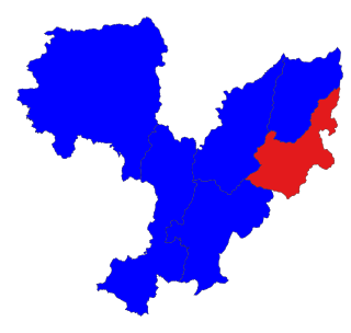
Chipwi Township is a township of Myitkyina District in the Kachin State of Burma. The principal town is Chipwi.
Gyobin is a river town in Homalin Township, Hkamti District, in the Sagaing Region of northwestern Burma. It is located east of Kaukngo. An old frontier outpost was located at Gyobin during the British Burma period.
Hmawyonmyaing is a river village in Homalin Township, Hkamti District, in the Sagaing Region of northwestern Burma. It is located north of Tonmalaw.
Nampagan is a village on the Chindwin River in Homalin Township, Hkamti District, in the Sagaing Region of northwestern Burma. It is located north of Hwena.
Kwenan is a river village in Homalin Township, Hkamti District, in the Sagaing Region of northwestern Burma. It is located to the north of Gyobin.
Kyaukkwe is a village near the Chindwin River in Homalin Township, Hkamti District, in the Sagaing Region of northwestern Burma. It is located to the north of Nawngsansaing.
Letsaunggan is a village in Homalin Township, Hkamti District, in the Sagaing Region of northwestern Burma. It lies on the Chindwin River, north of Nampagan.
Maingdaung is a village in Homalin Township, Hkamti District, in the Sagaing Region of northwestern Burma. It lies on the Chindwin River, just to the north of Tason.
Makaukpat is a village in Homalin Township, Hkamti District, in the Sagaing Region of northwestern Burma. It lies to the north of Gwedaukkon.
Manmaw is a village in Homalin Township, Hkamti District, in the Sagaing Region of northwestern Burma. Its geographical coordinates are 25° 4' 0" North, 95° 4' 0" East and it is located on a tributary of the Chindwin River, southeast of Maungkan.
Nankaung is a village in Homalin Township, Hkamti District, in the Sagaing Region of northwestern Burma. It lies on the Chindwin River to the north of Tason.
Pamun is a village in Homalin Township, Hkamti District, in the Sagaing Region of northwestern Burma. An agricultural village, Pamun lies to the north of Gwedaukkon.
Pinpalu is a village in Homalin Township, Hkamti District, in the Sagaing Region of northwestern Burma. It lies on the Chindwin River, north of Kawya.
Kyigon is a village in Kale Township, Kale District, in the Sagaing Region of western Burma (Myanmar). Kyigon is located on the left (north) bank of the Myittha River about 2.4 kilometres (1.5 mi) above where the Neyinzaya River enters the Myittha. It is about 8.8 kilometres (5.5 mi) northeast of the regional capital at Kalemyo.
Alanzu is a small town in Okpho Township, Tharrawaddy District, in the Bago Region of southern-central Burma. It is located to the due east of Okpho. National Highway 2 passes to the west of the town. Alanzu is situated close to the localities Teinhmyok and Ywathit.

Sike Khaung or Sai Khao is a village in Hsi Hseng Township, Taunggyi District, Pa'O Self-Administered Zone, in the Shan State of eastern Myanmar. It is located north of the township capital of Hsi Hseng by National Highway 5. Nawnge and Lothkan are located to the west, Loimut to the southeast, and Hsohsa to the northeast.
Hsohsa is a village in Hsi Hseng Township, Taunggyi District, in the Shan State of eastern Burma. It is located northeast of the town of Loisawn. It is a primary agricultural village, with extensive fields around it. The village is named after Hso Hsa Hpa, a ruler of ancient Shan who was the son of Sao Pet Law.
Kyawngtet is a village in Hsi Hseng Township, Taunggyi District, in the Shan State of eastern Burma. It is located just to the south of Banyin and to the north of Loisawn along the National Highway 5.
Maihpit is a village in Hsi Hseng Township, Taunggyi District, in the Shan State of eastern Burma. It is located southwest of Nawnghkathpa and Loisawn. It is a primarily agricultural village with extensive fields surrounding it.


