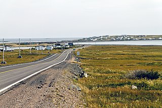
Division No. 1, Subdivision A is an unorganized subdivision on the Avalon Peninsula in Newfoundland and Labrador, Canada. It is in Division No. 1, and lies between Trinity Bay and Placentia Bay.

Lawn,, is a town located at the tip of the Burin Peninsula on Newfoundland's South coast, Newfoundland and Labrador. Lawn is spread around a small harbour in a relatively lush valley. According to one local tradition it was this lushness that inspired Captain James Cook to name the place Lawn Harbour. But it has also been speculated that a Frenchman named the community after a doe caribou that he spotted there.
The Burin Peninsula is a peninsula located on the south coast of the island of Newfoundland in the province of Newfoundland and Labrador. Marystown is the largest population centre on the peninsula.

Allan's Island, formerly Allan Island, is a Canadian fishing settlement in the Burin peninsula of the province of Newfoundland and Labrador. It is a part of the town of Lamaline.

Point May is the most southerly community on the Burin Peninsula in Newfoundland and Labrador with a population of 254 in 2021. It is a Catholic community with a church, town hall, fire hall, softball and soccer field. It is known for its close proximity, 19 km (12 mi), to the French islands of St. Pierre and Miquelon, where the smuggling of liquor and tobacco has been a way of life since before Canada was a country. The tiny Canadian Green Island lies 10 km (6 mi) west of Point May, roughly halfway to St. Pierre.
Little Burnt Bay is a small coastal community outside Embree and Lewisporte. In 2021, the population was 238, down 15.3 percent from 2016.

Lamaline is a town in the Canadian province of Newfoundland and Labrador. The town had a population of 480 in 1940, 643 in 1956 and 218 in the Canada 2021 Census. Lamaline was a small place with 10 families in 1864. The Way Office was established in 1863 and the first Waymaster was James Pittman.
Lord's Cove is a town in the Canadian province of Newfoundland and Labrador. The town had a population of 155 in the Canada 2021 Census. Lord's Cove has an inshore fishing history. The town is approximately 65 km southeast of Marystown.
Petley is a local service district and designated place in the Canadian province of Newfoundland and Labrador. It is east of Clarenville.
Philips Head, or Phillips Head, is a local service district and designated place in the Canadian province of Newfoundland and Labrador. It is in the north-central portion of the island of Newfoundland. It is in the Bay of Exploits, west of Lewisporte and north of Botwood.
Laurenceton is a local service district and designated place in the Canadian province of Newfoundland and Labrador. It is southwest of Lewisporte.
Little St. Lawrence is a local service district and designated place in the Canadian province of Newfoundland and Labrador.
Stanhope is a local service district and designated place in the Canadian province of Newfoundland and Labrador.
Snook's Arm is a designated place in the Canadian province of Newfoundland and Labrador. The community was entirely resettled in 2018.
Smith's Harbour is a local service district and designated place in the Canadian province of Newfoundland and Labrador.
St. Patricks is a local service district and designated place in the Canadian province of Newfoundland and Labrador.
St. Anthony Bight is a local service district and designated place in the Canadian province of Newfoundland and Labrador.
Norman's Bay is a local service district and designated place in the Canadian province of Newfoundland and Labrador. It is an isolated community at the head of Norman Bay, an extension of Martin Bay. The population of the community was 15 in the 2021 census.
Brown's Arm is a local service district and designated place in the Canadian province of Newfoundland and Labrador
Bay St. George South is a local service district and designated place in the Canadian province of Newfoundland and Labrador on the south coast of Bay St. George, a large bay on the west coast of the island of Newfoundland. Bay St. George South consists nine communities, namely Heatherton, Robinsons, Cartyville, McKay's, Jeffrey's, St. David's, St. Fintan's, Lock Leven en Highlands.


