
Nelson is a New Zealand city and unitary authority on the eastern shores of Tasman Bay at the top of the South Island. It is the oldest city in the South Island and the second-oldest settled city in New Zealand; it was established in 1841 and became a city by royal charter in 1858.

The Waitaki River is a large braided river in the South Island of New Zealand. It drains the Mackenzie Basin and runs 209 kilometres (130 mi) south-east to enter the Pacific Ocean between Timaru and Oamaru on the east coast. It starts at the confluence of the Ōhau and Tekapo rivers, now at the head of the artificial Lake Benmore, these rivers being fed by three large glacial lakes, Pukaki, Tekapo, and Ōhau at the base of the Southern Alps. The Waitaki flows through Lake Benmore, Lake Aviemore and Lake Waitaki, these lakes being contained by hydroelectric dams, Benmore Dam, Aviemore Dam and Waitaki Dam. The Waitaki has several tributaries, notably the Ahuriri River and the Hakataramea River. It passes Kurow and Glenavy before entering the Pacific Ocean. The River lends its name the Waitaki District on the south side of the river bank.

The Great Morava is the final section of the Morava, a major river system in Serbia.

Tasman Bay, originally known in English as Blind Bay, is a large V-shaped bay at the north end of New Zealand's South Island. Located in the centre of the island's northern coast, it stretches along 120 kilometres (75 mi) of coastline and is 70 kilometres (43 mi) across at its widest point. It is an arm of the Tasman Sea, lying on the western approach to Cook Strait.

The Rangitaiki River is the longest river in the Bay of Plenty region in New Zealand's North Island. It is 155 kilometres (96 mi) long, and rises inland from northern Hawkes Bay to the east of the Kaingaroa Forest. The Rangitaiki catchment covers an area of 3005 km2. It flows in a generally northeastward direction, passing through the town of Murupara and skirting close to the western edge of Te Urewera National Park before turning northwards, flowing past Edgecumbe and into the Bay of Plenty close to Thornton.

The Lepenac is a river in southern Kosovo and northern North Macedonia, a 75 km (47 mi) long left tributary to the Vardar river.

Somerfield is a suburb in the south of Christchurch, New Zealand. It is nominally bordered by the Ōpāwaho / Heathcote River to the south and west, Strickland and Colombo Streets to the east, and Milton Street to the north. The suburb includes Somerfield School, Somerfield Park and a small number of shops which service the local area, although it is predominantly residential. Somerfield is also known for its wide variety of trees, especially along the banks of the Ōpāwaho / Heathcote River.

Nelson City Council is a unitary local authority. It has its headquarters in Nelson.

State Highway 6 is a major New Zealand state highway. It extends from the Marlborough region in the northeastern corner of the South Island across the top of the island, then down the length of the island, initially along the West Coast and then across the Southern Alps through inland Otago and finally across the Southland Plains to the island's south coast. Distances are measured from north to south.

The Maitai River is the largest river in the city of Nelson, in the north of New Zealand's South Island. The river stretches from the Bryant Range, situated to the east (inland) of Nelson, where it flows towards the city, flowing west through the heart of the city and into the Tasman bay at Nelson Haven. The catchment of the river covers some 9000 hectares, and has two branches in the upper catchment, the north meets a dam, where the south travels west into the middle catchment, from where it takes its final journey through the urban area of the city before meeting the ocean.

Taylors Hill, is a volcano in the Auckland volcanic field. It erupted about 33,000 years ago. Its scoria cone reaches 57 m (187 ft) high.

Hadopyrgus ngataana is a tiny, transparent, and critically endangered freshwater snail, found only in a single stream in a cave in New Zealand.
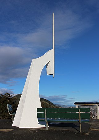
Maitai is an inner suburb of Nelson, New Zealand. It lies at the western edge of Nelson city centre, immediately to the south of The Wood, on the northern bank of the Maitai River. A monument representing the location of the geographic centre of New Zealand is located in Maitai.
Nelson East is an inner suburb of Nelson, New Zealand. As its name suggests, it lies to the east of Nelson city centre, along the banks of the Maitai River between the city centre and Maitai. Notable features of Nelson East include Queen's Gardens and the Nelson Marlborough Institute of Technology.
Sharland Creek flows south and joins Packer Creek before flowing into the Maitai / Mahitahi River near Waahi Takaaro Golf Course in Nelson, New Zealand. Sharland Creek takes its name from an early European landowner, James Henry Sharland, who bought land in the area now named Sharland Hill. The land remained in the family until 1969 when it was bought by the State Forest Service.
Brook Stream, or Waimarama, is a major tributary of the Maitai / Mahitahi River in Nelson, South Island, New Zealand.
Groom Creek, which flows northwards from Fringed Hill then past Tantragee Saddle, is a tributary of the Maitai / Mahitahi River in Nelson, South Island, New Zealand.
The Dun Mountain-Maitai Terrane comprises the Dun Mountain Ophiolite Belt, Maitai Group and Patuki Mélange. The Dun Mountain Ophiolite is an ophiolite of Permian age located in New Zealand's South Island. Prehistorically this ophiolite was quarried by Māori for both metasomatized argillite and pounamu (jade) which was used in the production of tools and jewellery.
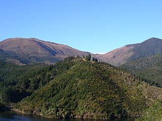
Dun Mountain is a mountain in the Richmond Range near the city of Nelson in the Tasman District of New Zealand's South Island. It is located between the catchments of the Pelorus, Maitai and Roding Rivers. The mountain is named for its brown (Dun) colour. The colour is caused by the ultramafic rock which forms the mountain. Ultramafic Rock weathers to this colour and plant growth is also stunted due to the soils high heavy metal content. The ultramafic rock formed in the Earth's mantle in the Permian and is now part of the Dun Mountain Ophiolite Belt.
