This is a list of the extreme points of Ireland – the points that are farthest north, south, east or west in Ireland. It includes the Republic of Ireland and Northern Ireland.

Cumberland Bay is a bay, 4 miles (6.4 km) wide at its entrance between Larsen Point and Barff Point, which separates into two extensive arms that recede inland 9 miles (14 km) along the northern coast of South Georgia. It was discovered and named in 1775 by a British expedition under James Cook.
Sappho Point is a headland which marks the west side of the entrance to Cumberland East Bay, on the north coast of South Georgia. Probably first sighted by the British expedition under Cook which explored the north coast of South Georgia in 1775. Named for HMS Sappho, British ship used in charting portions of Cumberland Bay in 1906.

Telefon Rocks is a group of rocks 1.5 miles (2.4 km) south-southwest of Demay Point, and just east of Telefon Point, at the west side of the entrance to Admiralty Bay, King George Island, in the South Shetland Islands. Named after the Telefon, a vessel which went aground and was abandoned there in 1908.

Telefon Bay is a small bay on the north-west coast of Port Foster, Deception Island, in the South Shetland Islands of Antarctica. It is surmounted by Telefon Ridge. The name appears on the chart of the French Antarctic Expedition under Charcot, 1908–10, and derives from the ship SS Telefon, which sat here awaiting repairs.
Niban Rock is a rock which protrudes into the sea 8 nautical miles (15 km) southwest of Cape Hinode, on the coast of Queen Maud Land. Mapped from surveys and air photos by Japanese Antarctic Research Expedition (JARE), 1957–62, and named Niban-iwa.

Jorum Glacier is a glacier draining the southeast slopes of Forbidden Plateau, and flowing east along the north side of Austa Ridge into Borima Bay southwest of Furen Point, on the east coast of Graham Land, Antarctica. It was surveyed by the Falkland Islands Dependencies Survey in 1947 and 1955. The UK Antarctic Place-Names Committee name alludes to the punchbowl shape of the head of the glacier, a "jorum" being a large drinking bowl used for punch.
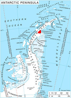
Tu Rocks is a two low rocks lying in Maxwell Bay 2 nautical miles (3.7 km) east of the southwest end of King George Island, in the South Shetland Islands. The name appears to have been given by DI personnel on the Discovery II who charted the rocks in 1935. Tu is apparently phonetic for two.

Polar Club Glacier is a broad glacier east-northeast of Stranger Point, King George Island, flowing south into Bransfield Strait. Named by the Polish Antarctic Expedition, 1980, after the Polish Polar Club.
Ecology Glacier is a glacier flowing northeast into Admiralty Bay, King George Island, north of Llano Point. It was named by the Polish Antarctic Expedition, 1980, after the Institute of Ecology of the Polish Academy of Sciences, the sponsor of nearby Arctowski Station.
Eddy Point is a small point located on the south side of Fildes Peninsula, 0.5 nautical miles (1 km) west of Halfthree Point on King George Island, in the South Shetland Islands. It was charted and named by Discovery Investigations personnel on the Discovery II in 1935. The feature is used as a reference point for locating the rocks which lie along the route of boats passing through Fildes Strait.
Pawson Peak is a solitary peak of irregular conical shape, rising to 250 m west-northwest of Sphinx Hill, Admiralty Bay, King George Island. Named in 1977 by the United Kingdom Antarctic Place-Names Committee (UK-APC) after Kenneth Pawson, Falkland Islands Dependencies Survey (FIDS) meteorological observer, Port Lockroy, 1947–48; general assistant, Admiralty Bay, 1948-50. The name "Czajkowski Needle" was applied to this feature by the Polish Antarctic Expedition, 1977–78, after Ryszard Czajkowski, a geophysicist with the expedition who climbed the peak.
Halfthree Point is a point forming the south-eastern end of Fildes Peninsula, King George Island, in the South Shetland Islands of Antarctica. It was charted and named by Discovery Investigations personnel on the Discovery II in 1935. It is part of the Fildes Peninsula Antarctic Specially Protected Area, designated as such because of its paleontological values.
Mirounga Point is the east entrance point to Potter Cove, King George Island, in the South Shetland Islands off Antarctica. The feature was called "Punta Baliza" by R. Araya and F. Herve in 1966. It was later called "Punta Elefante" by the Argentine Antarctic Expedition after the elephant seal, in connection with the establishment of Site of Special Scientific Interest number 13 in this vicinity under the Antarctic Treaty. The approved name avoids the duplication of Elephant Point on Livingston Island.
Melville Glacier is a glacier, 12 nautical miles (22 km) long, between Mapple Glacier and Pequod Glacier on the east coast of Graham Land, Antarctica. It flows eastwards between Stevrek Ridge and Parlichev Ridge in the Aristotle Mountains, to enter Domlyan Bay in the Weddell Sea. It was surveyed by the Falkland Islands Dependencies Survey in 1947 and 1955, and was named by the UK Antarctic Place-Names Committee after Herman Melville, the author of Moby-Dick. Several other features in the area are named after characters in the story.
Mathias Point is a point about 1.5 nautical miles (3 km) north of Allen Point, Montagu Island, in the South Sandwich Islands. It was named by the UK Antarctic Place-Names Committee for W.A. Mathias, Royal Navy, a pilot in HMS Protector's ship's flight during the survey of the South Sandwich Islands in 1964.
Mackellar Inlet is an inlet forming the northwestern head of Admiralty Bay, at King George Island in the South Shetland Islands. It was probably named by the Fourth French Antarctic Expedition under Jean-Baptiste Charcot, who charted Admiralty Bay in December 1909.

Rakusa Point is a point 0.5 nautical miles (0.9 km) southeast of Point Thomas, Admiralty Bay, on King George Island, South Shetland Islands. Named by the Polish Antarctic Expedition in 1977 after Stanislaw Rakusa-Suszczewski, who established Poland's Arctowski Station near this point, February 26, 1977.
Round Point is a point 22 km (14 mi) west of False Round Point on the north coast of King George Island, in the South Shetland Islands of Antarctica. Kellick Island lies 2 km to the north-east and Tartar Island 1 km to the north-west. The descriptive name dates back to at least 1822 and is established in international usage.


