Related Research Articles

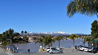
Lake Elsinore is a city in western Riverside County, California, United States. Established as a city in 1888, it is on the shore of Lake Elsinore, a natural freshwater lake about 3,000 acres (1,200 ha) in size. The city has grown from a small resort town in the late 19th and early 20th centuries to a suburban city with more than 60,000 residents.

Murrieta is a city in southwestern Riverside County, California, United States. The population of Murrieta was 103,466 in 2010. Murrieta experienced a 133.7% population increase between 2000 and 2010, according to the most recent census, making Murrieta one of the fastest-growing cities in the state. Largely residential in character, Murrieta is typically characterized as a bedroom community. Murrieta is bordered by the city of Temecula to the south, the cities of Menifee and Wildomar to the north, and the unincorporated community of French Valley to the east. Murrieta is located in the center of the Los Angeles-San Diego mega-region. Murrieta is named for Juan Murrieta, a Californio ranchero who founded the town.

Lake Elsinore is a natural freshwater lake in Riverside County, California, located east of the Santa Ana Mountains and fed by the San Jacinto River. Originally named Laguna Grande by Spanish explorers, it was renamed for the town of Elsinore, established on its northeastern shore on April 9, 1888.

The Santa Ana River is the largest river entirely within Southern California in the United States. It rises in the San Bernardino Mountains and flows for most of its length through San Bernardino and Riverside Counties, before cutting through the northern Santa Ana Mountains via Santa Ana Canyon and flowing southwest through urban Orange County to drain into the Pacific Ocean. The Santa Ana River is 96 miles (154 km) long, and its drainage basin is 2,650 square miles (6,900 km2) in size.
The Santa Margarita River which with the addition of what is now Temecula Creek, was formerly known as the Temecula River, is a short intermittent river on the Pacific coast of southern California in the United States, approximately 30.9 miles (49.7 km) long. One of the last free-flowing rivers in southern California, it drains an arid region at the southern end of the Santa Ana Mountains, in the Peninsular Ranges between Los Angeles and San Diego.

Skinner Reservoir, also known as Lake Skinner, is a reservoir in western Riverside County, California, located at the foot of Bachelor Mountain in the Auld Valley, approximately 10 miles (16 km) northeast of Temecula. It was created in 1973 by the construction of the Skinner Clearwell Dam on Tucalota Creek, and currently has a capacity of 44,200 acre feet (54,500,000 m3). Located north of Rancho California Road near the Temecula Valley Wine Country, The address of the reservoir is: 37701 Warren Road, Temecula, CA 92592.

The Temecula Valley is a graben rift valley in western Riverside County, California.
Temecula Creek, formerly known as the Temecula River, runs 32.6 miles (52.5 km) through southern Riverside County, California, United States, past the rural communities of Radec and Aguanga, and ending 0.5 miles (0.80 km) southeast of the original city center of Temecula. The creek is filled with boulders and is typically dry and sandy. It is a relatively undeveloped coastal-draining watershed. Until the 1920s, water flowed in Temecula Creek year-round.

French Valley is a region located in southwestern Riverside County, near the cities and communities of Hemet, Winchester, Murrieta, and Temecula in the state of California, United States. It is part of the Plains of Leon, contiguous with the Perris Plain, that drains into the Temecula Basin by means of tributaries of the Santa Margarita River.
Rancho La Laguna was a 13,339-acre (53.98 km2) Mexican land grant in present-day Riverside County, California given in 1844 by Governor Manuel Micheltorena to Julian Manriquez. The rancho lands are included in the present day city of Lake Elsinore and Wildomar. At the time of the US Patent, Rancho Laguna was a part of San Diego County. The County of Riverside was created by the California Legislature in 1893 by taking land from both San Bernardino and San Diego Counties.
Rancho Temecula was a 26,609-acre (107.68 km2) Mexican land grant in present-day Riverside County, California given on December 14, 1844 by Governor Manuel Micheltorena to Feliz Valdez. The grant extended south along the east bank Murrieta Creek to Temecula Creek and encompassed present-day Temecula, Murrieta and Murrieta Hot Springs. At the time of the US patent, Rancho Temecula was a part of San Diego County. Riverside County was created by the California Legislature in 1893 by taking land from both San Bernardino and San Diego Counties.
The Elsinore Mountains are a ridge of mountains within the larger range of the Santa Ana Mountains, in the Cleveland National Forest, Riverside County, California, United States. the tallest peaks within the range is the unofficially named San Mateo Peak at 3,591 ft (1,095 m). Second is officially named Elsinore Peak at 3,536 ft (1,078 m). The Elsinore Mountanins run in a ridge from just east of El Cariso, southeast to Elsinore Peak. Beyond that peak the ridge begins to descend and curves to the east. From Elsinore Peak, a ridge runs to the west and then northwest to San Mateo Peak, enclosing the Morrell Potrero on the south and west.
The Elsinore Trough is a graben rift valley in Riverside County, southern California. It is created by the Elsinore Fault Zone.
The Perris Block is the central block of three major fault-bounded blocks of the northern part of the Peninsular Ranges. The Perris Block lies between the Santa Ana Block to the west and the San Jacinto Block to the east. The Perris Block, was named by Walter A. English in 1925 for the city of Perris, located near the center of the block.

Warm Springs Creek is a stream or arroyo, and a tributary of Murrieta Creek, in Riverside County, Southern California.
Wolf Valley is a graben rift valley in the Elsinore Trough, in western Riverside County, California.
Willow Springs Station was a changing station at Alamos or Willow Springs along the Second Division route of the Butterfield Overland Mail, in what is now Murrieta, in Riverside County, California. It was also known as Alamos, Clines's or Kline's, or Willows, was one of the later Butterfield Overland Mail stations, placed in 1859, between some of the original stations for changing teams and providing water between stops in hot dry areas. Willow Springs, also originally known as Alamos Springs, was located west of the hills that line the east side of the Temecula Valley, on land of the Rancho Temecula, near Santa Gertrudis Creek on the low flood plain of Murrieta Creek, between Santa Gertrudis and Warm Springs Creek.
Linda Rosa, or Linda Rose, is a former populated place, formerly in San Diego County, now in Riverside County, California. The town site of Linda Rosa was located southwest of the old town of Murrieta, California on the west side of Murrieta Creek. Linda Rosa is a name derived from Spanish meaning "pretty rose".
Murrieta Creek runs 13 miles (21 km) southeasterly through southwestern Riverside County, California, United States, through the cities of Wildomar, Murrieta, and Temecula, ending 0.5 miles (0.80 km) southeast of the city center of Temecula, where it has its confluence with Temecula Creek and forms the head of the Santa Margarita River.
Borrego Valley Groundwater Basin, located in the very southern region of California, is one of the driest basins in the state. With climate change predicted to have strong effects into foreseeable future, the region is viewed with a skepticism in the sustainable use of water at current rates of consumption. Both natural and man-made geographic divisions within this basin allow for a closer inspection of the various management techniques implemented throughout the years, and provide a basis for what may be pursued for an uncertain future.
References
- ↑ John F. Mann, Geology of a Portion of the Elsinore Fault Zone, California, Special Report 43, Department of Resources, Division of Mines, San Francisco, October 1955.
- ↑ San Diego Region - The Basin Plan from waterboards.ca.gov accessed April 26, 2015
- ↑ Gerald A. Waring, UNITED STATES GEOLOGICAL SURVEY Water-Supply Paper 429, Ground Water In The San Jacinto And Temecula Basins, California, Government Printing Office, Washington, 1919
- 1 2 Experiment Station Record, Volume 41, United States. Office of Experiment Stations, United States Agricultural Research Service, U.S. Government Printing Office, 1920., p.785
| | This Riverside County, California-related article is a stub. You can help Wikipedia by expanding it. |