Related Research Articles

The Holy Grail is a treasure that serves as an important motif in Arthurian literature. Various traditions describe the Holy Grail as a cup, dish, or stone with miraculous healing powers, sometimes providing eternal youth or sustenance in infinite abundance, often guarded in the custody of the Fisher King and located in the hidden Grail castle. By analogy, any elusive object or goal of great significance may be perceived as a "holy grail" by those seeking such.

The zodiac is a belt-shaped region of the sky that extends approximately 8° north and south of the ecliptic, the apparent path of the Sun across the celestial sphere over the course of the year. Also within this zodiac belt appear the Moon and the brightest planets, along their orbital planes. The zodiac is divided along the ecliptic into 12 equal parts ("signs"), each occupying 30° of celestial longitude. These signs roughly correspond to the astronomical constellations with the following modern names: Aries, Taurus, Gemini, Cancer, Leo, Virgo, Libra, Scorpio, Sagittarius, Capricorn, Aquarius, and Pisces.

Glastonbury is a town and civil parish in Somerset, England, situated at a dry point on the low-lying Somerset Levels, 23 miles (37 km) south of Bristol. The town had a population of 8,932 in the 2011 census. Glastonbury is less than 1 mile (2 km) across the River Brue from Street, which is now larger than Glastonbury.

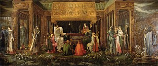
Avalon is a mythical island featured in the Arthurian legend. It first appeared in Geoffrey of Monmouth's 1136 Historia Regum Britanniae as a place of magic where King Arthur's sword Excalibur was made and later where Arthur was taken to recover from being gravely wounded at the Battle of Camlann. Since then, the island has become a symbol of Arthurian mythology, similar to Arthur's castle of Camelot.
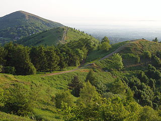
Glastonbury Tor is a tor near Glastonbury in the English county of Somerset, topped by the roofless St Michael's Tower, a Grade I listed building. The site is managed by the National Trust and has been designated a scheduled monument. The Tor is mentioned in Celtic mythology, particularly in myths linked to King Arthur, and has several other enduring mythological and spiritual associations.

Ley lines are straight alignments drawn between various historic structures, prehistoric sites and prominent landmarks. The idea was developed in early 20th-century Europe, with ley line believers arguing that these alignments were recognised by ancient societies that deliberately erected structures along them. Since the 1960s, members of the Earth Mysteries movement and other esoteric traditions have commonly believed that such ley lines demarcate "earth energies" and serve as guides for alien spacecraft. Archaeologists and scientists regard ley lines as an example of pseudoarchaeology and pseudoscience.

The Somerset Levels are a coastal plain and wetland area of Somerset, England, running south from the Mendips to the Blackdown Hills.

Glastonbury Abbey was a monastery in Glastonbury, Somerset, England. Its ruins, a grade I listed building and scheduled ancient monument, are open as a visitor attraction.
Geoffrey Thomas Leslie Ashe was a British cultural historian and lecturer, known for his focus on King Arthur.

A Glastonbury Romance was written by John Cowper Powys (1873–1963) in rural upstate New York and first published by Simon and Schuster in New York City in March 1932. An English edition published by John Lane followed in 1933. It has "nearly half-a-million words" and was described as "probably the longest undivided novel in English".

John Frederick Carden Michell was an English author and esotericist who was a prominent figure in the development of the pseudoscientific Earth mysteries movement. Over the course of his life he published over forty books on an array of different subjects, being a proponent of the Traditionalist school of esoteric thought.

Katharine Emma Maltwood was a writer and artist on the esoteric and occult. Throughout her childhood, she was reared to be an artist. Her parents were progressive, and they pushed each of their children equally to achieve their potential. In her formative years of art education, her artistic inclinations drew her into the fashionable Arts and Crafts Movement. Maltwood matriculated at the Slade School of Fine Art, University College, London (1896–97). Here, she studied sculpture.

In archaeology, earthworks are artificial changes in land level, typically made from piles of artificially placed or sculpted rocks and soil. Earthworks can themselves be archaeological features, or they can show features beneath the surface.

Burrow Mump is a hill and historic site overlooking Southlake Moor in the village of Burrowbridge within the English county of Somerset. It is a scheduled monument, with a never completed church on top of the hill a Grade II listed building.

Chilton Polden is a rural village and civil parish, situated close to Edington on the Somerset Levels to the north of the Polden Hills in Somerset, England.
A landscape zodiac is a purported map of the stars on a gigantic scale, formed by features in the landscape, such as roads, streams and field boundaries. Perhaps the best known alleged example is the Glastonbury Temple of the Stars, situated around Glastonbury in Somerset, England. The temple is thought by some to depict a colossal zodiac.

The sculptured Dendera zodiac is a widely known Egyptian bas-relief from the ceiling of the pronaos of a chapel dedicated to Osiris in the Hathor temple at Dendera, containing images of Taurus and Libra. This chapel was begun in the late Ptolemaic period; its pronaos was added by the emperor Tiberius. This led Jean-François Champollion to date the relief to the Greco-Roman period, but most of his contemporaries believed it to be of the New Kingdom.

Brent Knoll Camp is an Iron Age hillfort at Brent Knoll, 3 kilometres (1.9 mi) from Burnham-on-Sea, Somerset, England. It has been designated as a Scheduled Monument, and is now in the care of the National Trust.

Ponter's Ball Dyke is a linear earthwork located near Glastonbury in Somerset, England. It crosses, at right angles, an ancient road that continues on to the former island of dry land in the Somerset levels surrounding Glastonbury Tor. It consists of an embankment with a ditch on the east side. It is built across the ridge of land between Glastonbury and West Pennard. Both ends of the ditch and dyke disappear into moorland, formerly swamps.

Chilton Priory (ST373389) is a Grade 2 listed folly, later extended to become a country house prominently located on Polden Hill, overlooking Bath Road, close to Chilton Polden, Parish of Polden Wheel, Somerset. The tower was erected in 1838 for William Stradling, deputy lieutenant of Somerset and a descendant of the local Stradling family who date back to the fourteenth century. The building commands extensive views over Somerset, including Glastonbury Tor. The first Ordnance Survey in 1886 recorded the tower and pleasure grounds as 'Chilton Priory (Museum).'
References
- ↑ Maltwood, K. E. A Guide to Glastonbury’s Temple of the Stars: Their Giant Effigies Described From Air Views, Maps, and From "The High History of the Holy Grail" (London, The Women’s Printing Society, Ltd., 1934). Her next book on the subject matter, Air View Supplement To A Guide To Glastonbury’s Temple of The Stars was published in 1937.
- ↑ "Glastonbury Zodiac, Mary Caine, Gandalf's Garden".
- ↑ Ian Burrow, Somerset’s Planning Department staff archeologist, concluded that "while the outlines of the effigies may be plotted today, their antiquity is illusory"
- ↑ Tom Williamson, Liz Bellamy, Ley Lines In Question, pages 162-168. (Tadworth, UK: World's Work, 1983). ISBN 0-437-19205-9
- ↑ Geoffrey Ashe, Avalonian Quest (London: Methuen in association with Fontana Paperbacks, 1982). ISBN 0-413-48800-4
- ↑ Rahtz, Phillip; Watts, Lorna (2003). Glastonbury Myth and archaeology. Stroud: Tempus. pp. 65–66. ISBN 978-0752425481.