
Seán O'Casey Bridge is a pedestrian swingbridge spanning the River Liffey in Dublin, joining City Quay in the Grand Canal Docks area to North Wall Quay and the IFSC.

Scotshouse (Irish: Teach an Scotaigh is a small agricultural village about 7 kilometres from the border town of Clones, in County Monaghan, Ireland. It is close to the border with both County Cavan and County Fermanagh. Cavan town is 18 km away and Monaghan town is 27 km away from Scotshouse.

Brosna is a village and parish situated in the Sliabh Luachra area of County Kerry, Ireland. It lies 16 km (9.9 mi) from the town of Castleisland. The civil parish of Brosna consists of the village and a number of townlands. It is a mainly agricultural area, supporting two churches, two schools, a post office, and five public houses.

Cloghduv or Cloghduff is a village in County Cork, Ireland. It has a population of over 300 people. The main industry is agriculture, although it is also a commuter village for Cork City. Cloughduv is part of the Cork North-West.

Adamstown is a village in County Wexford, Ireland. It is about 24 km (15 mi) north-west of Wexford, 20 km (12 mi) east of New Ross, and 20 km (12 mi) south-west of Enniscorthy.

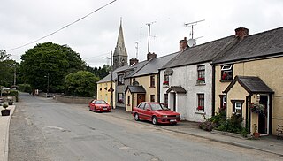
Crecora is a village in County Limerick, Ireland, located approximately 8 miles (13 km) from Limerick city.

Rhode is a village in County Offaly, Ireland. It is situated on the R400 at its junction with the R441 which leads to Edenderry, 12 km to the east. Rhode village is on an "island" of high ground surrounded by an expanse of raised bog which forms part of the Bog of Allen.
Kilanerin or Killinierin is a village in north County Wexford, Ireland, 4 kilometres west of the N11 road, near the village of Inch and approximately 12 kilometres from the town of Gorey.

Cloonfad is a village in County Roscommon, Ireland, at the crossroads of the N83 National secondary road and the R327 regional road, about 10 km from the town of Ballyhaunis in County Mayo. A public walkway takes walkers to neighbouring villages through surrounding moorland. This habitat gave rise to the village's name in Irish - Cluain Fada or "Long Meadow". Cloonfad's local church, the Church of Saint Patrick, has been publishing an annual parish magazine since 1992 "The Cloonfad Magazine".
Killenaule is a small town and civil parish in County Tipperary, Ireland. It is part of the ecclesiastical parish of Killenaule and Moyglass, in the Roman Catholic Archdiocese of Cashel and Emly, and the barony of Slievardagh. It is 19 km (12 mi) east of Cashel on the R689 and R691 roads, at the south-western edge of the Slieveardagh Hills.

Ardagh is a civil parish and townland in County Mayo, located slightly to the southwest of Ballina.

Cogaula is a townland in the civil parish of Islandeady, County Mayo, Ireland. The townland has an area of approximately 1.5 square kilometres (0.6 sq mi), and had a population of 74 people as of the 2011 census.

Knockavilla is a small village in County Cork, Ireland, a few of kilometres from Crossbarry and Innishannon. The local Roman Catholic church is dedicated to Saint Patrick. There is also a school, a pub, a graveyard, and a community hall. Knockavilla Celtic is the local association football club.

St. Dairbhile's Church is a medieval church and National Monument in County Mayo, Ireland.
Kilcullane is a civil parish and townland located in County Limerick, Ireland. The civil parish is in the barony of Smallcounty. It is located in east County Limerick near the village of Bruff. The north-eastern part of the parish borders the parish of Ballinard.
Kilbeacon is a civil parish in the ancient barony of Knocktopher. It is located in the south of County Kilkenny, Ireland and is around 22 miles (35 km) south of the city of Kilkenny on the road to Waterford. The parish contains 3,151 statute acres. According to Lewis's survey of 1837, "At Earlsrath was a large fort, encompassed by a fosse and a bank about 20 feet high.". In 1833, there were 383 inhabited houses in the parish; of these, 270 families were primarily engaged in agriculture, 61 in manufactures or crafts, 52 in other. The total population was 2284 people.
Castleknock is a civil parish and a townland located in the south-western corner of the modern county of Fingal, Ireland. The civil parish is part of the ancient barony of Castleknock. It is centred on the suburban village of Castleknock. The townland of Castleknock itself is the location of the eponymous "Cnucha's Castle" - Castleknock Castle. The town with the biggest population in the parish is Blanchardstown. In geology, the parish rests on a substratum of limestone and comprises 2943 statute acres, the whole of which is arable land.
Lexilip is a civil parish and a townland located in the north-eastern corner of County Kildare, Ireland. The civil parish is mainly in the ancient barony of Salt North with a small part in the neighbouring barony of Newcastle. It is centred on the town of Leixlip. In geology, the parish rests on a substratum of limestone, and contains chalybeate springs. It lies at the confluence of the River Liffey and the Rye Water.

Curry is a village and townland in County Sligo, Ireland. The townland has an area of approximately 3.9 square kilometres (1.5 sq mi), and had a population of 148 people as of the 2011 census.
