
Guam is an organized, unincorporated territory of the United States in Micronesia in the western Pacific Ocean. It is the westernmost point and territory of the United States. The capital city of Guam is Hagåtña, and the most populous city is Dededo. Guam has been a member of the Pacific Community since 1983. The inhabitants of Guam are American citizens by birth. The indigenous Guamanians are the Chamorros, who are related to other Austronesian peoples of Indonesia, the Philippines, Taiwan, Micronesia, and Polynesia.

Hagåtña is the capital village of the United States territory of Guam. From the 18th through mid-20th century, it was Guam's population center, but today it is the second smallest of the island's 19 villages in both area and population. However, it remains one of the island's major commercial districts in addition to being the seat of government.

Tenjho Tenge, also written as Tenjo Tenge, is a Japanese manga series written and illustrated by Oh! great. The story primarily focuses on the members of the Juken Club and their opposition, the Executive Council, which is the ruling student body of a high school that educates its students in the art of combat. As the story unfolds, both groups become increasingly involved with an ongoing battle that has been left unresolved for four hundred years. Tenjho Tenge was serialized in the magazine Ultra Jump from 1997 to 2010, and collected into 22 volumes by Shueisha.

The 77th Sustainment Brigade is a unit of the United States Army that inherited the lineage of the 77th Infantry Division, which served in World War I and World War II. Its headquarters has been at Fort Dix, New Jersey, since its predecessor command, the 77th Regional Readiness Command, was disestablished in 2008 from Fort Totten, in Bayside (Queens), New York. Soldiers from the 77th have served in most major conflict and contingency operations since World War II.

Yona is a village in the United States territory of Guam.

Chía is a town and municipality in the Cundinamarca department of Colombia, located to the north of Bogotá on the main road to Zipaquira. Its history dates back to the pre-Columbian era.

Funza is a municipality and town of Colombia in the Western Savanna Province, of the department of Cundinamarca. Funza is situated on the Bogotá savanna, the southwestern part of the Altiplano Cundiboyacense with the urban centre at an altitude of 2,548 metres (8,360 ft). In Funza the La Florida wetland, part of the wetlands of Bogotá, remains to exist, a remnant of the Pleistocene Lake Humboldt. The town is part of the Metropolitan Area of Bogotá and borders Madrid and Tenjo in the north, Mosquera in the south, Madrid in the west and Cota and the locality Engativá of the capital Bogotá in the east. The eastern boundary is formed by the Bogotá River. Funza is the site of the former main settlement Bacatá of the Muisca Confederation. Modern Funza was founded by Gonzalo Jiménez de Quesada during the Spanish conquest of the Muisca on April 20, 1537.

Tenjo is a municipality and town of Colombia in the Central Savanna Province, part of the department of Cundinamarca. The urban centre is located at an altitude of 2,587 metres (8,488 ft) on the Bogotá savanna. Tenjo is part of the Metropolitan Area of Bogotá and borders Chía, Madrid, Tabio, Funza, Subachoque and Cota.

Metropolitan Area of Bogotá is the metropolitan area of the Colombian capital city of Bogotá, usually used for statistical analysis or technical use.

The Tenjō-Yama Park Mt. Kachi Kachi Ropeway, officially the Lake Kawaguchi Mt. Tenjō Ropeway, is a Japanese aerial lift line in Fujikawaguchiko, Yamanashi, operated by Fuji Kyuko. Opened in 1959, the line climbs Mount Tenjō from the shores of Lake Kawaguchi, one of the Fuji Five Lakes. The line name comes from Kachi-kachi Yama, a folktale which took place on the mountain. The observatory has a view of the lake, as well as Aokigahara forest, and Mount Fuji.

The following is an alphabetical list of articles related to the United States Territory of Guam.
The Ramu languages are a family of some thirty languages of Northern Papua New Guinea. They were identified as a family by John Z'graggen in 1971 and linked with the Sepik languages by Donald Laycock two years later. Malcolm Ross (2005) classifies them as one branch of a Ramu – Lower Sepik language family. Z'graggen had included the Yuat languages, but that now seems doubtful.

Kōzushima Airport is a regional airport serving Kōzushima in the northern Izu Islands, Tokyo, Japan. Operated by the Tokyo government, it is located 1.7 NM south of the Kōzushima village office. It began operations in July 1992.

Iro ni Ide ni Keri Waga Koi wa, abbreviated as Denikeri (でにけり), is a Japanese adult visual novel developed and published by Windmill for Windows. It was released on April 29, 2010. Denikeri is Windmill's eleventh game, along with other titles like Happiness! and Shukufuku no Campanella. The game bears the tagline of "my deep love shows in the blush of my face".

The Scuttling of SMS Cormoran off Guam on April 7, 1917 was the result of the United States entry into World War I and the internment of the German merchant raider SMS Cormoran. The incident was the only hostile encounter between United States and German military forces during the Pacific Ocean campaign of the war.
The Tamolan languages are a small family of clearly related languages spoken in the region of the Guam River in Madang Province, Papua New Guinea.
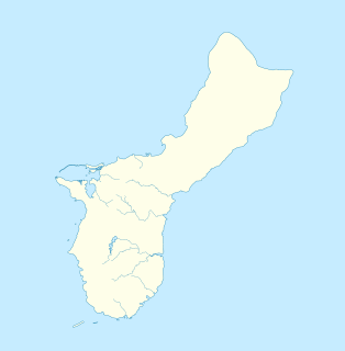
The Mount Tenjo Fortifications are a historic defensive gun battery site on Mount Tenjo, a hill overlooking Apra Harbor, the principal deep-water port on the island of Guam. The site includes concrete mounting pads for seven guns and the crumbling remains of a concrete command post structure. These facilities are located just below the crest of the hill on its west side. A defensive trench also extends along the top of the plateau-like hill. Unlike most early 20th-century fortifications on Guam, these facilities were built in the late 1910s by the United States Navy, and not by Japanese forces during the World War II occupation period. These are the only known surviving pre-World War II defensive fortification sites on the island. They were functionally abandoned as a result of the 1922 Washington Naval Conference. Mount Tenjo was the site of battle during the 1944 liberation of Guam.
The geology of Guam formed as a result of mafic, felsic and intermediate composition volcanic rocks erupting below the ocean, building up the base of the island in the Eocene, between 33.9 and 56 million years ago. The island emerged above the water in the Eocene, although the volcanic crater collapsed. A second volcanic crater formed on the south of the island in the Oligocene and Miocene. In the shallow water, numerous limestone formations took shape, with thick alternating layers of volcanic material. The second crater collapsed and Guam went through a period in which it was almost entirely submerged, resembling a swampy atoll, until structural deformation slowly uplifted different parts of the island to their present topography. The process of uplift led to widespread erosion and clay formation, as well as the deposition of different types of limestone, reflecting different water depths.

The Guam River is a river in northern Papua New Guinea.
