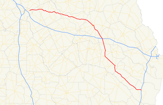
U.S. Route 1 (US 1) in the U.S. state of Georgia, which is concurrent for almost its entire length with State Route 4 (SR 4), is a highway traversing south-to-north through portions of Charlton, Ware, Bacon, Appling, Toombs, Emanuel, Jefferson, and Richmond counties in the southeastern and east-central parts of the state. In Georgia, the highway originates at US 1/US 23/US 301/SR 15 at the St. Marys River and the Florida state line, where SR 4 and SR 15 reach their southern terminus. It travels to its northern terminus at US 1/US 25/US 78/US 278/SC 121 at the Savannah River and the South Carolina state line in Augusta. Here, SR 10 reaches its eastern terminus, and SR 121 reaches its northern terminus.

State Route 4 (SR 4) is a state highway in the eastern part of the U.S. state of Georgia. Except for its northernmost portion, it is completely concurrent for its entire length with U.S. Route 1 (US 1). It traverses south-to-north through portions of Charlton, Ware, Bacon, Appling, Toombs, Emanuel, Jefferson, and Richmond counties in the southeastern and east-central parts of the state. The highway begins at the Florida state line, on US 1/US 23/US 301/SR 15 at the St. Marys River, where SR 15 also reaches its southern terminus. It travels to its northern terminus at the South Carolina state line, on the Augusta–North Augusta, South Carolina city line, on US 25 Business at the Savannah River.
U.S. Highway 1 (US 1) in Florida runs 545 miles (877 km) along the state's east coast– from Key West to its crossing of the St. Marys River into Georgia north of Boulogne –and south of Folkston. US 1 was designated through Florida when the United States Numbered Highway System was established in 1926. The road is maintained by the Florida Department of Transportation (FDOT).
State Route 82 (SR 82) is a primary state highway in central Russell County, Virginia, United States. Known as Cleveland Road for most of its length, the route runs 6.84 miles (11.01 km) from SR 600 (SR 600) and SR 661 (SR 661) in Cleveland to U.S. Route 19 Business in Lebanon, providing a mountain crossing connecting the two towns.
State Route 58, also locally called "Highway 58", is a north–south state highway in the U.S. state of Tennessee that serves as a major route for many communities in Roane, Meigs, and Hamilton counties.
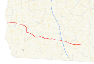
State Route 37 (SR 37) is a 153.6-mile-long (247.2 km) state highway that travels west-to-east through portions of Clay, Calhoun, Baker, Mitchell, Colquitt, Cook, Berrien, Lanier, and Clinch counties in the southwestern and south-central parts of the U.S. state of Georgia. The highway connects the Alabama state line west of Fort Gaines to the Homerville area, via Newton, Camilla, Moultrie, Adel, and Lakeland. The highway actually serves as the eastern terminus of a long multi-state route that starts in Mississippi and goes through Alabama.
State Route 266 (SR 266) is a 14-mile-long (23 km) east–west state highway located in the southeastern portion of Ohio. SR 266's western terminus is at an intersection with SR 377 nearly 3 1⁄2 miles (5.6 km) northwest of Stockport, and its eastern terminus is an intersection with SR 60 approximately 4 1⁄2 miles (7.2 km) northwest of Beverly.

State Route 46 (SR 46) is a 96.5-mile-long (155.3 km) state highway that travels west-to-east through portions of Dodge, Laurens, Wheeler, Treutlen, Emanuel, Candler, and Bulloch counties in the central part of the U.S. state of Georgia. The highway connects the Eastman area with the south-central part of Bulloch County. The highway closely parallels Interstate 16 (I-16) and serves local traffic.
State Route 57 (SR 57) is a 178.5-mile-long (287.3 km) state highway that travels northwest-to-southeast through portions of Bibb, Jones, Twiggs, Wilkinson, Washington, Johnson, Emanuel, Candler, Tattnall, Long, and McIntosh counties in the central and southeastern parts of the U.S. state of Georgia. The route connects the eastern part of the Macon area to the Eulonia area, via Swainsboro.

State Route 684 is a short north–south state highway in the southern portion of Ohio. Its southern terminus is at State Route 143 in the unincorporated community of Harrisonville, and its northern terminus is at State Route 681 near the community of Pageville.
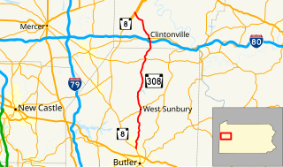
Pennsylvania Route 308 is a 28.5-mile-long (45.9 km) state highway located in Butler and Venango Counties in Pennsylvania. The southern terminus is at PA 8 near Butler. The northern terminus is at PA SR 3013 just north of the PA 8 junction in Pearl.

State Route 692 was a short north–south state route in southern Ohio that was located entirely within Meigs County. The southern terminus of SR 692 was at SR 143 approximately three miles (4.8 km) northwest of the hamlet of Harrisonville. Its northern terminus was at SR 681 near the hamlet of Pageville. In 2013, the Ohio Department of Transportation (ODOT) removed SR 692 from the state highway system by making the route north of Pageville an extension of SR 684 and the remainder being transferred to Meigs County's jurisdiction.
State Route 60 is a north-south major state route in Eastern Tennessee. It covers 54 miles (87 km) and runs from the Tennessee-Georgia state line in Bradley County to Dayton joining US 27.
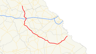
State Route 80 (SR 80) is an 84.0-mile-long (135.2 km) state highway that predominantly travels in a west–east direction in the east-central part of the U.S. state of Georgia. It exists within portions of Wilkes, Warren, Glascock, Jefferson, and Burke counties. It connects the Washington area with the northern part of Burke County, via Warrenton, Wrens, and Waynesboro.

State Route 733 is a state highway in south-central Meigs County, Ohio. At a length of 2.24 miles (3.60 km) long, the route acts as a connector from State Routes 124 and 833 in the north-easternmost extents of Pomeroy to an interchange with US 33 and SR 7 near the unincorporated community of Five Points within Salisbury Township. The road itself is the former routing of SR 7 before it was moved onto an expressway; following 15 years of county maintenance and control as Meigs County Road 7A, this segment of road assumed state jurisdiction again in late 2013.
State Route 74 (SR 74) is a north–south state highway located primarily in Bradley County, Tennessee. It runs from the Georgia state line to downtown Cleveland. The route serves as a major shortcut, along with SR 60, for Cleveland citizens to commute to Atlanta, Georgia.
State Route 308 is a secondary state route located in northern Bradley County, Tennessee that serves the city of Charleston. The route is 7.5 miles (12.1 km) long and is located entirely in Bradley County.
State Route 312 (SR 312) is a secondary state route in Hamilton and Bradley counties in the US state of Tennessee that runs from Birchwood to Cleveland. The route runs east and west, however, much of the route in Hamilton County runs north and south.
State Route 313 is a secondary state highway mostly in Bradley County but also in Polk County. Although it is signed as an east-west highway, it actually runs diagonally on a northwest-southeast axis.
State Route 163 is an east-west state highway in McMinn and Polk counties of East Tennessee. It connects Calhoun and Delano, along with serving as the main access road between Interstate 75 (I-75) and Calhoun.
