
U.S. Route 43 (US 43) is a 410-mile-long (660 km) north–south United States Highway in the Southern states of Alabama and Tennessee. It travels from Prichard, Alabama, to Columbia, Tennessee. The highway's southern terminus is in Prichard, at an intersection with US 90, and its northern terminus is in Columbia at an intersection with US 31/US 412/US 412 Bus.

U.S. Route 411 (US 411) is an alternate parallel-highway associated with US 11. It extends for about 309.7 miles (498.4 km) from US 78 in Leeds, Alabama, to US 25W/US 70 in Newport, Tennessee. US 411 travels through northeastern Alabama, northwestern Georgia, and southeastern Tennessee. It is signed north-south, as with most highways that have odd numbers, but the route runs primarily in a northeast-southwest direction, and covers a more east-west mileage than it does north-south. Notable towns and cities along its route include Gadsden, Alabama; Rome, Georgia; Cartersville, Georgia; Maryville, Tennessee; Sevierville, Tennessee, and Newport, Tennessee.

State Route 91 is a primary state highway in the U.S. state of Virginia. The state highway runs 55.12 miles (88.71 km) from the Tennessee state line near Damascus, where the highway continues as Tennessee State Route 91, north to U.S. Route 19 Business and US 460 Business at Frog Level. SR 91 connects Damascus in southeastern Washington County with the northeastern county town Glade Spring, where the highway has junctions with US 11 and Interstate 81 (I-81). The state highway also indirectly connects Saltville in northwestern Smyth County and Tazewell, the county seat of Tazewell County. SR 91 is the only primary state highway in Virginia with an unpaved section; this gravel section is in southern Tazewell County.

U.S. Route 221 (US 221) is a part of the U.S. Highway System that runs from Perry, Florida to Lynchburg, Virginia. In Virginia, the U.S. Highway runs 149.61 miles (240.77 km) from the North Carolina state line near Independence north to its northern terminus at US 29 Business, US 460 Business, and US 501 Business in Lynchburg. US 221 connects Independence, Galax, and Hillsville in Southwest Virginia while running concurrently with US 58. The U.S. Highway connects those communities with Roanoke via Floyd County, within which US 221 is the main east–west highway. Entering Bedford County, US 221 exits the Blue Ridge Mountains; it then passes through the Piedmont town of Bedford on its way to Lynchburg and shares a brief overlap with US 460 Business through the town. The U.S. Highway also runs concurrently with US 460 from Roanoke to Bedford and parallels that U.S. Highway from Bedford to Lynchburg.

Delaware Route 24 (DE 24) is a state highway located in Sussex County, Delaware. The route runs from Maryland Route 348 (MD 348) at the Maryland border east of Sharptown, Maryland, east to an intersection with DE 1 in Midway, between Lewes and Rehoboth Beach. Along the way, DE 24 passes through Laurel, Millsboro, and Long Neck. DE 24 intersects U.S. Route 13 (US 13) in Laurel, US 113/DE 20 and DE 30 in Millsboro, and DE 5 and DE 23 in Long Neck. DE 24 features an alternate route, DE 24 Alternate, that runs to the north of the route from US 113 in Stockley to DE 24 near Midway. DE 24 was built as a state highway throughout the 1920s, with completion of the entire route by 1931. DE 24 was assigned onto its current alignment by 1936. DE 24 Alt. was designated by 2006.

State Route 14 is a south–north route from the Mississippi border in Memphis, Tennessee to an intersection with State Route 54 in Tipton County.

Pennsylvania Route 271 is a north–south state route located in Western Pennsylvania. Its southern terminus is at PA 711 in Oak Grove in Ligonier Township, and its northern terminus is at U.S. Route 219 (US 219) in Northern Cambria. The route was designated on May 27, 1935 in coordination with the release of a new state road map.

State Route 62 is a 87.5-mile-long (140.8 km) west-to-east highway in the U.S. state of Tennessee. It is designated as a primary route except for the short segment between SR 169 and its eastern terminus, which is secondary.

State Route 131 is a south-to-north highway in the U.S. state of Tennessee that is 68.8 miles long. It is designated as a secondary route.

State Route 61 is a west-to-east highway in the U.S. state of Tennessee that is 81.67-mile-long (131.44 km). State Route 61 begins in Roane County, and it ends in Grainger County.

State Route 116 is a 41.97-mile-long (67.54 km) north–south state highway in the mountains of East Tennessee. The highway runs from its junction with SR 62 at its southern end between Wartburg and Coalfield in Morgan County, to its northern end at Caryville, Tennessee in Campbell County.
U.S. Route 221 (US 221) in the U.S. state of Georgia is a south–north U.S. Highway. It travels from the Florida border near the Quitman area to the South Carolina state line, north of Pollards Corner. The highway connects North Central Florida with Upstate South Carolina.

U.S. Route 441 stretches for 83.28 miles (134.03 km) through the mountains of East Tennessee, connecting Rocky Top with Knoxville, Sevierville, Gatlinburg, and the Great Smoky Mountains National Park, crossing into North Carolina at Newfound Gap. Near its northern terminus, US 441 crosses over Norris Dam and passes through Norris Dam State Park.

State Route 70 is a state-maintained highway in East Tennessee, beginning at the border with North Carolina in the midst of the Cherokee National Forest and the Great Smoky Mountains and ending at the Virginia border in the extremely rural and mountainous terrain of Hancock County.

State Route 107 is a 78.77-mile (126.77 km) state highway in eastern Tennessee, United States. It begins at an intersection with Round Mountain Road south of Del Rio and ends at the North Carolina state line east of Unicoi, where it becomes NC 226.

State Route 55 is an east–west highway in Middle Tennessee. The road begins at SR 50 in Lynchburg and ends at U.S. Route 70S and SR 380 in McMinnville. The current length is 49.3 mi (79.3 km). SR 55 heads northeast from Lynchburg to Tullahoma as a two-lane road. In Tullahoma, the route runs concurrent with US 41A. From here, SR 55 heads northeast as a multilane highway to Manchester, where it intersects US 41 and Interstate 24 (I-24). The route continues northeast, serving Summitville and Morrison before it reaches McMinnville.
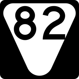
State Route 82 is a secondary state highway that runs through Moore and Bedford counties in south central Tennessee in the United States. The route runs from an intersection with SR 55 in Lynchburg north and east to SR 64 near Beech Grove.

State Route 35 is a north–south state highway in East Tennessee. The 81.35 miles (130.92 km) long state highway traverses Blount, Sevier, a small portion of Jefferson, Cocke, and Greene Counties. Most of the route is a secret, or hidden designation, as it runs concurrently with U.S. Highways in the area.
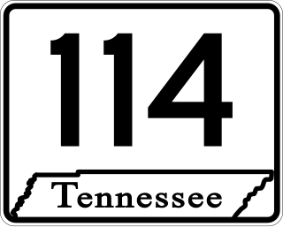
State Route 114 is a north–south state highway that traverses six counties in the western grand division of Tennessee. The 96.49-mile-long (155.29 km) route travels from Clifton Junction to an area south of Paris via Scotts Hill, Lexington, and the Natchez Trace State Park.
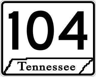
State Route 104 is a 114.43-mile-long east–west state highway in West Tennessee.

