
The Au Sable River in Michigan, United States runs approximately 138 miles (222 km) through the northern Lower Peninsula, through the towns of Grayling and Mio, and enters Lake Huron at the town of Oscoda. It is considered one of the best brown trout fisheries east of the Rockies and has been designated a blue ribbon trout stream by the Michigan Department of Natural Resources. A map from 1795 located in the United States Gazetteer calls it the Beauais River. In French, the river is called the Rivière au sable, literally "Sand River".

Ten Sleep is a town in Washakie County, Wyoming, United States. It is located in the Bighorn Basin in the western foothills of the Bighorn Mountains, approximately 26 miles (42 km) east of Worland and 59 miles (95 km) west of Buffalo.

The Bridger Mountains are a short subrange of the Rocky Mountains, approximately 40 miles (64 km) long, in central Wyoming in the United States. The range forms a bridge between the Owl Creek Mountains to the west and the southern end of the Bighorn Mountains to the east. The Wind River passes through the gap between the range and the Owl Creek Mountains. Bridger Creek passes through the gap between the range and the Bighorns. The highest point in the range is Copper Mountain at 8,300 feet (2,500 m).

The Bighorn Basin is a plateau region and intermontane basin, approximately 100 miles (160 km) wide, in north-central Wyoming in the United States. It is bounded by the Absaroka Range on the west, the Pryor Mountains on the north, the Bighorn Mountains on the east, and the Owl Creek Mountains and Bridger Mountains on the south. It is drained to the north by tributaries of the Bighorn River, which enters the basin from the south, through a gap between the Owl Creek and Bridger Mountains, as the Wind River, and becomes the Bighorn as it enters the basin. The region is semi-arid, receiving only 6–10 in (15–25 cm) of rain annually.

The Guyandotte River is a tributary of the Ohio River, approximately 166 mi (267 km) long, in southwestern West Virginia in the United States. It was named after the French term for the Wendat Native Americans. It drains an area of the unglaciated Allegheny Plateau south of the Ohio between the watersheds of the Kanawha River to the northeast and Twelvepole Creek and the Big Sandy River to the southwest. Via the Ohio River, it is part of the Mississippi River watershed.

The Great Divide Basin or Great Divide Closed Basin is an area of land in the Red Desert of Wyoming where none of the water falling as rain to the ground drains into any ocean, directly or indirectly. It is thus an endorheic basin, one of several in North America that adjoin the Continental Divide. To the south and west of the basin is the Green River watershed, draining to the Gulf of California/Pacific Ocean; to the north and east is the North Platte watershed, draining to the Gulf of Mexico/Atlantic Ocean. The basin is very roughly rectangular in shape; the northwest corner is at Oregon Buttes near South Pass, about 40 miles (64 km) southwest of Lander, and the southeast corner is in the Sierra Madre Range near Bridger Pass, about 20 miles (32 km) southwest of Rawlins.

Pine River may refer to any of the following rivers in the U.S. state of Michigan:
Meshoppen Creek is a tributary of the Susquehanna River in Susquehanna and Wyoming counties, Pennsylvania, in the United States. It is approximately 30.6 miles (49.2 km) long and flows through Bridgewater Township, Dimock Township, and Springville Township in Susquehanna County and Lemon Township, Washington Township, Meshoppen Township, and Meshoppen in Wyoming County. The watershed of the creek has an area of 114 square miles (300 km2). It is possible to canoe on 17.0 miles (27.4 km) of Meshoppen Creek.

Beaver River is a large river in east-central Alberta and central Saskatchewan, Canada. It flows east through Alberta and Saskatchewan and then turns sharply north to flow into Lac Île-à-la-Crosse on the Churchill River which flows into Hudson Bay.

Mehoopany Creek is a tributary of the Susquehanna River in Sullivan and Wyoming counties, Pennsylvania, in the United States. It is approximately 26.8 miles (43.1 km) long. In Sullivan County the creek flows through Colley Township and in Wyoming County it flows through Forkston Township and Mehoopany Township. The stream's watershed has an area of 123 square miles (320 km2). Its major tributaries include Stony Brook and North Fork Mehoopany Creek.

The Bridger Trail, also known as the Bridger Road and Bridger Immigrant Road, was an overland route connecting the Oregon Trail to the gold fields of Montana. Gold was discovered in Virginia City, Montana in 1863, prompting settlers and prospectors to find a trail to travel from central Wyoming to Montana. In 1863, John Bozeman and John Jacobs scouted the Bozeman Trail, which was a direct route to the Montana gold fields through the Powder River Country. At the time the region was controlled by the Sioux, Cheyenne and Arapaho, who stepped up their raids in response to the stream of settlers along the trail.

The Grand Loop Road is a historic district which encompasses the primary road system in Yellowstone National Park. Much of the 140-mile (230 km) system was originally planned by Captain Hiram M. Chittenden of the US Army Corps of Engineers in the early days of the park, when it was under military administration. The Grand Loop Road provides access to the major features of the park, including the Upper, Midway and Lower geyser basins, Mammoth Hot Springs, Tower Fall, the Grand Canyon of the Yellowstone and Yellowstone Lake.

Sand Creek is a stream noted for the "most spectacular examples of cross-bedded sandstone and topple blocks in North America". Sand Creek flows from the Laramie Mountains in Larimer County, Colorado into Albany County, Wyoming where it joins the Laramie River.
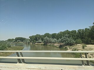
The Nowood River is a river in the U.S. state of Wyoming. The 95 miles (153 km)-river rises in the Bridger Mountains on the southeastern side of the Bighorn Basin. The stream runs north through the foothills of the Bighorn Mountains and past the town of Ten Sleep where it is joined by Tensleep Creek. The river then flows out of the Bighorn mountains to join the Big Horn River near Manderson. Local tradition relates that a group of men arrived on the river and found no wood to construct a fire, thus the name "No wood".

The Wind River Basin or Shoshone Basin is a semi-arid intermontane foreland basin in central Wyoming, United States. It is bounded by Laramide uplifts on all sides. On the west is the Wind River Range and on the North are the Absaroka Range and the Owl Creek Mountains. The Casper Arch separates the Wind River from the Powder River Basin to the east and the Sweetwater Uplift lies to the south. The basin contains a sequence of 10,000–12,000 feet of predominantly marine sediments deposited during the Paleozoic and Mesozoic Eras. During the Laramide over 18,000 feet of Eocene lacustrine and fluvial sediments were deposited within the basin. Following the Eocene an additional 3,000 feet of sediments were deposited before, and as the basin was uplifted in the late Tertiary.

Redwater Creek is a stream in the U.S. states of South Dakota and Wyoming.

The geology of Wyoming includes some of the oldest Archean rocks in North America, overlain by thick marine and terrestrial sediments formed during the Paleozoic, Mesozoic and Cenozoic, including oil, gas and coal deposits. Throughout its geologic history, Wyoming has been uplifted several times during the formation of the Rocky Mountains, which produced complicated faulting that traps hydrocarbons.
