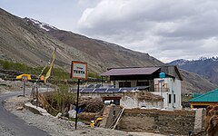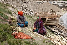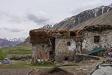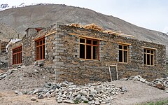
Zanskar, Zahar (locally) or Zangskar, is a tehsil of Zanskar district, in the Indian union territory of Ladakh. The administrative centre is Padum. Zanskar, together with the neighboring region of Ladakh, was briefly a part of the kingdom of Guge in Western Tibet. Zanskar lies 250 km south of Kargil town on NH301.

Kargil district is a district in Indian-administered Ladakh in the disputed Kashmir-region, which is administered as a union territory of Ladakh. It is named after the city of Kargil, where the district headquarters lies. The district is bounded by the Indian-administered union territory of Jammu and Kashmir to the west, the Pakistani-administered administrative territory of Gilgit–Baltistan to the north, Ladakh's Leh district to the east, and the Indian state of Himachal Pradesh to the south. Encompassing three historical regions known as Purig, Dras and Zanskar, the district lies to the northeast of the Great Himalayas and encompasses the majority of the Zanskar Range. Its population inhabits the river valleys of the Dras, Suru, Wakha Rong, and Zanskar.
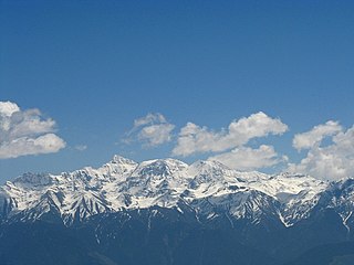
The Pir Panjal Range is a range of mountains in the Lower Himalayan region located in the Western Himalayas of northern Indian subcontinent. It runs southeast to northwest between the Beas and Neelam/Kishanganga rivers, in the Indian state of Himachal Pradesh and Indian-administered union territory of Jammu and Kashmir, with its northwestern end extending into territory administered by Pakistan. The Himalayas show a gradual elevation towards the Dhauladhar and Pir Panjal ranges. Pir Panjal is the largest and westernmost range of the Lesser Himalayas. Near the bank of the Sutlej River, it dissociates itself from the main Himalayan range and forms a divide between the Beas and Ravi rivers on one side and the Chenab on the other. Further west, the Pir Panjal range forms the southwestern boundary of the Kashmir Valley, separating it from the hills of Jammu region, forming a divide between the Jhelum and Chenab rivers.

Padum is the main town and the administrative centre of the Zanskar tehsil in Kargil district, Ladakh, India. Named after the Buddhist guru Padmasambhava, it was historically one of the two main capitals of the Zanskar Kingdom, the other being Zangla. It is 235 km (146 mi) via the link road from Kargil city. The new Nimmu–Padum–Darcha road connects Padum directly to Leh in the east and to Darcha in Himachal Pradesh.

Ladakh is an administrative territory of India that has been under its control since 1947. The geographical region of Ladakh union territory is the highest altitude plateau region in India, incorporating parts of the Himalayan and Karakoram mountain ranges and the upper Indus River and valley.

Shingo La is a mountain pass in India, on the state boundary between Ladakh and Himachal Pradesh. It connects the Lahaul region of Himachal Pradesh with the Zanskar region of Ladakh. The Nimmu-Padum-Darcha road strategic road runs over the pass. The Shingo La Tunnel is planned under the pass. It is expected to be completed by 2025 and will reduce the Manali to Kargil distance by 522 km. This will provide an all-weather route to Ladakh, as an alternative to the Leh–Manali Highway.

Zangla is a village in Zanskar tehsil of Kargil district, in the Indian union territory of Ladakh. It is located 262 km (163 mi) southeast of Kargil city, the district headquarters, and 32 km (20 mi) northeast of Padum, the headquarters of Zanskar. An ancient ruined palace, known as Zangla Fort or Zangla Khar is located on a hilltop 1 km (0.62 mi) outside the village, believed to be 11th-century. The Buddhist nunnery in Zangla contains some impressive paintings.

Tourism is one of the economic contributors to the union territory of Ladakh in Northern India. The union territory is sandwiched between the Karakoram mountain range to the north and the Himalayas to the south, and is situated at a height of 11,400 ft. Ladakh is composed of Leh and Kargil districts. The region contains prominent Buddhist sites and has an ecotourism industry.

The Zanskar River is the first major tributary of the Indus River, equal or greater in volume than the main river, which flows entirely within Ladakh, India. It originates northeast of the Great Himalayan range and drains both the Himalayas and the Zanskar Range within the region of Zanskar. It flows northeast to join the Indus River near Nimo.

The Leh–Manali Highway is a 428 km (266 mi) long highway in northernmost India connecting Leh, the capital of the Union Territory of Ladakh, to Manali in the state of Himachal Pradesh. It crosses four passes Rohtang la, Baralacha la, lungalacha la, tanglang la. It connects the Kullu Valley of the upper Beas river to the Chandra and Bhaga river valleys of Lahaul via the Atal tunnel in Himachal Pradesh, then crosses over a series of high Himalayan passes into the Indus river valley in Ladakh. It is usually open for about six months a year from the first week of May when the snow is cleared from the highway to October when snowfall again blocks the high passes on the highway. Before the construction of the Atal tunnel, the highway used to remain closed beyond the Rohtang Pass during winter. With the completion of the proposed Shingo La Tunnel on an alternate route through Zanskar valley, targeted to be completed by 2025, the whole Leh-Manali route will become an all-weather road.
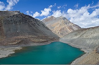
Suraj Tal, also called Tso Kamtsi or Surya Tal, is an 800 m (2,600 ft) long lake that lies just below the 4,890 m (16,040 ft) high Bara-lacha-la pass in Lahaul and Spiti district of the Indian state of Himachal Pradesh. It is the third-highest lake in India and the 21st-highest in the world. Suraj Tal Lake is just below the source of the Bhaga River that joins the Chandra River downstream at Tandi to form the Chandrabhaga River in Himachal Pradesh. The Chandrabhaga River is known as the Chenab as it enters the Jammu region of Jammu and Kashmir. The other major tributary of the Chandrabhaga, the Chandra, originates and flows south-east of the Bara-lacha La.

Karsha Monastery or Karsha Gompa is a Buddhist monastery in the Padum Valley of the Zanskar region of the union territory of Ladakh in northern India. The Doda River flows past the monastery from its source at the Drang Drung Glacier of the Pensi La. It was founded by the translator Phagspa Shesrab. The monastery, also known by the name Karsha Chamspaling, was founded by Phagspa Shesrab, under the Gelugpa Order or Yellow Hats. It is 11 km north of Padum in Zanskar River valley.

Stongdey is a small village in the Zanskar valley in Zanskar tehsil, Kargil district, Ladakh, India. The village is situated on the right bank of the Zanskar River about 18 km (11 mi) northeast of Padum on the Padum-Nimmu highway.

Darcha is a pair of villages on the Bhaga River in the Lahaul sub-division in the Lahaul and Spiti district in the Indian state of Himachal Pradesh. It is the northernmost permanent settlement in Himachal Pradesh along the Manali-Leh Highway. With the opening of the Atal Tunnel, Darcha is likely to see a large influx of tourists as it is now connected to Manali throughout the year. The Nimmu–Padam–Darcha road which is being constructed, will improve connectivity of Kargil, Zanskar and Leh District of Ladakh to Darcha.

Paddar, also spelled Padar, is a Sub-District and remote valley in the Kishtwar district of the union territory of Jammu and Kashmir, India. It falls in the Jammu division. It consists of two tehsils namely Machail and Atholi Paddar The valley covers the entire southeastern portion of the Kishtwar district. It borders Zanskar (Ladakh) in the north and east, Pangi in the south and the rest of Jammu and Kashmir in the west. The valley is known for its Sapphire mines. Albeit Sapphires are located in the valley of Paddar in Jammu division, they are known as Kashmiri sapphires which is a misnomer. It lies along the Chandrabhaga river (Chenab) in the Great Himalayas. Paddar is one of the most remote regions of Jammu and Kashmir. There are a number of small valleys within Paddar, such as Machail, Gandhari, Kabban, Ongai, Bhuzunu, Barnaj, Bhuzas, Kijai Nallah, Ishtiyari, Tiyari and Dharlang, among others.
Zangskari dialect is an endangered Tibetic language. It is a dialect of Ladakhi language. It is mostly spoken in the Zanskar region of the Kargil district of Ladakh, India and also by Buddhists in the upper reaches of Lahaul, Himachal Pradesh, and Paddar, Jammu and Kashmir. It is written using the Tibetan script.
All Ladakh Gonpa Association (ALGA) is the central organisation of the Buddhist monasteries in Ladakh, India. It aims to preserve and strengthen the monastic institutions. It was founded by the 19th Kushok Bakula Rinpoche in 1949 and he acted as its president for 41 years, from 1949 until 1991. In 1949, the first meeting of the great monasteries was held and ten monasteries took part. All Ladakh Gonpa Association was registered in 1959 and is run by a governing body consisting of fifteen lama members belonging to all four major schools of Tibetan Buddhism. There are sixteen major monastic institutions with hundreds of monks in each monastery.
Chiling Sumda is a village in the Leh district of Ladakh, India. It is located Nimmu–Padum–Darcha road (NPDR) or Zanskar Highway in the Likir tehsil, on the bank of the Zanskar River in Zanskar region. It serves as a base camp for the Chadar Trek in the winters and is used to raft the Zanskar river in the summers.

Nimmu–Padum–Darcha road or Zanskar Highway is a road between the Indian union territory of Ladakh and the state of Himachal Pradesh, passing through the region of Zanskar. It connects Nimmu in the Indus Valley to Padum, the capital of Zanskar, and to Darcha village in Lahul and Spiti. It provides an alternative to the Leh–Manali Highway in linking Ladakh with the rest of India. It was built by the Border Roads Organisation (BRO) of the Indian Army. The construction of road was completed in March 2024. The already completed Atal tunnel, and the proposed unidirectional-twin-tube total-4-lane Shingo La Tunnel, which is expected to be completed by 2025 will provide all weather connectivity and reduce the distance from Manali to Kargil by 522 km.

Chah is a small village in the Lungnak valley in Zanskar tehsil, Kargil district, Ladakh, India. The village is situated at the base of a mountain range on the right bank of the Tsarap River. It is located on the Padum-Darcha road, 47 km (29 mi) south from Padum.


