Teufenbach-Katsch

Last updated
Teufenbach-Katsch
KatschLaurentiusKirche.JPG
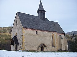
Saint Laurentius church in Katsch
AUT Teufenbach-Katsch COA.png
Austria adm location map.svg
Red pog.svg
Teufenbach-Katsch
Location within Austria
Coordinates: 47°07′43″N14°21′32″E / 47.12861°N 14.35889°E / 47.12861; 14.35889
Country Austria
State Styria
District Murau
Government
   Mayor Lydia Künstner-Stöckl (SPÖ)
Area
[1]
  Total
42.32 km2 (16.34 sq mi)
Elevation
760 m (2,490 ft)
Population
 (2018-01-01) [2]
  Total
1,899
  Density45/km2 (120/sq mi)
Time zone UTC+1 (CET)
  Summer (DST) UTC+2 (CEST)
Postal code
8812, 8833, 8841, 8842, 8850
Website www.teufenbach-katsch.gv.at

Teufenbach-Katsch is a municipality since 2015 in the Murau District of Styria, Austria.

Contents

It was created as part of the Styria municipal structural reform, [3] at the end of 2014, by merging the former towns Teufenbach and Frojach-Katsch. [4]

Geography

Municipality arrangement

The municipality territory includes the following three hamlets (populations as of January 2015 [5] ):

The municipality consists of the three Katastralgemeinden: Frojach, Katsch und Teufenbach.

Culture and sights

References

  1. "Dauersiedlungsraum der Gemeinden Politischen Bezirke und Bundesländer - Gebietsstand 1.1.2018". Statistics Austria. Retrieved 10 March 2019.
  2. "Einwohnerzahl 1.1.2018 nach Gemeinden mit Status, Gebietsstand 1.1.2018". Statistics Austria. Retrieved 9 March 2019.
  3. Steiermärkische Gemeindestrukturreform Archived 2016-11-30 at the Wayback Machine .
  4. § 3 Abs. 7 Z 1 des Gesetzes vom 17. Dezember 2013 über die Neugliederung der Gemeinden des Landes Steiermark ("Steiermärkisches Gemeindestrukturreformgesetz Archived 2014-04-07 at the Wayback Machine " – StGsrG). Landesgesetzblatt für die Steiermark. 2 April 2014. Nr. 31, Jahrgang 2014. ZDB-ID   705127-x. p. 3.
  5. "Statistik Austria, Bevölkerung am 1.1.2015 nach Ortschaften". Archived from the original on 2016-03-04. Retrieved 2016-11-14.