Texas Park Road 37

Last updated

Texas Park Road 37.svg

Park Road 37
Medina Lake Park Road
Route information
Maintained by TxDOT
Length14.191 mi [1] (22.838 km)
ExistedFebruary 20, 1946 [1] –present
Major junctions
West endBandera County Park in Lakehills
East endTexas 16.svg SH 16 near Helotes
Location
Counties Bandera, Medina
Highway system
Texas Park Road 36.svg PR 36 PR 38 Texas Park Road 38.svg

Park Road 37 (PR 37) is a state highway located in the Texas Hill Country. The highway runs from Bandera County Park (formerly Avalon State Park) at the shores of Medina Lake in Lakehills to SH 16 northwest of Helotes. PR 37 has been noted as an excellent drive by motorcyclists for its views, tight bends and hills. [2]

Texas Hill Country Region of Texas

The Texas Hill Country is a geographic region of Central and South Texas, forming the southeast part of the Edwards Plateau. Given its location, climate, terrain, and vegetation, the Hill Country can be considered the border between the American Southeast and Southwest.

Medina Lake lake in United States of America

Medina Lake is a reservoir on the Medina River in the Texas Hill Country of the United States. It is operated by the Bexar/Medina/Atascosa County Agricultural District. Medina Dam was completed in 1913 in a privately financed project, creating the lake to supply irrigation water for local agricultural use. Lake Medina is in northeastern Medina County, and southeastern Bandera County, about 40 miles (64 km) northwest of San Antonio.

Lakehills, Texas CDP in Texas, United States

Lakehills is a census-designated place (CDP) in Bandera County, Texas, United States. The population was 5,150 at the 2010 census, making it the most populous place in Bandera county. It is part of the San Antonio Metropolitan Statistical Area.

Contents

Route description

PR 37 begins in Bandera County Park on the edge of Medina Lake. The highway runs northwest out of the park, before a sharp turn to the southeast near Comanche Trail. After passing by a subdivision, PR 37 turns back to the northeast. The highway runs north-south through the town of Lakehills, serving as its main street. The highway turns sharp right at 3rd Street West, running in an east-west direction. Shortly after leaving the city, PR 37 intersects FM 1283 at a stop sign. After this intersection, PR 37 runs by many ranches and curves back down to the south. In Medina County, the highway turns back towards the east. PR 37 ends at an intersection with SH 16 a few miles northwest of Helotes.

Medina County, Texas U.S. county in Texas

Medina County is a county located in the U.S. state of Texas. As of the 2010 census, its population was 46,006. Its county seat is Hondo. The county is named for the Medina River.

Texas State Highway 16 highway in Texas

State Highway 16, or SH 16, is a south–north state highway that runs from Zapata on the Texas-Mexico boundary to U.S. Highway 281 24 miles (38.6 km) south of Wichita Falls. It is the longest state highway in Texas at almost 542 miles, but is only the 9th longest of any highway classification in the state. Before the 1939 renumbering, SH 4 was the longest state highway.

Helotes, Texas City in Texas, United States

Helotes is a city in Bexar County, Texas, United States, located on the far northwest side of San Antonio. It is part of the San Antonio-New Braunfels Metropolitan Statistical Area. The population was 7,341 at the 2010 census.

Due to the low levels of the lake, the boat ramp in Plum Creek Cove (near the highway's western terminus) has been closed. [3]

History

The highway was designated in 1946 and generally follows an existing road. In 1958, the highway was extended about 0.2 miles to the shores of Medina Lake.

Major intersections

CountyLocationmikmDestinationsNotes
Bandera Lakehills 0.00.0Bandera County Park main entranceWestern terminus of Park Road 37
1.01.6Texas FM 1283.svg FM 1283  Pipe Creek
Medina 14.222.9Texas 16.svg SH 16  Bandera, San Antonio Eastern terminus of Park Road 37
1.000 mi = 1.609 km; 1.000 km = 0.621 mi

See also

Related Research Articles

U.S. Highway 96 (US 96) is a north–south United States Numbered Highway that runs for about 117.11 miles (188.47 km) entirely in the U.S state of Texas. Its number is a violation of the standard numbering convention, as even-numbered two-digit highways are east–west routes by rule. As of 2004, the highway's southern terminus is in Port Arthur at an intersection with State Highway 87 (SH 87). Its northern terminus is in Tenaha at an intersection with US 59 /(Future I-369) and US 84.

Texas State Highway 46 highway in Texas

State Highway 46, or SH 46, is a 71.4-mile (114.9 km) state highway in the U.S. state of Texas that runs from State Highway 16 east of Bandera to the intersection of SH 123 and SH 123 Business just south of Seguin.

Texas State Highway 289 highway in Texas

State Highway 289, known for most of its length as Preston Road, is a north–south Texas state highway. It begins at the intersection of Preston Road and Loop 12/Northwest Highway in Dallas. The Preston Road designation comes from the fact that the highway generally follows the course of an older road known as the Preston Trail, which ran to the town of Preston Bend. Preston Bend is now submerged by Lake Texoma.

Loop 1604, also known as the Charles W. Anderson Loop, is an outer highway loop that encircles San Antonio, Texas, spanning approximately 95.6 miles (153.9 km). What began as a two-lane highway has been upgraded to a four-lane freeway along its northern stretches from US Hwy 90 on the West to Kitty Hawk Rd on the East. The Texas Department of Transportation (TxDOT) is planning to further upgrade this freeway segment from 4 general purpose lanes to 8 general purpose lanes and 2 HOV lanes from Bandera Rd to I-35. Loop 1604 is named for former Bexar County Judge Charles W. Anderson, who died from cancer in 1964 after serving for 25 years on the bench.

Oklahoma State Highway 137 highway in Oklahoma

State Highway 137 (SH-137) is a 6.31-mile (10.15 km) highway in Ottawa County, Oklahoma. It is a two-lane highway beginning at State Highway 10 east of Miami and ends at U.S. Highway 60 in Twin Bridges State Park on the north side of the Grand Lake o' the Cherokees. It has no lettered spur routes.

Texas State Highway 27 highway in Texas

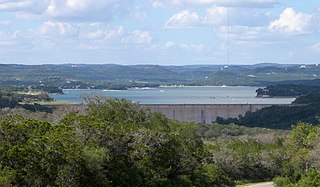
State Highway 27 is located in Kerr and Kendall counties and runs parallel to Interstate 10.

State Highway 150 is a state highway in McIntosh County, Oklahoma, in the United States. It is 8.77 miles (14.11 km) long, running diagonally from U.S. Highway 69 north of Eufaula in the southeast to Interstate 40 west of Checotah in the northwest. SH-150 provides access to Lake Eufaula and Lake Eufaula State Park. It has no lettered spur routes.

Oklahoma State Highway 38 highway in Oklahoma

State Highway 38 is a state highway in the U.S. state of Oklahoma. It runs for 14.78 miles (23.79 km) in an irregular south-to-north pattern in eastern Alfalfa County, in the northwest part of the state. The highway begins at U.S. Route 64 (US-64) in Jet and extends to SH-11. SH-38 provides access to Great Salt Plains State Park, which the road skirts on the park's eastern edge.

Oklahoma State Highway 85 highway in Oklahoma

State Highway 85 is a state highway in the northeastern part of the U.S. state of Oklahoma. The highway is 13.3 miles (21.4 km) long. SH-85 provides access to the northwest shore of Grand Lake, a major recreation center for northwest Oklahoma. SH-85 has one lettered spur highway, SH-85A.

Loop 108 is a 3.922-mile-long (6.312 km) state highway loop in Port Bolivar, Texas.

Park Road 1836 (PR 1836), also known as San Jacinto Battleground State Park Road and Juan N. Seguin Boulevard, is a Park Road in southeast Texas. The route is 7.234 miles (11.642 km) long, and connects San Jacinto Battleground State Historic Site to Independence Parkway in Houston in southeast Harris County. The designation is given to multiple roads on the park grounds. The road was designated as PR 9 in 1939 before receiving its current designation in 1960.

Northwest Highway is a major highway/road in the Dallas-Fort Worth Metroplex area of Texas. The highway was originally built as the route of State Highway 114 into Dallas. The road has been the site of major development for almost half a decade, especially in Dallas. The route is known as other names at various points. This includes Northwest Parkway and Northwest Drive in Mesquite.

Farm to Market Road 471 is an FM highway in the San Antonio area of Texas. The highway is known as Culebra Road within Bexar County.

References

  1. 1 2 Transportation Planning and Programming Division (n.d.). "Park Road No. 37". Highway Designation Files. Texas Department of Transportation . Retrieved January 17, 2014.
  2. "State Park Road 37, Texas". Motorcycle Roads US. Retrieved January 17, 2014.
  3. "Medina Lake nears 1968 record low". Bandera Bulletin. Retrieved January 4, 2014.

Route map:

KML file (edithelp)
    KML is from Wikidata

    Openstreetmap logo.svg Geographic data related to Texas Park Road 37 at OpenStreetMap

    OpenStreetMap Collaboratively edited world map available under free Open Database License

    OpenStreetMap (OSM) is a collaborative project to create a free editable map of the world. The geodata underlying the map is considered the primary output of the project. The creation and growth of OSM has been motivated by restrictions on use or availability of map data across much of the world, and the advent of inexpensive portable satellite navigation devices. OSM is considered a prominent example of volunteered geographic information.