Tha Faek

Last updated
Tha Faek

ท่าแฝก
CountryThailand
Province Uttaradit
District Nam Pat District
Area
  Total315 km2 (122 sq mi)
Population
(2014)
  Total4,434
Time zone UTC+7 (ICT)
Postal code
53110
TIS 1099530407

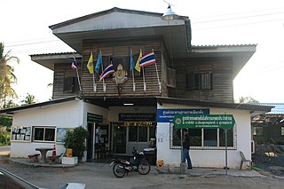
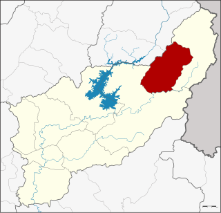
Tha Faek (Thai : ท่าแฝก, pronounced  [tʰâː fɛ̀ːk] ) is a tambon (sub-district) of Nam Pat District, in Uttaradit Province, Thailand. In 2014 it had a population of 4,434 people. [1]

Thai language language spoken in Thailand

Thai, Central Thai or Ayutthaya or Siamese, is the sole official and national language of Thailand and the first language of the Central Thai people and vast majority of Thai of Chinese origin. It is a member of the Tai group of the Kra–Dai language family. Over half of Thai vocabulary is derived from or borrowed from Pali, Sanskrit, Mon and Old Khmer. It is a tonal and analytic language.
Tambon central government unit in Thailand

Tambon is a local governmental unit in Thailand. Below district (amphoe) and province (changwat), they form the third administrative subdivision level. As of 2016 there were 7,255 tambons, not including the 180 khwaeng of Bangkok, which are set at the same administrative level, thus every district contains eight to ten tambon. Tambon is usually translated as "township" or "subdistrict" in English — the latter is the recommended translation, though also often used for king amphoe, the designation for a subdistrict acting as a branch of the parent district. Tambon are further subdivided into 69,307 villages (muban), about ten per tambon. Tambon within cities or towns are not subdivided into villages, but may have less formal communities called chumchon (ชุมชน) that may be formed into community associations.

Nam Pat District District in Uttaradit, Thailand

Nam Pat is a district (amphoe) of Uttaradit Province, northern Thailand.

Contents

History

The sub-district originally was part of Tha Pla District. With the creation of the Sirikit Dam in 1972, the sub-district has become separated from the central part of Tha Pla District. Effective 14 February 2015, the sub-district was reassigned to Nam Pat District to make the authorities easier to reach for the local residents. [2]

Tha Pla District District in Uttaradit, Thailand

Tha Pla is a district (amphoe) of Uttaradit Province, in northern Thailand.

Administration

The sub-district is divided into nine administrative villages.

No.NameThai
1.Ban Ngom Thamบ้านงอมถ้ำ
2.Ban Ngom Motบ้านงอมมด
3.Ban Ngom Sakบ้านงอมสัก
4.Ban Huai Phuengบ้านห้วยผึ้ง
5.Ban Pa Kangบ้านป่ากั้ง
6.Ban Ten Yaoบ้านเด่นยาว
7.Ban Wang Nam Tonบ้านวังน้ำต้น
8.Ban Huai Phaiบ้านห้วยไผ่
9.Ban Pha Phueng Noiบ้านผาผึ้งน้อย

The entire sub-district is covered by the Tha Faek sub-district administrative organization (องค์การบริหารส่วนตำบลท่าแฝก) as the local government unit, established in 1997. [3]

Related Research Articles

Phunphin District Amphoe in Surat Thani, Thailand

Phunphin is a district (amphoe) in Surat Thani Province in the south of Thailand. Tha Kham is the principal town of the district. In 2014, the population was 73,067.

Na Noi District District in Nan, Thailand

Na Noi is a district (amphoe) in Nan Province, northern Thailand.

Khai Bang Rachan District District in Sing Buri, Thailand

Khai Bang Rachan is a district (amphoe) of Sing Buri Province, central Thailand.

Kantharalak District Amphoe in Sisaket, Thailand

Kantharalak is a district (amphoe) in the southeastern part of Sisaket Province, northeastern Thailand.

Sanam Chai Khet District Amphoe in Chachoengsao, Thailand

Sanam Chai Khet is a district (amphoe) in the eastern part of Chachoengsao Province, central Thailand.

Mueang Rayong District District in Rayong, Thailand

Mueang Rayong is the capital district of Rayong Province, Thailand. The provincial administration is in Tambon Map Ta Phut.

Thong Saen Khan District District in Uttaradit, Thailand

Thong Saen Khan is a district (amphoe) in the southern part of Uttaradit Province, northern Thailand.

Mueang Uttaradit District District in Uttaradit, Thailand

Mueang Uttaradit is the capital district of Uttaradit Province, northern Thailand.

Ban Khok District District in Uttaradit, Thailand

Ban Khok is the northeasternmost district (amphoe) of Uttaradit Province, northern Thailand.

Fak Tha District District in Uttaradit, Thailand

Fak Tha is a district (amphoe) of Uttaradit Province, northern Thailand.

Na Muen District District in Nan, Thailand

Na Muean is a district (amphoe) in the southern part of Nan Province, northern Thailand.
Mueang Khon Kaen District District in Khon Kaen, Thailand

Mueang Khon Kaen is the capital district of Khon Kaen Province, northeastern Thailand.

Mueang Phayao District Amphoe in Phayao, Thailand

Mueang Phayao is the capital district of Phayao Province, northern Thailand.

Pa Sang District Amphoe in Lamphun, Thailand

Pa Sang is a district (amphoe) of Lamphun Province, northern Thailand.

Hang Dong District District in Chiang Mai, Thailand

Hang Dong is a district (amphoe) of Chiang Mai Province in northern Thailand, known for its traps

Si Chiang Mai District Amphoe in Nong Khai, Thailand

Si Chiang Mai is a district (amphoe) in the western part of Nong Khai Province, northeastern Thailand. It may also be spelled Sri Chiang Mai.

Seka District Amphoe in Bueng Kan, Thailand

Seka is a district (amphoe) in the eastern part of Bueng Kan Province, northeastern Thailand.

Renu Nakhon District Amphoe in Nakhon Phanom, Thailand

Renu Nakhon ) is a district (amphoe) of Nakhon Phanom Province, northeastern Thailand.

References

  1. "Population statistics 2014" (in Thai). Department of Provincial Administration. Retrieved 2015-02-13.
  2. "พระราชกฤษฎีกาเปลี่ยนเขตอำเภอท่าปลากับอำเภอน้ำปาด จังหวัดอุตรดิตถ์ พ.ศ. ๒๕๕๘" (PDF). Royal Gazette (in Thai). 132 (10 ก): 62–64. 2015-02-13.
  3. "ประกาศกระทรวงมหาดไทย เรื่อง จัดตั้งองค์การบริหารส่วนตำบล" (PDF). Royal Gazette (in Thai). 113 (พิเศษ 52 ง): 1–365. 1996-12-25.

Coordinates: 17°56′44″N100°37′53″E / 17.94556°N 100.63139°E / 17.94556; 100.63139

Geographic coordinate system Coordinate system

A geographic coordinate system is a coordinate system that enables every location on Earth to be specified by a set of numbers, letters or symbols. The coordinates are often chosen such that one of the numbers represents a vertical position and two or three of the numbers represent a horizontal position; alternatively, a geographic position may be expressed in a combined three-dimensional Cartesian vector. A common choice of coordinates is latitude, longitude and elevation. To specify a location on a plane requires a map projection.