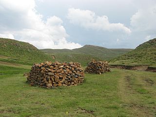
Thaba Mokhele

Last updated
Thaba Mokhele
Community Council
Lesotho adm location map.svg
Red pog.svg
Thaba Mokhele
Geographic Center of Community
Coordinates: 30°01′25″S27°33′01″E / 30.02361°S 27.55028°E / -30.02361; 27.55028
CountryFlag of Lesotho.svg  Lesotho
District Mohale's Hoek District
Elevation
[1]
5,682 ft (1,732 m)
Population
 (2006)
  Total18,135
Time zone UTC+2 (CAT)
Coordinates computed from Lesotho Villages file. [2]

Thaba Mokhele is a community council located in the Mohale's Hoek District of Lesotho. Its population in 2006 was 18,135. [3]

Contents

Villages

The community of Thaba-Mokhele includes the villages of Boikhutsong, Five Rand, Ha 'Mako, Ha Belemane, Ha Biane, Ha Bokoro, Ha Chefa, Ha Faetoa, Ha Jimi, Ha Kaphe (Maholong), Ha Kaphe (Moreneng), Ha Khanyane, Ha Khoale, Ha Kholoane, Ha Kooko, Ha Lisene, Ha Mabaka, Ha Mahlelebe, Ha Mahooana (Mahahaneng), Ha Mako (Ha Folatsane), Ha Mako (Mahlalela), Ha Mapuru, Ha Maqeba, Ha Maqoala, Ha Masita, Ha Matseo, Ha Moeletsi, Ha Mohale, Ha Mokhothu, Ha Mokunyane, Ha Moloche, Ha Monakalali, Ha Moshabe, Ha Mosika, Ha Mosotho, Ha Mothe, Ha Mothetho, Ha Ntepe, Ha Ntsapi, Ha Pekenene, Ha Phala, Ha Pitseng, Ha Qoane, Ha Rakhenku, Ha Ralepei, Ha Ramahloli, Ha Ramahlolonyane, Ha Ramatlali, Ha Ramokongoane, Ha Rampeli, Ha Rantšoeu, Ha Ranyakane, Ha Rasebolelo, Ha Rathobeli, Ha Ratšoeu, Ha Seabata, Ha Sehloho, Ha Sekunyane, Ha Sepinare (Moreneng), Ha Sepinare (Sekiring), Ha Soere, Ha Taele, Ha Tepa, Ha Thetela, Ha Thokoa, Ha Tšese, Hloahloeng, Hohobeng, Kalakeng, Khang-ka-Khotso, Kholokoe, Kolobere, Kopialena, Lefikeng, Lefikeng (Thaba-Tšoeu), Lekhalong, Letlapeng, Lifateng (Ha Nkunyane), Lifateng (Lekhalong), Lifateng (Moreneng), Lifateng (Motse-Mocha), Lifateng (Thoteng), Lifateng (Tšoeneng), Linokong, Liphofung (Ha Ralijeng), Lithabaneng (Boithatelo), Lithakaling, Maboneng, Makhaloaneng, Makutoaneng, Maqoala, Matsatseng, Matsaung, Matsekeng, Matsoapong, Motsekong, Nk'hunk'hu, Nkoboto, Noka-Ntšo, Nomoroane, Ntširele, Patisa, Phahameng, Phohlokong, Pontšeng, Sehlabaneng, Senekane, Terai Hoek (Ha Molomo), Thabana- Ntšonyana, Thabaneng-tsa-Marole, Thoteng and Tutululung. [4]

Related Research Articles

Mohales Hoek human settlement

Mohale's Hoek is the capital city of Mohale's Hoek District in Lesotho. It had a population of approximately 40,040 in 2016.

Mohales Hoek District District in Lesotho

Mohale's Hoek is a district of Lesotho. Mohale's Hoek is the capital city or camptown, and only town in the district. In the southwest, Mohale's Hoek borders on South Africa, while domestically, it borders on Mafeteng District in northwest, Maseru District in north, Thaba-Tseka District in northeast, Qacha's Nek District in east, and Quthing District in southeast.

Linakeng Community Council in Butha-Buthe District, Lesotho

Linakeng is a community council located in the Thaba Tseka District of Lesotho.

Mphorosane Community Council in Leribe District, Lesotho

Mphorosane is a community council located in the Leribe District of Lesotho. Its population in 2006 was 9,392.

Mathula Community Council in Mafeteng District, Lesotho

Mathula is a community council located in the Mafeteng District of Lesotho. Its population in 2006 was 17,867.

Mashaleng Community Council in Mohales Hoek District, Lesotho

Mashaleng is a community council located in the Mohale's Hoek District of Lesotho. Its population in 2006 was 21,869.

Mootsinyane Community Council in Mohales Hoek District, Lesotho

Mootsinyane is a community council located in the Mohale's Hoek District of Lesotho. Its population in 2006 was 9,995.

Phamong Community Council in Mohales Hoek District, Lesotho

Phamong is a community council located in the Mohale's Hoek District of Lesotho. Its population in 2006 was 8,402. Chieftainess Nthati Bereng Bereng was confirmed into office as Principal Chief of Phamong at a ceremony presided over by King Letsie III on August 27, 2004. The inauguration follows the death of her husband in 2002.

Qabane Community Council in Mohales Hoek District, Lesotho

Qabane is a community council located in the Mohale's Hoek District of Lesotho. Its population in 2006 was 6,924.

Qhobeng Community Council in Mohales Hoek District, Lesotho

Qhobeng is a community council located in the Mohale's Hoek District of Lesotho. Its population in 2006 was 3,083.

Qobong Community Council in Mohales Hoek District, Lesotho

Qobong is a community council located in the Mohale's Hoek District of Lesotho. Its population in 2006 was 9,324.

Seroto Community Council in Mohales Hoek District, Lesotho

Seroto is a community council located in the Mohale's Hoek District of Lesotho, Africa. Its population in 2006 was 7,836., [[Motseki]]

Siloe, Lesotho Community Council in Mohales Hoek District, Lesotho

Siloe is a community council located in the Mohale's Hoek District of Lesotho. Its population in 2006 was 18,261.

Teke, Lesotho Community Council in Mohales Hoek District, Lesotho

Teke is a community council located in the Mohale's Hoek District of Lesotho. Its population in 2006 was 5,403.

Liphakoe Community Council in Quthing District, Lesotho

Liphakoe is a community council located in the Quthing District of Lesotho. Its population in 2006 was 14,537.

Matsatseng Community Council in Quthing District, Lesotho

Matsatseng is a community council located in the Quthing District of Lesotho. Its population in 2006 was 18,713.

Mokotjomela Community Council in Quthing District, Lesotho

Mokotjomela is a community council located in the Quthing District of Lesotho. Its population in 2006 was 12,340.

Mphaki Community Council in Quthing District, Lesotho

Mphaki is a community council located in the Quthing District of Lesotho. Its population in 2006 was 20,288.

Monyetleng Community Council in Thaba-Tseka District, Lesotho

Monyetleng is a community council located in the Thaba-Tseka District of Lesotho. Its population in 2006 was 7,306.

Makheka, Thaba-Tseka District Community Council in Thaba-Tseka District, Lesotho

Rapoleboea is a community council located in the Thaba-Tseka District of Lesotho. Its population in 2006 was 11,533.

References

  1. GTOPO30 via GeoNames. Retrieved 2010-10-01.
  2. Google Earth Download Site Retrieved 2010-07-21.
  3. Statoids.com
  4. Lesotho Bureau of Statistics, Village List 2006.