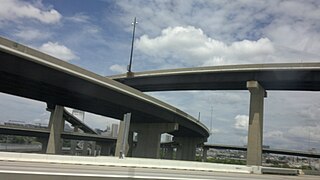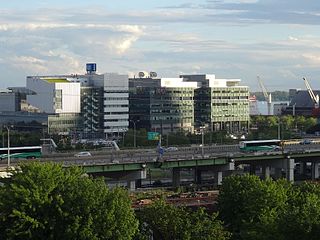
Transportation in Boston includes roadway, subway, regional rail, air, and sea options for passenger and freight transit in Boston, Massachusetts. The Massachusetts Port Authority (Massport) operates the Port of Boston, which includes a container shipping facility in South Boston, and Logan International Airport, in East Boston. The Massachusetts Bay Transportation Authority (MBTA) operates bus, subway, short-distance rail, and water ferry passenger services throughout the city and region. Amtrak operates passenger rail service to and from major Northeastern cities, and a major bus terminal at South Station is served by varied intercity bus companies. The city is bisected by major highways I-90 and I-93, the intersection of which has undergone a major renovation, nicknamed the Big Dig.

New York Harbor is at the mouth of the Hudson River where it empties into New York Bay near the East River tidal estuary, and then into the Atlantic Ocean on the United States East coast.

The Port of Los Angeles is a seaport managed by the Los Angeles Harbor Department, a unit of the City of Los Angeles. It occupies 7,500 acres (3,000 ha) of land and water with 43 miles (69 km) of waterfront and adjoins the separate Port of Long Beach. Promoted as "America's Port", the port is located in San Pedro Bay in the San Pedro and Wilmington neighborhoods of Los Angeles, approximately 20 miles (32 km) south of downtown.

The North End is a neighborhood of Boston, Massachusetts. It has the distinction of being the city's oldest residential community, which has been inhabited since it was colonized in the 1630s. It is only 0.36 square miles (0.93 km2), yet the neighborhood has nearly one hundred establishments and a variety of tourist attractions. It is known for its Italian American population and Italian restaurants.

Boston Harbor is a natural harbor and estuary of Massachusetts Bay, and is located adjacent to the city of Boston, Massachusetts. It is home to the Port of Boston, a major shipping facility in the Northeastern United States.

The Rose Fitzgerald Kennedy Greenway is a linear park located in several Downtown Boston neighborhoods. It consists of landscaped gardens, promenades, plazas, fountains, art, and specialty lighting systems that stretch over one mile through Chinatown, the Financial District, the Waterfront, and North End neighborhoods. Officially opened in October 2008, the 17-acre Greenway sits on land created from demolition of the John F. Fitzgerald Expressway as part of the Big Dig project.

Governor Tom McCall Waterfront Park is a 36.59-acre (148,100 m2) park located in downtown Portland, Oregon, along the Willamette River. After the 1974 removal of Harbor Drive, a major milestone in the freeway removal movement, the park was opened to the public in 1978. The park covers 13 tax lots and is owned by the City of Portland. The park was renamed in 1984 to honor Tom McCall, the Oregon governor who pledged his support for the beautification of the west bank of the Willamette River—harkening back to the City Beautiful plans at the turn of the century which envisioned parks and greenways along the river. The park is bordered by RiverPlace to the south, the Steel Bridge to the north, Naito Parkway to the west, and Willamette River to the east. In October 2012, Waterfront Park was voted one of America's ten greatest public spaces by the American Planning Association.

Canton is a historic waterfront neighborhood in Baltimore, Maryland, United States. The neighborhood is along Baltimore's outer harbor in the southeastern section of the city, roughly 2 miles (3 km) east of Baltimore's downtown district and next to or near the neighborhoods of Patterson Park, Fell's Point, Highlandtown, and Brewers Hill.

The Port of Boston is a major seaport located in Boston Harbor and adjacent to the City of Boston. It is the largest port in Massachusetts and one of the principal ports on the East Coast of the United States.

Harbor Drive is a short roadway in Portland, Oregon, spanning a total length of 0.7 miles (1.1 km), which primarily functions as a ramp to and from Interstate 5. It was once much longer, running along the western edge of the Willamette River in the downtown area. Originally constructed from 1942–43, the vast majority of the road was replaced with Tom McCall Waterfront Park in the 1970s. Signed as U.S. Route 99W, it had been the major route through the city and its removal is often cited as the first instance of freeway removal in the U.S. and as a milestone in urban planning; the original road is remembered as the first limited-access highway built in the city.

The Harbor Towers are two 40-story residential towers located on the waterfront of Boston, Massachusetts, located between the New England Aquarium and the Rowes Wharf mixed-use development. Harbor Towers I, the taller of the two towers, stands at 400 feet (120 m), while Harbor Towers II rises 396 feet (121 m). Harbor Towers I is in a tie as 36th-tallest building in Boston. They were designed by Henry N. Cobb of I. M. Pei & Partners.

Westport is a neighborhood in south Baltimore, Maryland. Westport is a majority African-American neighborhood that has struggled with crime, housing abandonment, and unemployment in the past decade. The neighborhood is bordered by the Middle Branch of the Patapsco River on the east, the city neighborhoods of Cherry Hill, Brooklyn and the southwestern Baltimore County community of Lansdowne to the southwest, Hollins Ferry Road and the Mount Winans and Lakeland neighborhoods to the west, and Interstate 95 to the north, along with the South Baltimore communities of Federal Hill and Otterbein. The Baltimore–Washington Parkway runs through the middle of Westport and intersects with Interstate 95, the main East Coast super-highway, north to south, Maine to Florida.
The Boston Harbor Islands Partnership is a non-profit partnership organization based in Boston, MA, whose purpose is "to coordinate the activities of the Federal, State, and local authorities and the private sector in the development and implementation of a general management plan" for the Boston Harbor Islands National Recreation Area. The Partnership was established by the United States Congress in 1996, as part of the law which designated the Boston Harbor Islands as a unit of the national parks system.

The Hudson River Waterfront Walkway, also known as the Hudson River Walkway, is a promenade along the Hudson Waterfront in New Jersey. The ongoing and incomplete project located on Kill van Kull and the western shore of Upper New York Bay and the Hudson River was implemented as part of a New Jersey state-mandated master plan to connect the municipalities from the Bayonne Bridge to the George Washington Bridge with an urban linear park and provide contiguous unhindered access to the water's edge.

Children's Wharf is a wharf on Congress Street in Boston, Massachusetts, on the Fort Point Channel with views of the Financial District and Boston Harbor. The wharf has sitting areas, patches of lawn, and several tourist attractions.

Boston Harborwalk is a public walkway that follows the edge of piers, wharves, beaches, and shoreline around Boston Harbor. When fully completed it will extend a distance of 47 miles (76 km) from East Boston to the Neponset River.

East Bayfront, or the East Bayfront Precinct, is an emerging neighbourhood in Toronto, Ontario, Canada. It is currently undergoing a transformation from industrial use to mixed-use as part of Waterfront Toronto's plans to create a residential and commercial district urban core near the lake.

Millers River was a river in Middlesex County, Massachusetts. It has since mostly been obscured by landfill and "made land". The small remaining estuary is a remnant of wetlands and open water that once divided Cambridge from Charlestown, Massachusetts. The exact historical course of parts the river is somewhat uncertain, and thus parts of the Charlestown-Cambridge and Somerville-Cambridge borders may have changed due to incorrect historical reconstruction.
The Vision 2020: New York City Comprehensive Waterfront Plan was introduced in March 2011 by Mayor Michael R. Bloomberg, City Council Speaker Christine C. Quinn, and the Director of the New York City Department of City Planning, Amanda Burden, this plan provides a framework for the next ten years of waterfront development in New York City. The plan has two components: a three-year action agenda comprising 130 funded projects, including the development of more than 50 acres (20 ha) of new waterfront parks, creation of 14 new waterfront esplanades, and introduction of new commuter ferry service, providing a framework for the City’s 520 miles (840 km) of shoreline for the next decade and beyond.

Piers Park is a public park owned by Massport located on the southwest side of East Boston, overlooking Boston Harbor and downtown Boston. Designed by Pressley Associates Landscape Architects of Boston, the 6.5-acre (2.6 ha) park was conceived to reclaim a condemned industrial pier for recreational use, allowing residents and visitors direct access to the waterfront.


