Related Research Articles
Earl's Court is a district of Kensington in the Royal Borough of Kensington and Chelsea in West London, bordering the rail tracks of the West London line and District line that separate it from the ancient borough of Fulham to the west, the sub-districts of South Kensington to the east, Chelsea to the south and Kensington to the northeast. It lent its name to the now defunct eponymous pleasure grounds opened in 1887 followed by the pre–World War II Earls Court Exhibition Centre, as one of the country's largest indoor arenas and a popular concert venue, until its closure in 2014.

Cromwell Road is a major London road in the Royal Borough of Kensington and Chelsea, designated as part of the A4. It was created in the 19th century and is said to be named after Richard Cromwell, son of Oliver Cromwell, who once owned a house there.

Albertopolis is the nickname given to the area centred on Exhibition Road in London, named after Prince Albert, consort of Queen Victoria. It contains many educational and cultural sites. It is in South Kensington, split between the Royal Borough of Kensington and Chelsea and the City of Westminster, and the area bordered by Cromwell Road to the south and Kensington Road to the north.

South Kensington is a district just west of Central London in the Royal Borough of Kensington and Chelsea. Historically it settled on part of the scattered Middlesex village of Brompton. Its name was supplanted with the advent of the railways in the late 19th century and the opening and naming of local tube stations. The area has many museums and cultural landmarks with a high number of visitors. Adjacent affluent centres such as Knightsbridge, Chelsea and Kensington, have been considered as some of the most exclusive real estate in the world.

The Cromwellian conquest of Ireland or Cromwellian war in Ireland (1649–1653) was the re-conquest of Ireland by the forces of the English Parliament, led by Oliver Cromwell, during the Wars of the Three Kingdoms. Cromwell invaded Ireland with the New Model Army on behalf of England's Rump Parliament in August 1649.

Brompton Road is a street located in the southern part from Knightsbridge and in the eastern part from Brompton in the Royal Borough of Kensington and Chelsea and partly the City of Westminster in London.

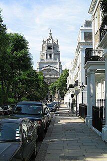
Old Brompton Road is a major street in the South Kensington district of The Royal Borough of Kensington and Chelsea, London.

Gloucester Road (B325) is a street in the Royal Borough of Kensington and Chelsea, London. It runs north–south between Kensington Gardens and Old Brompton Road.
West Kensington, formerly North End, is an area in the ancient parish of Fulham, in the London Borough of Hammersmith and Fulham, England, 3.4 miles (5.5 km) west of Charing Cross. It covers most of the London postal area of W14, including the area around Barons Court tube station, and is defined as the area between Lillie Road and Hammersmith Road to the west, Fulham Palace Road to the south, Hammersmith to the north and West Brompton and Earl's Court to the east. The area is bisected by the major London artery the A4, locally known as the Talgarth Road. Its main local thoroughfare is the North End Road.

Fulham Road is a street in London, England, which comprises the A304 and part of the A308.

Lambeth Road is a road in Lambeth and Southwark, London running between Lambeth Bridge over the River Thames at the western end and St George's Circus at the eastern end. The road is designated the A3203. The borough boundary runs along it from the intersection with King Edward's Walk to Kennington Road.

Cromwell Gardens is a short but major road in South Kensington, within the Royal Borough of Kensington and Chelsea, London, England. It joins the Cromwell Road at the junction with Exhibition Road to the west with the Brompton Road to the east.

Queen's Gate is a street in South Kensington, London, England. It runs south from Kensington Gardens' Queen's Gate to Old Brompton Road, intersecting Cromwell Road.
Greenwood Roadway was an auto and motorcycle paved racetrack located in Otter Township, Warren County, 28 miles (45 km) south of Des Moines, Iowa, on Highway 65. It was only open from 1963 to 1966, but it managed to host several major auto racing events, including several Sports Car Club of America races and one round of the United States Road Racing Championship, the predecessor to the Can-Am series. Other major events included AMA National Championship motorcycle races and a round of the United States Auto Club stock car series.
Thurloe Square is a traditional garden square in South Kensington, London, England.

Transport House was the headquarters of the Transport and General Workers' Union (T&G), and also originally of the Labour Party, the Trades Union Congress, and the Workers' Travel Association. The term "Transport House" was once a metonym for both Labour Party Headquarters and the T&G.

The Bentley London is a luxury AA 5-star hotel in London, England. It is located at 27-33 Harrington Gardens in south Kensington, between Cromwell Road and Brompton Road. It is nearby to the museums Natural History Museum, Victoria and Albert Museum and other sites such as the Royal Albert Hall, Sloane Square and the Royal Court Theatre, and the boutiques of Knightsbridge such as Harrods and Harvey Nichols. The hotel contains 64 rooms. The building was constructed in 1880, joined the Hilton Group as a franchise in October 2008 and was added to the elite Waldorf-Astoria collection on 12 March 2009. As of January 2012, The Bentley Hotel is a standalone Luxury hotel with no association with Hilton or Waldorf Astoria.

The Cromwell Curve was a short section of railway line on the London Underground between Gloucester Road and High Street Kensington stations. The line was opened by the District Railway (DR) on 5 July 1871. The tracks formed a triangle across the end of the ∨ connecting the District's existing routes from Earl's Court station to Gloucester Road and High Street Kensington, and ran in a cutting parallel to the Metropolitan Railway (MR). The name derives from Cromwell Road which is immediately south of the site of the curve.

Grenville Place is a street in the Royal Borough of Kensington and Chelsea, London, that connects Cornwall Gardens and Launceston Place in the north with Cromwell Road in the south. It is crossed in its northern part by Cornwall Mews South, and joined on its western side by Emperor's Gate (twice). it is joined on its eastern side by Southwell Gardens.

Kensington New Town is an area of housing in Kensington, London, which was developed in the early 19th century. It lies to the south of Kensington High Street and to the southwest of Kensington Gardens.
References
- ↑ Warburton, Nick. "The Cromwellian, 3 Cromwell Road, South Kensington". garagehangover.com. Retrieved 17 July 2022.