The Forks of Troublesome

Last updated
The Forks of Troublesome
Physical characteristics
SourceLeft Fork headwaters
  coordinates 37°19′31″N82°54′23″W / 37.32526°N 82.90650°W / 37.32526; -82.90650 (Left Fork headwaters)
2nd sourceNealy Branch headwaters
  coordinates 37°20′32″N82°53′24″W / 37.34220°N 82.88990°W / 37.34220; -82.88990 (Nealy Branch headwaters)
3rd sourceRight Fork headwaters
  coordinates 37°17′31″N82°54′58″W / 37.29184°N 82.91621°W / 37.29184; -82.91621 (Right Fork headwaters)
4th sourceReynolds Fork headwaters
  coordinates 37°18′45″N82°54′15″W / 37.31254°N 82.90424°W / 37.31254; -82.90424 (Reynolds Fork headwaters)
Mouth Troublesome Creek
  location
Hindman, Kentucky
  coordinates
37°20′05″N82°58′51″W / 37.33483°N 82.98086°W / 37.33483; -82.98086 (The Forks)
  elevation
1,015 feet (309 m) [1]
Basin features
post offices

The Forks of Troublesome, more simply The Forks, are the Left Fork and Right Fork tributaries of Troublesome Creek in what is now Knott County, Kentucky. [2] [3] This was the name of the place where they met until the city of Hindman was established as the county seat in April 1884, [2] and the name used in the Act of the Kentucky General Assembly that established Knott County. [4] At the time, The Forks was in Letcher County, Kentucky. [2]

Contents

Left Fork is 6 miles (9.7 km) long, [5] and Right Fork is 6.5 miles (10.5 km) long. [6]

Early settlers in the area were Samuel Cornett who had a home and a watermill on Left Fork, followed by the families of Peyton M. Duke and Anderson Hays. [2]

Tributaries and other locations

What is now Hindman is 42.75 miles (68.80 km) upstream along Troublesome Creek from its mouth, at an altitude (measured at the town courthouse steps) of 1,032 feet (315 m) [1]

The KGS Fourth Report recorded Jones Fork as a left branch of Left Fork, [17] and Nealy Branch and Alum Cave Branches as direct tributaries of Left Fork; [17] [18] however some modern maps have erased the name Jones Fork and switched Left Fork to its place, giving the KGS-reported route of Left Fork proper the name Watts Fork.

before Knott County

The Cornett's Valley post office was established on 1854-10-12 by postmaster Samuel Cornett, and was the first post office in the area. [2] Peyton M. Duke took over as postmaster in February 1861, with the new name Cornett's Mill. [2] It closed in October 1863. [2] Duke reëstablished it on 1874-02-17 as McPherson, to serve Cornett's mill, several families, and a general merchanise store owned by Lewis Hays. [2] [19] Lewis Hays was also one of its postmasters. [19]

It is not certain where the name McPherson came from. [2] Two possibilities are that it was named after James Birdseye McPherson and (as suggested by local Kentucky historian R. Lee Stewart) that it was named for a USPS department official. [2]

At the foundation of Hindman, it became Hindman post office, after the city, on 1884-10-07 with postmaster Franklin Pierce "Chick" Allen. [2]

in Knott County

The Brinkley post office was established on 1892-09-29 by postmaster Randolph Adams. [6] It was originally at the head of Trace Branch, but in 1913 moved 1 mile (1.6 km) downstream and proceeded to be located at several places in the vicinity. [6] It closed in June 1993. [6]

The Ivis post office was established in 1902-03-21 by postmaster Laura A. Hammons. [6] It was originally located at the mouth of Trace Fork; [6] moved 0.3 miles (0.48 km) east in 1912, placing it roughly midway between Hindman and Mallie; [20] and then in 1933 moved 0.75 miles (1.21 km) further east to the mouth of Calhoun Branch. [20] It closed in 1956. [6]

In 1918, Joseph Childress had a mine at Right Fork, 0.25 miles (0.40 km) upstream. [1] Henry Magyard had a mine at Perkins Branch, 0.125 miles (0.201 km) upstream, [8] as did Daniel Hays, 0.25 miles (0.40 km) upstream, [8] and Albert Madden, 0.75 miles (1.21 km) upstream. [21] Jack Sturgill's mine was on a minor fork of Perkins, 0.5 miles (0.80 km) upstream, [21] and Benjamin Everidge's on another Perkins minor fork, 1.5 miles (2.4 km) upstream. [21]

Jasper Baker's mine was on Baker Branch, [7] and Wiley Parks's mine was on a minor fork of Parks Branch, 0.375 miles (0.604 km) upstream. [10]

On Cave Branch, John Fugate had a mine 0.5 miles (0.80 km) upstream, and Joseph Parley one 1.5 miles (2.4 km) upstream. [9]

Wesley Hays's mine was 2 miles (3.2 km) upstream on Right Fork itself. [22] Joseph Pigmans's was on a minor branch of Right Fork, 2.375 miles (3.822 km) upstream. [22] N. Craft's mine was also on Right Fork, 4.5 miles (7.2 km) upstream. [14]

Along Trace Fork, Grant Smith had a mine 0.25 miles (0.40 km) upstream and A. J. Smith a mine 0.375 miles (0.604 km) upstream; [11] with Shade Stacy's mine being on a minor fork of Trace 0.875 miles (1.408 km) upstream, [11] and William Mullins's mine on another minor fork 1.125 miles (1.811 km) upstream. [12] Randolph Adams's mine was 0.125 miles (0.201 km) upstream on the Right Fork of Trace Fork. [12]

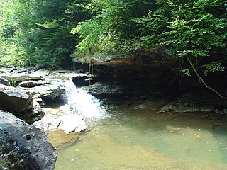
Trace Fork is the route of Kentucky Route 160, [6] over a gap (altitude 1,550 feet (470 m)) leading to Irishman Creek. [12]

E. H. Hammond had a mine on Saw Pit Branch, 0.25 miles (0.40 km) upstream; [13] and J. Jones on Calhoun Branch, 0.25 miles (0.40 km) upstream. [13] On two minor forks of Sams branch, J. M. Pigman had a mine 0.25 miles (0.40 km) upstream, and E. Short had one 0.375 miles (0.604 km) upstream. [14]

William Hodge's mine was on a minor branch of Reynolds Fork, 0.25 miles (0.40 km) upstream, [14] with W. T. Campbell's mine on another minor branch, 0.625 miles (1.006 km) upstream. [23] W. Reynolds's mine was 0.5 miles (0.80 km) upstream on Reynolds itself. [23]

W. H. Pratt's mine was 0.25 miles (0.40 km) upstream on Possum Trot Branch. [16] I. Thacker's was on a minor fork of Mill Creek, 0.75 miles (1.21 km) upstream; [16] R. B. Tate's was on another minor fork of Mill, 2.25 miles (3.62 km) upstream; [16] and William Cox's mine was 2.375 miles (3.822 km) upstream on Mill itself. [24]

George Tuft had a mine on Jones Fork, 0.875 miles (1.408 km) upstream. [17]

G. C. Childress's mine was on a minor branch of Left Fork, 5 miles (8.0 km) upstream. [18] Silas Watts's mine was 5.375 miles (8.650 km) upstream on Left Fork itself, and Squire Watts's mine 6 miles (9.7 km) upstream. [25]

Mallie

The Mallie post office was established on 1895-04-24 by postmaster Thomas J. Craft. [6] Although it has been suggested that it was named after Craft's daughter, she was not born until 1897. [6] It was, and still is, located at the head of Right Fork, and has over the years been at several sites in the vicinity. [6]

Leburn

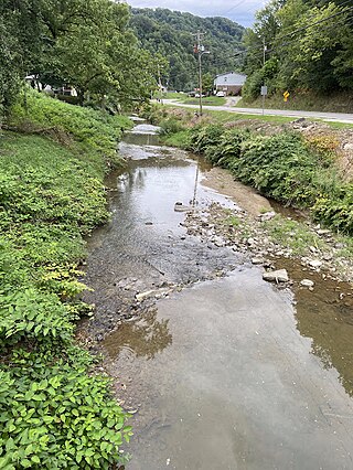
The Leburn post office was established on 1908-07-26 by postmaster Minta Pratt. [5] It was at the mouth of Mill Creek. [5] It moved 0.4 miles (0.64 km) west some time before 1911, to the mouth of Possumtrot Branch, where it still exists today. [5]

Garner

The Garner post office was established in 1936 by postmaster Mollie Gayhart. [5] She had wanted either of the names Mollie or Farley. [5] It was named after John Nance Garner. [5] It was, and still is, at the mouth of what used to be Alum Cave Branch, but whose downstream end is now Watts Creek. [5]

Early settlers

Samuel Cornett was the son of Revolutionary soldier William Cornett and Mary Everidge Cornett. [3] His wife Polly Adams came from the Adams settlement at the headwaters of the Kentucky River. [3] It's not known exactly when he arrived at The Forks of Troublesome; but when he did he built the aforementioned watermill and two-storey log house. [3]

Solomon Everidge, nicknamed "The Granddaddy of Troublesome", was a later settler, along with Peyton Duke from North Carolina. [19]

The Hays family comprised Captain Anderson Hays, his wife Rachel Sizemore Hays, and Lewis Hays, their son. [3] Anderson Hays was born in Lackey, and had been a Confederate soldier. [19] He settled on what was then known as Hays Creek, 1 mile (1.6 km) upstream from The Forks, building a watermill. [19] Lewis was later to marry Solomon's daughter Margaret. [19]

By the time of the establishment of Knotts County, there were also a few farmers and businessmen, including Franklin Pierce "Chick" Allen and Robert Bates. [19] [2] Allen married Bates's daughter Mary. [19] Bates himself had large landholdings at The Forks and was one of the principal people responsible for the creation of Knott County, earning him the nickname "The Father of Knott County". [19] He planned Hindman alongside attorneys T. Y. Fitzpatrick of Whitesburg and Fielding Johnson of Carrs Fork and was a member of the Kentucky House of Representatives. [19]

On 1885-07-08 the Louisville Commercial characterized The Forks as "nothing [...] but two or three log houses not grouped together with any view of making a beginning for a town" with "vast forests exist[ing] in every direction". [4] "A road extends to Whitesburg [...];", it continued, "another to Hazard [...], a third to Jackson [...] and one going to Prestonburg". [4]

See also

Cross-reference

  1. 1 2 3 4 Hodge 1918, p. 127.
  2. 1 2 3 4 5 6 7 8 9 10 11 12 Rennick 2000a, p. 4.
  3. 1 2 3 4 5 Scalf 2000, p. 146.
  4. 1 2 3 Scalf 2000, p. 148.
  5. 1 2 3 4 5 6 7 8 Rennick 2000a, p. 23.
  6. 1 2 3 4 5 6 7 8 9 10 11 Rennick 2000a, p. 24.
  7. 1 2 Hodge 1918, p. 128.
  8. 1 2 3 Hodge 1918, p. 129.
  9. 1 2 Hodge 1918, p. 131.
  10. 1 2 Hodge 1918, p. 132.
  11. 1 2 3 Hodge 1918, p. 134.
  12. 1 2 3 4 5 Hodge 1918, p. 135.
  13. 1 2 3 4 5 Hodge 1918, p. 137.
  14. 1 2 3 4 5 Hodge 1918, p. 138.
  15. 1 2 Hodge 1918, p. 140.
  16. 1 2 3 4 5 Hodge 1918, p. 141.
  17. 1 2 3 4 5 Hodge 1918, p. 143.
  18. 1 2 3 Hodge 1918, p. 145.
  19. 1 2 3 4 5 6 7 8 9 10 Scalf 2000, p. 147.
  20. 1 2 Rennick 2000a, p. 25.
  21. 1 2 3 Hodge 1918, p. 130.
  22. 1 2 Hodge 1918, p. 133.
  23. 1 2 Hodge 1918, p. 139.
  24. Hodge 1918, p. 142.
  25. Hodge 1918, p. 146.

Sources

Further reading

Related Research Articles

South Fork Kentucky River is a river in Kentucky in the United States. It is a fork of the Kentucky River that it joins just downstream of Beattyville. It is approximately 30 mi long.

Middle Fork Kentucky River is a river in Kentucky in the United States. It is a fork of the Kentucky River that it joins just upstream of Beattyville. It is approximately 85 miles (137 km) long.

<span class="mw-page-title-main">Red Bird River</span> River in Kentucky, United States

The Red Bird River is one of two tributaries at the head of the South Fork Kentucky River, the other being the Goose Creek. It is located in the Daniel Boone National Forest, in the southeast of the U.S. state of Kentucky. It is 34.3 miles (55.2 km) long and drains the eastern half of Clay County.

Laurel Creek is a creek that is a tributary of Goose Creek river in Clay County, Kentucky. It is 7.5 miles (12.1 km) long. The name comes from the proliferation of mountain laurel on its riverbanks.

Big Creek is a stream in Perry County, Kentucky in the United States. It a tributary of the North Fork Kentucky River that joins it 1 mile (1.6 km) upstream of Typo and 5 miles (8.0 km) downstream of Hazard, at an altitude of 810 feet (250 m). It is nearly 10 miles (16 km) long, and is paralleled by Kentucky Route 80 for some of its length.

Lotts Creek is a creek in Perry County and Knott County, Kentucky in the United States. It a tributary of the North Fork Kentucky River that joins it at Darfork 3 miles (4.8 km) downstream of Hazard at an altitude of 820 feet (250 m). It is 8.5 miles (13.7 km) long from its mouth to where it splits into the Young's and Kelly Forks.

Horse Creek is a creek a tributary of Goose Creek river in Clay County, Kentucky. It is 1.5 miles (2.4 km) upstream of Manchester on Goose at an altitude of 800 feet (240 m).

Sexton's Creek is a creek in Clay County, Kentucky that is a tributary of the South Fork Kentucky River in neighbouring Owsley County, Kentucky. It is 24 miles (39 km) long.

Trace Fork or Trace Branch is a creek in Perry County, Kentucky in the United States. It a fork of Lotts Creek 1 mile (1.6 km) upstream from the latter's mouth at an altitude of 825 feet (251 m).

Big Creek is a 4.5 miles (7.2 km) long creek in Kentucky, United States whose headwaters are in Leslie County and that flows into the Red Bird River in Clay County. A postoffice and village are named for it. Its own name is likely purely descriptive of its frequent flooding and high water levels, as it is not otherwise one of the biggest tributaries of Red Bird River.

Goose Creek is a creek in Clay County, Kentucky. It is one of two tributaries at the head of the South Fork Kentucky River, the other being the Red Bird River. It is 40 miles (64 km) long.

<span class="mw-page-title-main">Troublesome Creek (North Fork Kentucky River tributary)</span> River in Kentucky, USA

Troublesome Creek is a creek in Breathitt, Perry and Knott counties, Kentucky, a fork of the North Fork Kentucky River. It is 41.46 miles (66.72 km) long with a gradient of 8.92 feet per mile (168.9 cm/km), normally free-flowing, and with banks that vary between tree-lined and open.

Bear Creek is a creek that is a tributary of the Red Bird River in Clay County, Kentucky.

Little Goose Creek is a tributary of Goose Creek river in Clay County with headwaters in Laurel County in the U.S. state of Kentucky. It is 16.5 miles (26.6 km) long with its confluence with Goose just north of Manchester, at an altitude of 795 feet (242 m).

Collins Creek, also known as Collins Fork, is a creek that is a fork of Goose Creek in Knox County and Clay County, Kentucky. It is 19 miles (31 km) long; is named for its first settler James Collins, a salt maker and hunter; joins Goose just south of Garrard; and is paralleled by road and railway for most of its course.

Martins Creek is creek that is a tributary of Goose Creek in Clay County, Kentucky that used to have a Martins Creek post office. It is 4.5 miles (7.2 km) long and named for early settler Salathiel Martin.

Beech Creek is a tributary of Goose Creek in Clay County, Kentucky. It is just under 6 miles (9.7 km) long and joins the Goose approximately 12 mile (0.80 km) below the mouth of Laurel Creek.

Lost Creek is a creek that is mainly in Breathitt County, Kentucky in the United States. It a tributary of the Troublesome Creek tributary of the North Fork Kentucky River that it joins over the county line in Perry County slightly more than 1 mile (1.6 km) upstream of the mouth of Troublesome, at an altitude of 810 feet (250 m). It is 10 miles (16 km) long. The junction of Kentucky Route 476 with Kentucky Route 15 about 6 miles (9.7 km) south-southeast of Jackson is nearby.

Balls Fork is a stream that is mainly in Knott County, Kentucky in the United States. It a fork of the Troublesome Creek tributary of the North Fork Kentucky River that it joins over the county line in Perry County. It is 19.5 miles (31.4 km) long.

The North Fork Kentucky River has several tributary creeks at, or in the immediate vicinity of, the city of Hazard, Kentucky. They were surveyed by the Kentucky Geological Survey in 1918. Most still exist, although some have since been eliminated by mining and the subsequent expansion of the city, and the post-World War 2 construction of the Daniel Boone Parkway.