Related Research Articles

Nadi is the third-largest conurbation in Fiji. It is located on the western side of the main island of Viti Levu, and had a population of 42,284 at the most recent census, in 2007. A 2012 estimate showed that the population had grown to over 50,000. Nadi is multiracial with many of its inhabitants Asians, Indian or Indigenous Fijians, along with a large transient population of foreign tourists. Along with sugar cane production, tourism is a mainstay of the local economy.

Lautoka is the second largest city in Fiji. It is on the west coast of the island of Viti Levu, in the Ba Province of the Western Division. Lying in the heart of Fiji's sugar cane-growing region, the city has come to be known as the Sugar City. Covering an area of 32 square kilometres, it had a population of 71,573 at the 2017 census, the most recent to date.

Nadi International Airport is the main international airport of Fiji as well as an important regional hub for the South Pacific islands, located by the coast on the Ba Province in the Western Division of the main island Viti Levu. Owned and operated by Fiji Airports Limited, it is the main hub of Fiji Airways and its domestic and regional subsidiary Fiji Link. The airport is located at Namaka, 10 km from the city of Nadi and 20 km from the city of Lautoka. In 2019, it handled 2,485,319 passengers on international and domestic flights. It handles about 97% of international visitors to Fiji, of whom 86% are tourists. Despite being Fiji's main airport, it is a considerable distance from the country's major population centre; it is located 192 kilometres (119 mi) northwest of the country's capital and largest city Suva and its own airport, Nausori International Airport.

Nausori International Airport, also known as Luvuluvu, is the secondary international airport in Fiji, behind Nadi International Airport. It is situated in Nausori on the south-eastern side of Viti Levu. Nausori Airport is roughly 23 km from Fiji's capital city, Suva. It was first constructed by U.S. Navy Seabees in 1942.
The Indians in Fiji are mainly descendants of the 15,132 contract labourers who were brought to Fiji between 1903 and 1916. This represents about 25% out of a total of 60,965 contract labourers who were brought to Fiji between 1879 and 1916. They were forced in to ships from Madras and were mainly recruited in the districts of North Arcot, Madras, Krishna, Godavari, Visakhapatnam, Tanjore, Malabar and Coimbatore. More than half of the labourers from South India were recruited from North Arcot and Madras, but most of those recruited in Madras were originally from North Arcot and Chingleput.

The Fiji Premier League or the FPL, also called Digicel Premier League for sponsorship reasons, is the top division men's professional football league in Fiji. Contested by ten teams, it shares a promotion and relegation system with the Fiji Senior League (FSL). The League is controlled by the Fiji Football Association.

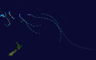
The 2007–08 South Pacific cyclone season was one of the least active South Pacific tropical cyclone seasons on record, with only four tropical cyclones occurring within the South Pacific basin to the east of 160°E. The season officially ran from November 1, 2007, until April 30, 2008, although the first cyclone, Tropical Depression 01F, developed on October 17. The most intense tropical cyclone of the season was Severe Tropical Cyclone Daman, which reached a minimum pressure of 925 hPa (27.32 inHg) as it affected Fiji. After the season had ended, the names Daman, Funa, and Gene were retired from the tropical cyclone naming lists.

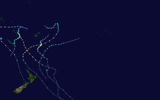
The 2006–07 South Pacific cyclone season was an event in the annual cycle of tropical cyclone formation. It began on November 1, 2006 and ended on April 30, 2007. These dates conventionally delimit the period of each year when most tropical cyclones form in the southern Pacific Ocean east of 160°E. Additionally, the regional tropical cyclone operational plan defines a tropical cyclone year separately from a tropical cyclone season, and the "tropical cyclone year" runs from July 1, 2006 to June 30, 2007.

The 2004–05 South Pacific cyclone season was an above-average season in which tropical cyclones formed within the South Pacific Ocean to the east of 160°E. The season officially ran from November 1, 2004 to April 30, 2005, however a tropical cyclone could form at any time between July 1, 2004 and June 30, 2005 and would count towards the season total. The season got off to an early start, when Tropical Depression 01F developed near the Solomon Islands on October 28, three days before the official start of the season. The final disturbance of the season dissipated as the season was drawing to a close on May 1. The season was above-average in terms of activity, with 9 tropical cyclones and 5 severe tropical cyclones forming during the season. The season featured Cyclone Percy, the most intense of the season in terms of pressure.

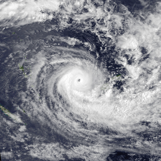
Severe Tropical Cyclone Daman was the strongest cyclone of the 2007–08 South Pacific cyclone season. Cyclone Daman was the fourth tropical depression and the first severe tropical cyclone to form east of longitude 180° during the 2007–08 South Pacific cyclone season. Due to the severity of the storm, the name Daman was retired and replaced with Denia.
A South Pacific tropical cyclone is a non-frontal, low pressure system that has developed, within an environment of warm sea surface temperatures and little vertical wind shear aloft in the South Pacific Ocean. Within the Southern Hemisphere there are officially three areas where tropical cyclones develop on a regular basis, these areas are the South-West Indian Ocean between Africa and 90°E, the Australian region between 90°E and 160°E and the South Pacific basin between 160°E and 120°W. The South Pacific basin between 160°E and 120°W is officially monitored by the Fiji Meteorological Service and New Zealand's MetService, while others like the Australian Bureau of Meteorology and the United States National Oceanic and Atmospheric Administration also monitor the basin. Each tropical cyclone year within this basin starts on July 1 and runs throughout the year, encompassing the tropical cyclone season which runs from November 1 and lasts until April 30 each season. Within the basin, most tropical cyclones have their origins within the South Pacific Convergence Zone or within the Northern Australian monsoon trough, both of which form an extensive area of cloudiness and are dominant features of the season. Within this region a tropical disturbance is classified as a tropical cyclone, when it has 10-minute sustained wind speeds of more than 65 km/h (40 mph), that wrap halfway around the low-level circulation centre, while a severe tropical cyclone is classified when the maximum 10-minute sustained wind speeds are greater than 120 km/h (75 mph).

The 2007–08 South Pacific cyclone season was a below-average season with only four tropical cyclones, forming within the South Pacific to the east of 160°E. The season officially ran from November 1, 2007 to April 30, 2008, although the first cyclone, Tropical Depression 01F, formed on October 17.

The 2008–09 South Pacific cyclone season was a below average tropical cyclone season, which featured six named tropical cyclones compared to an average of about nine. Ahead of the season officially starting on November 1, 2008, the Island Climate Update tropical cyclone outlook predicted that the season, would feature an average risk of tropical cyclones impacting the South Pacific between 160°E and 120°W. The first tropical disturbance of the season developed to the northeast of the Samoan Islands on December 1, however, it remained weak and was last noted during the next day.

The 2009–10 South Pacific cyclone season began on December 3, 2009 with the formation of Tropical Disturbance 01F, 32 days after the cyclone season had officially begun on November 1, 2009. The season ended on April 30, 2010. These dates conventionally delimit the period of each year when most tropical cyclones form in the southern Pacific Ocean east of 160°E. Additionally, the regional tropical cyclone operational plan defines a tropical cyclone year separately from a tropical cyclone season; the "tropical cyclone year" began on July 1, 2009 and ended on June 30, 2010. Tropical cyclones between 160°E and 120°W and north of 25°S are monitored by the Fiji Meteorological Service. Those that move south of 25°S are monitored by the Tropical Cyclone Warning Centre in Wellington, New Zealand. The first tropical disturbance of the season formed on December 3, about 1015 km (700 mi) to the north of Suva, Fiji and later intensified into Tropical Cyclone Mick. The last system, 15F, dissipated on April 5 of the following year.

The 2010–11 South Pacific cyclone season was an average tropical cyclone season, with seven tropical cyclones and five severe tropical cyclones developing during the season. The season ran from November 1, 2010 until April 30, 2011, though if any tropical cyclones had developed between July 1, 2010 and June 30, 2011, the official tropical cyclone year, they would have been counted towards the season's total. Within the South Pacific basin tropical cyclones were officially monitored by the Fiji Meteorological Service's Regional Specialized Meteorological Center in Nadi, Fiji, north of 25°S, and to the south the Meteorological Service of New Zealand's Tropical Cyclone Warning Center in Wellington, New Zealand. Any disturbances forming in the region were designated with a sequential number suffixed by the letter F. In addition, the United States Military's Joint Typhoon Warning Center unofficially monitored parts of the basin during the season, where any systems judged to have achieved tropical storm strength or greater received a number suffixed with the letter P. RSMC Nadi and TCWC Wellington both use the Australian Tropical Cyclone Intensity Scale, and measure wind speeds over a period of ten minutes, while the JTWC measures sustained winds over a period of one minute which can be applied to the Saffir–Simpson hurricane scale. Seven named storms formed or moved into the South Pacific basin during the 2010–11 season, the strongest of which was Severe Tropical Cyclone Wilma in late January.

The 2013–14 South Pacific cyclone season was a slightly below average tropical cyclone season, with six tropical cyclones occurring within the basin between 160°E and 120°W. The season ran from November 1, 2013, to April 30, 2014, however, the first four tropical disturbances occurred during October 2013 and were included as a part of the season. During the season, tropical cyclones were officially monitored by the Fiji Meteorological Service (FMS), Australian Bureau of Meteorology (BoM) and New Zealand's MetService. The United States Joint Typhoon Warning Center (JTWC) and other national meteorological services including Météo-France and NOAA also monitored the basin during the season. During the season there were 21 significant tropical disturbances were assigned a number and an "F" suffix by the FMS's Regional Specialized Meteorological Center in Nadi, Fiji (RSMC Nadi), including the remnants of Tropical Cyclone Hadi from the Australian region. The BoM, MetService and RSMC Nadi all estimated sustained wind speeds over a period of 10-minutes and used the Australian tropical cyclone intensity scale, while the JTWC estimated sustained winds over a 1-minute period, which are subsequently compared to the Saffir–Simpson hurricane wind scale (SSHS).

Severe Tropical Cyclone Oscar was one of the worst tropical cyclones to affect Fiji. The system was first noted as a shallow depression on 23 February, while it was located to the north of Fiji's capital Suva. The system subsequently developed further as it moved westwards and was named as Tropical Cyclone Oscar during the next day. Over the next few days Oscar subsequently intensified as it moved westwards and gradually developed further and equivalent to a Category 3 severe tropical cyclone, on the modern day Australian tropical cyclone intensity scale during 27 February. The system subsequently turned and started to move south-eastwards towards Fiji.
As of 2015, Fijian had at least two translations available of the Tirukkural.
Serupepeli Tuvula is a Fijian former rugby union footballer, he played as wing.
Samisoni Rabaka Nasigavesi is a Fijian former rugby union player who played as a scrum-half. His brother is the late Tomasi Rabaka, who was also a Fijian international.
References
- ↑ "About Jet Newspaper". The Jet Newspaper. October 1, 2009.