The Nautical Magazine was a monthly magazine containing articles of general interest to seafarers. [1] The magazine was first published in 1832 by Simpkin, Marshall, and Co. (London) as The Nautical Magazine: A Journal of Papers on Subjects Connected with Maritime Affairs in General and then as The Nautical Magazine And Naval Chronicle. From 1891 (Volume 60) the title was modified to Nautical Magazine and Journal of the Royal Naval Reserve and it was published by Brown, Son and Ferguson, (Glasgow), who continued to produce it until it was acquired and merged into Sea Breezes in 2011. [2] [3]
The editors were as follows:
In its early years, the magazine was closely associated with the Hydrographic Office of the Admiralty. [4] The first editor, A.B. Becher, was a navy surveyor who became assistant to Francis Beaufort, Hydrographer of the Navy, and was responsible for arranging and classifying the original charts held in the office. [5] Under Becher's editorship the magazine published details of hazards to navigation, reviewed Admiralty charts and publications, and reported on surveying activities. But it also documented a huge range of events, discoveries and achievements of the early Victorian period. It contains contemporary reports from the Crimean War and the First and Second Opium Wars, descriptions of the building and opening of the Suez Canal, and running updates on the long and fruitless search for Sir John Franklin's lost expedition in search of the North-West Passage. There are statistics on shipwrecks and on lives saved by the recently founded RNLI, information about the construction of new harbours and lighthouses, discussion of the latest technology such as iron ships, steam engines, and submarine telegraph cables, together with notes on new legislation and details of appointments and promotions of naval personnel. During this period the magazine also describes British colonies in Australia and New Zealand, rivalries with other colonial powers, and the cultures and languages of indigenous peoples from the Inuit to the Maori.
The magazine's authors have included:
Open access to the journal is available at the Internet Archive as follows:
A hydrographic office is an organization which is devoted to acquiring and publishing hydrographic information.
The United Kingdom Hydrographic Office (UKHO) is the UK's agency for providing hydrographic and marine geospatial data to mariners and maritime organisations across the world. The UKHO is a trading fund of the Ministry of Defence (MoD) and is located in Taunton, Somerset, with a workforce of approximately 900 staff.
Admiralty charts are nautical charts issued by the United Kingdom Hydrographic Office (UKHO) and subject to Crown Copyright. Over 3,500 Standard Nautical Charts (SNCs) and 14,000 Electronic Navigational Charts (ENCs) are available with the Admiralty portfolio offering the widest official coverage of international shipping routes and ports, in varying detail.
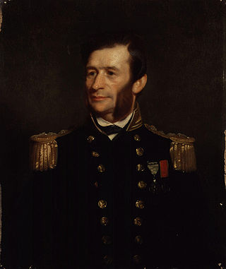
Sir George Henry Richards was Hydrographer of the Royal Navy from 1863 to 1874.
The Naval Secretary is the Royal Navy officer who advises the First Sea Lord and Chief of Naval Staff on naval officer appointing.
The Russian Hydrographic Service, full current official name Department of Navigation and Oceanography of the Ministry of Defence of the Russian Federation, is Russia's hydrographic office, with responsibility to facilitate navigation, performing hydrographic surveys and publishing nautical charts.
During the early 17th century, England's relative naval power deteriorated, In the course of the rest of the 17th century, The office of the Admiralty and Marine Affairs steered the Navy's transition from a semi-amateur Navy Royal fighting in conjunction with private vessels into a fully professional institution, a Royal Navy. Its financial provisions were gradually regularised, it came to rely on dedicated warships only, and it developed a professional officer corps with a defined career structure, superseding an earlier mix of sailors and socially prominent former soldiers.
The Civil Lord of the Admiralty formally known as the Office of the Civil Lord of Admiralty also referred to as the Department of the Civil Lord of the Admiralty was a member of the Board of Admiralty who was responsible for managing the Royal Navy's supporting civilian staff, the works and buildings departments and naval lands from 1830 to 1964.
The Architectural and Engineering Works Department was the main civil engineering department of the British Royal Navy responsible constructing, and maintaining naval buildings, dockyards, ports and managing civil engineering staff from 1837 to 1919 it was superseded by the Civil Engineer in Chief's Department.
Admiral Martin White was an officer of the Royal Navy. He worked his way up the ranks during a 53-year career; retiring as Captain and made up to Admiral in retirement and settling in Jersey. He was particularly known for gathering and publishing nautical data and mappings of the Channel Islands, English Channel, French Coast, Bristol Channel and Irish Sea and even gained a mention in the French Maritime Atlas of the 1800s.
Henry Charles Otter was a Royal Navy officer and hydrographic surveyor, noted for his work in charting Scotland in the mid-19th century. He was active in surveying in the Baltic Sea during the war with Russia (1853-6) and in supporting the laying of the first transatlantic telegraph cable in 1858.
HMS Shearwater was a wooden paddle steamer which became the main surveying vessel in the UK in the 1840s. Shearwater was built in Harwich in 1826 for the Post Office, transferred to the Royal Navy in 1837, and equipped for surveying at Woolwich in 1841. Her length was 137', beam 23'.
William Hewett was a Royal Navy officer noted for making the first comprehensive survey of the North Sea and for his work on tides.
George Thomas was a Master in the Royal Navy who was one of the early surveyors of the coasts of Great Britain
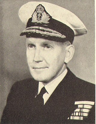
Sir Archibald Day was an officer in the Royal Navy and Hydrographer of the Navy from 1950-1955. He played an important part in planning the evacuation from Dunkirk in 1940, and wrote a history of the Hydrographic Service.
Rear Admiral Edward James Bedford was a Royal Navy officer noted for his work as a surveyor, particularly in Scotland.
Michael Atwell Slater was a Royal Navy Officer and hydrographic surveyor particularly noted for his survey work in the north-east of England and the east of Scotland.
Edward Killwick Calver was a Captain in the Royal Navy, and hydrographic surveyor. He is particularly noted for his surveying work in the east of Britain, and as the captain of HMS Porcupine, in oceanographic voyages in 1869 and 1870.
John Edward Davis (1815-1877) was a Royal Navy officer, hydrographic surveyor and artist, noted for his illustrations of the Antarctic voyage of James Clark Ross (1839-1843) and for his expertise in deep-sea sounding.
Richard Hoskyn (1811-1873) was a Royal Navy officer and hydrographic surveyor. He discovered the site of Ancient Kaunos in what is now southern Turkey, surveyed much of the coast of Ireland, carried out deep-sea sounding in preparation for the laying of telegraphic cables, and became superintendent of charts for the UK Admiralty.